broken walls and narratives

A not so revolutionary blog about feminism, socialism, activism, travel, nature, life, etc.

Archive for the category “state park”

Monson Lake: The Worst State Park in Minnesota

H. Bradford

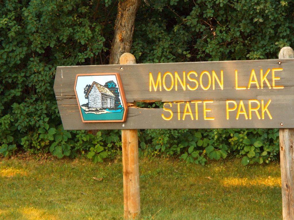
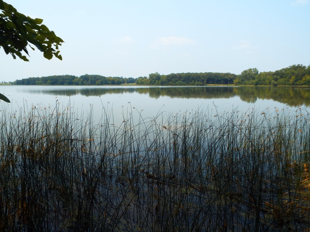
I am on a slow quest to see every state park in Minnesota. To this end, I visited Sibley State Park with my brother this past weekend. While in the area, we decided to stop by Monson Lake since it was only 17 miles away. There are 75 state parks and recreation areas in the state, so of course, one of them is going to be the worst. Thus far, Monson Lake State Park is the worst on account of its history and size.

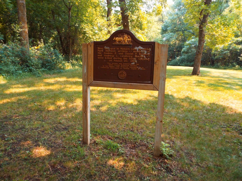
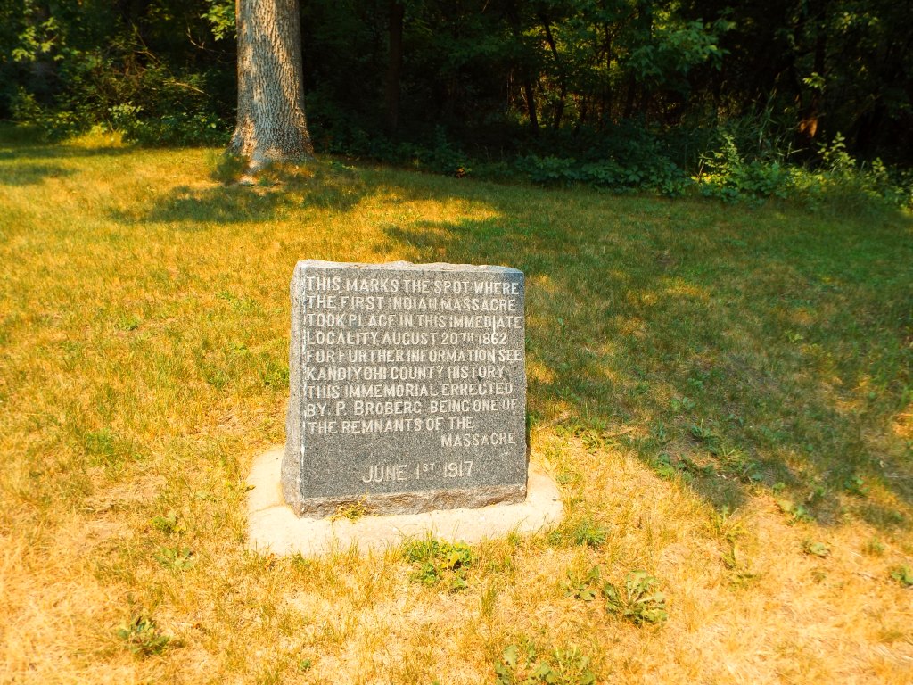
The history of why it was established is the worst aspect of the park. Monson Lake State Park was established in the 1920s as a private memorial park to remember the deaths of 13 Swedish settlers who were killed in the Dakota War of 1862. Since the park is small, this history of the park isn’t masked by size, a large network of trails, or other facilities. There is only one trail, a camp site, the lake, and some signs about the white casualties in the Dakota War. The few signs remain stilted towards colonial history. Although there is brief mention that the conflict arose out of the starvation conditions imposed upon the Dakota people on account of late annuity payments, the signs were more sympathetic to the history of settlers. For instance, the informational sign mentioned that the Dakota people were resisting white civilization, which is loaded language which attributes “civilization” to white people, but not to Native Americans. A more accurate word for what they were resisting was genocide. The sign denotes the names and ages of the colonists who were killed, whereas the impact of the conflict on Dakota people is unspoken and far more horrific. If the park remains, it should expand its signs to include more information about Native American history of the region, more information about the conflict, and also facts about what happened after the Dakota War of 1862. The outcome of the Dakota uprising was the largest mass hanging in U.S. history (when 38 Dakota prisoners were hanged in a single day in Mankato) and mass internment. 1,600 Dakota prisoners of all ages were held near Fort Snelling, of which 300 died that winter. Previous treaties were nullified and the Dakota were forcibly expelled from Minnesota, with a bounty on any found in the state and state sponsored scouting parties to scalp those who remained.   

There are several other state parks which have connections to the Dakota War of 1862.  Nearby Sibley State Park was named after Henry Hastings Sibley, the first governor of Minnesota and a commander in the Dakota War. The park itself was established by a survivor of the Dakota war who wanted to see a local park established in the area. Fort Ridgely State Park was also established as a memorial to its role in the conflict. This park features a fort defenders monument and the site served as a fort in the war. As mentioned, Fort Snelling State Park was the site of an internment camp after the war.  Lake Shetek State Park was established from a site where settlers were buried after the war. Flandrau State Park was named after Charles Flandrau, a settler who defended New Ulm. Since many of these parks are in Southern and Western Minnesota, I have not yet visited them and it may happen that they are worse than Monson Lake. It remains to be seen how and if these parks approach this history. However, the sheer number of state parks with connections to the war should demonstrate that the state park system arose out of a movement to preserve and commemorate a certain version of history. It is easy to treat state parks as benign public spaces to preserve nature, but they are largely white spaces.     

Aside from this history, Monson Lake is rather small. It doesn’t seem like a destination in its own right. At 343 acres, it is not the smallest Minnesota State park. However, it featured only one trail, which took less than an hour to explore. The campground and lake seem like they could be locally attractive, but might have been better as a municipal park. The office is not staffed, so visitors must go to nearby Sibley State Park for passes or to speak to a ranger. Again, because of its small size and lack of points of interest, the history seemed like the main attraction.

The park may have some good qualities. For instance, the lake might offer opportunities for birding. My brother and I saw three snakes within the first few minutes of the hike, so the park seems to punch above its weight in reptiles. We also saw chipmunks, toads, a dead turtle, egret, and several other birds. The park is a small area but seemed to have a large number of animals for its size. Again, it probably is a nice local place for a picnic, camping, or fishing, but hardly worth the drive for visitors outside the area. The fact that it is a state park means that it is a protected area, which preserves it from private development. This should be viewed as a plus. But, the history is uncomfortably colonial and this is something which needs to change. Thus, that is why it is the worst state park I have been to.   


Yurt Camping at Cuyuna State Recreation Area

Yurt Camping at Cuyuna State Recreation Area

Yurt Camping at Cuyuna State Recreation Area

H. Bradford

11/21/20

I learned this summer, while visiting Glendalough State Park, that some Minnesota State Parks have yurts for rent.  Only three state parks feature yurt rental including Glendalough State Park, Afton State Park, and Cuyuna State Recreation Area. I decided this would be a fun adventure, so I set out to rent one at Cuyuna State Recreation Area.  However, as it turns out, the yurts are pretty popular, so there were no reservations until late October. I nabbed the available reservation, which was for Monday, October 26th. At $70, the rental is not exactly cheap for one person, but would be a pretty good deal for a group. The yurt at Cuyuna State Recreation Area can sleep up to seven people!  In my case, I had the whole unit to myself. 

Winter came early to Minnesota, so there was snow on the ground and cold temperatures by mid-October. The night that I planned on camping was particularly cold, with a low of 16 degrees F.  I was a little worried about the wintery conditions.  But, I set out anyway, hoping for the best.  The park itself was a former mining area from the early 1900s to 1960s and is pocked with deep mining pits. It was also the site of the deadliest mining accident in Minnesota history, when a mine shaft of the Milford Mine suddenly filled with water and mud on Feb. 5th, 1924, killing forty one miners. There is still mining equipment, historical markers, old buildings, and of course, the landscape itself, which mark decades of mining history in the park. Some of these historical areas were closed for the season.


The Cuyuna State Recreation Area is located about 100 miles west of Duluth. Many of the trails at Cuyuna State Recreation Area were closed until the ground was frozen, as to avoid damage. In better weather conditions, the park is known for its mountain bike trails. I had thought of bringing my bicycle, as there are also flat trails, but, it worked out better that I didn’t. During my visit, I was the only person in the park. The yurts are located at Yawkey Lake, where there are three yurts and a few trails. My yurt was named Manganese. It was the furthest from the parking lot and the outhouse restroom. Campers can use a cart found at the yurt to haul in their items. Instructions of where to find the key are sent with the reservation, so there is no need to check in at an office. I carted in my items from my car, grabbing firewood along the way. There is a firewood station near the outhouses, where free firewood is available for the wood stove during the winter months. A hand pumped water spigot is also located in that area, but I packed my own water.  I was definitely glad that there was plenty of  free firewood to use in the stove!


My first order of business was setting up LED candles in the yurt. Actual candles are not allowed and I wanted some source of light during the dark evening ahead. I set up a dozen LED candles, unpacked some things, took a few photos, then set off to do some hiking before sunset. As I had mentioned, many trails were closed, but there were a few nearby trails which I explored before it got dark. Upon my return from hiking, I started up a fire in the wood stove. That was my first time using a wood stove, but it was pretty easy to figure out, with a single lever used to control the oxygen to the fire.  The stove was small and it took over six hours for the yurt to become semi-comfortably warm. I also started a fire outside in the fire pit, where I joined a weekly socialist meeting via zoom and ate s’mores. I was happy that my cell phone actually had reception and it is interesting how a person can be in the middle of the woods but also on a video conference.


After sunset, it definitely felt cold. The yurt has a pretty large area to heat, so I found myself huddled by the wood stove for hours in my winter jacket. I even pulled my mattress off one of the bunks so that I could sleep on the floor by the wood tove. It was also dark. The many LED candles, my camping lantern, and small flashlight didn’t provide nearly enough light. I managed to spend a few hours reading, but the room beyond my book was very dark and cold.  Outside the yurt, I could hear many nature noises, such as the yipping of dogs or coyotes from across the mining lake and the flutey call of a saw-whet owl.  I didn’t sleep well, as I woke up throughout the night to feed wood to the stove. A few times throughout the night, I stepped out into the cold and looked out at the stars. By morning, the yurt was toasty and comfortable. I went for another hike in the morning, then packed up my things. I made the mistake of trying to clean out the ashes from the stove, which only brought them back to life and filled the yurt with smoke. I had to fan out the smoke with the door. Outside the yurt, the sun shone brightly on the cool morning and there were many chickadees and juncos fluttering about the campsite, perhaps eating leftover crumbs from my s’mores.

Overall, I had a fun time. It was my first time “camping” in cold weather and my first time using a wood stove. Although many of the trails were closed, I enjoyed the time spent hiking alone. There wasn’t a single car in the whole park. The early cold weather really seemed to scare people away from nature. I was happy to hear a saw-whet owl and would try winter cabining again. My main advice would be to bring plenty of light. The night is long and dark. While the LED candles provided some ambiance, they did not shed a lot of light. I relied on my camp flashlight for my reading. Another thing I learned was not to clean out the ashes in the morning. I was trying to be thoughtful, but it ended up being a smoky mess. Also, I went through a lot of wood! I used almost all of the wood that I had carted in, which was more than I expected to use. So, I would definitely try to overshoot the amount of wood needed, as it wouldn’t have been fun to fetch more in the middle of the night. On the way home, I stopped in Aitkin, where I ate lunch at the Block North Brew Pub. I had a PLT sandwich (portabella, mushroom, and tomato) and it was great! They also have a wild rice black bean burger. I would definitely recommend Block North for a post-camping meal.


Big Bog with My Brother

Big BoG

Big Bog with My Brother

H. Bradford

8/1/20


I promised my brother “it would be the Disneyland of bogs.” In my mind, the Big Bog State Recreation Area was a big deal. It had been on my bucket list for a few years and a July visit with my father in Bemidji provided the perfect opportunity to make the journey. So, I coaxed my brother into abandoning his family and coming along. As a spoiler, it was not “the Disneyland of bogs,” that I had promised. This has happened before. As a teen, I visited the amethyst mines by Thunder Bay, ON.  I imagined fantastic caverns of sparkling lavender hued crystals. Instead, it was a giant open pit mine of dusty brown rocks. Last summer, I visited the Forestville Mystery Cave, which was epic in my imagination with twisting caverns of fossil embossed walls. It was a large cave, but the standard tour visited only a small portion, and it was much more mundane than the cave I had imagined. Big Bog State Recreation Area was indeed a very large bog. It had all of the impressive qualities of a very large bog, but it was not the orchid bejeweled paradise with towering mounds of moss and giant, carnivorous plants. Big Bog was big in my imagination and big in real life, but it is best appreciated for exactly what it is…a large bog with an impressive, mile long bog walk.

Image may contain: Heather Bradford, standing, tree, plant, bridge, shoes, sky, outdoor and nature


To begin, bogs are a type of wetland or water saturated environment. They are furthermore a type of peatland, which is an environment wherein organic material has built up over time because cool (usually) low oxygen conditions have inhibited the decay of these materials. Among peatlands, bogs are characterized by peat or partially decayed vegetation that has built up over time. According to basic definitions of bogs, this built up peat landscape is not nourished by groundwater, and instead derives its nutrients from precipitation. This results in water with low nutrient content and high acidity. This means that bogs host uniquely adapted plants such as carnivorous plants, orchids, and stunted, slow growing trees.

Image may contain: plant, flower, tree, outdoor and nature


Minnesota has 6 million acres of peatlands, which make up 10% of the state. It is second only to Alaska in peatlands. According to the Department of Natural Resources, Minnesota’s peatlands began forming 5,000-6,000 years ago during a climate cooling period that saw increased precipitation. Big Bog State Recreational Area, which is also known as The Red Lake Peatland, was formed in the part of the basin of Glacial Lake Agassiz.  Nearby Upper Red Lake and Lower Red Lake are remnants of the lake.  Richard Ojakanga’s Roadside Geology of Minnesota states that Big Bog itself formed about 3,000 years ago as vegetation began to overtake low lying areas of Glacial Lake Agassiz. The average thickness of peat is ten feet. Big Bog is 50 miles long east to west and 12 miles wide. It is the largest bog in the lower 48 states. The Red Lake Peatland is also unique in that it is located only 50 miles from prairie.  

Image may contain: text that says 'E landforms. flowing water, and vegetation. The world' patterned oon mostly in the northern bo arctic regions of the north hemisphere. Smaller peatl elsewhere, too, at high alti tropical regions, and along deltas and ocean shoreline Minnesota Peatlands'


Big Bog State Recreation Area was added to the Minnesota State Park system in 2000. It was established through a local effort to boost the economy after the collapse of walleye fishing on Red Lake.  Fishing was the main tourist attraction for the nearby town of Waskish, which saw resorts close in the late 1990s. When I told my brother this, he was skeptical that a large bog would attract tourists.  After all, there is a difference between the type of tourist who wants to stroll through a bog and those who want to go walleye fishing.  In other words, people who like bogs might be a bit more on the nerdy side. I had read that several years after opening, there were 75,000 visitors to Big Bog, a number that was expected to grow (but cannot find the source). Since walleye fishing resumed in 2006 after efforts to restock the fish and a moratorium on fishing them, the two types of tourism actually coexist at the moment. 

Image may contain: plant, tree, outdoor and nature


Big Bog State Recreational Area attracted me for a number of reasons. One, I want to visit all of Minnesota’s State Parks (and Big Bog is part of the state park system). Two, I like big bogs and I can not lie. Really, I like bogs of all sizes. Bogs are interesting. They are full of interesting berries, carnivorous plants, orchids, and unique trees. In Europe, they have preserved corpses.  There are also opportunities to see unique birds. Three, it is the biggest bog in the lower 48 states! Four, it has a great board walk. Speaking of which, the boardwalk really is amazing. The mile-long boardwalk was completed in 2005. The DNR states that it is the longest boardwalk  in the U.S.  The Bemidji Pioneer reported that the boardwalk was constructed in a way which allowed for 60% of sunlight to reach the plants under the walkway (Wikipedia reports 38%). Sixteen foot sections of boardwalk were installed without machinery, as to avoid damage to the fragile ecosystem. Work was done in the winter to minimize damage and the boardwalk itself stands 18 inches above the bog on anchors drilled fifteen feet into the peat. The boardwalk itself is worth the visit.

Image may contain: tree, sky, plant, grass, outdoor, nature and water


As I mentioned in my introduction, the Big Bog Recreation Area didn’t quite live up to the hype in my head. One reason for this is that we wanted to see orchids. My brother and I had visited Lake Bemidji State Park the previous day and saw two species of orchids. The Showy Lady’s Slipper was past its prime and wilted. I was hoping that by going an hour north to Big Bog, we might catch some fresher specimens. We didn’t see any. Also, we were attacked by deer flies. This made it difficult to stop and enjoy the nature around us. We saw many different species of butterflies, but I was unable to stop and identify them because I would be immediately assaulted by flies once I stopped moving. The most comical example was when a Mourning Cloak butterfly landed on my butt, but I couldn’t stop to photograph it because of the flies. I also didn’t see many birds that morning. The boardwalk was impressive and certainly a feat to build.  It was also pretty astonishing to see what seemed like endless bog in all directions. But, my brother pointed out that we grew up in a boggy area and it really didn’t look that different. Perhaps it is hard to take in all of the small details of such a large area, especially while attacked by flies. 

Image may contain: plant, flower, nature and outdoor


The interpretive signs were full of useful facts. For instance, I learned about efforts in the early 1900s to drain the bog for farmland. Millions of dollars were spent to dig 1,500 miles of ditches in the Red Lake Peatlands. This project failed as farms were abandoned during the Great Depression, but the bog is still scarred in some areas due to the drainage ditches that were constructed earlier in the last century. I also learned that Big Bog was home to remnant woodland caribou into the 1930s. The population was cut off from its Canadian calving grounds and ultimately failed to thrive. The boardwalk might be better appreciated in the spring and fall when the bugs are less bad. It might also be better enjoyed on a guided hike, where a naturalist can point out the plants, butterflies, and birds. Due to Covid-19, Minnesota State Parks have not been offering naturalist programs. I think this would be a great way to get to know the bog.

DSCF3253


Another interesting fact about the Big Bog State Recreational Area was that it was used during the Cold War as a bombing/ammunition test site. Between 1947 and 1951, the U.S. army used Big Bog as Upper Red Lake Firing Range for gunnery and bombing training. Later, the Naval Reserve dropped over 50 bombs to create wallowing holes for moose. From 1948-1953, the National Guard set up targets in the bog for aerial bombing based on the Cold War fear that Duluth was a strategic target for the Soviet Union. Some of the bombs that were dropped in the bog were inert bombs or non-nuclear parts of bombs otherwise developed as nuclear weapons.  One of these non-nuclear bombs weighed 11,000 pounds, was detonated 3000 feet above the bog, and seen 60 miles away in Bemidji. This history was uncovered when researchers in the 1970s began to suspect that a meteor may have created Hillman Lake and a bomb casing was later found in the bog by a naturalist. Despite the fact that the bog was abused for military and agricultural purposes for most of the century, in 1975 it was designated a National Natural Landmark. Of course, the bog was a source of food, tools and housing supplies, and medicine to prehistoric Native Americans to Ojibwe. For instance, many Native American tribes have made medicinal beverages from Bog Labrador Tea. Yellow eyed grass is also one of the 150 medicinal bog plants utilized by the Ojibwe.

Image may contain: plant, flower, nature and outdoor


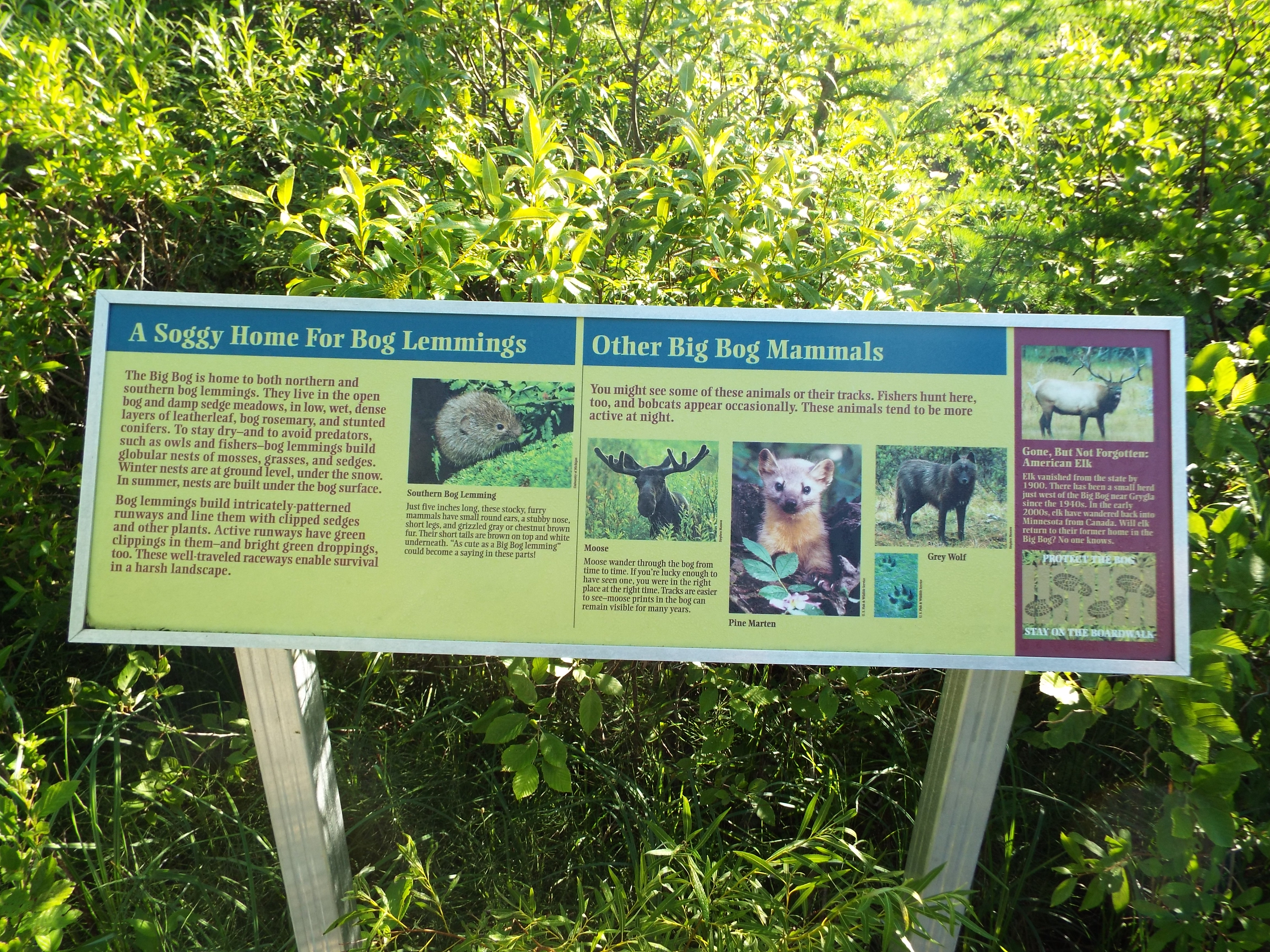
While the bog is not a magical wonderland, it is scientifically, ecologically, and culturally important. Had we visited a few weeks earlier, we may have seen orchids. Even without orchids, the simple vastness of the bog and engineering feat of the bog walk are worth the visit. The bog walk begins at Ludlow Pond and a wet mixed forest. This slowly transforms into the open expanse of tamaracks, spruce, and mounds of sphagnum moss. We were the only visitors on the bog walk during our short hike. The walkway is a unique opportunity to delve deeper into a bog than what is typical. The morning was noticeably quiet of people, cars, and the sounds of society. As a whole, it was a good experience. At the same time, there are many short bog walkways where it is easier to get a more condensed, but detailed experience. Because of the length of the bog walk and size of the bog, it was hard to focus on the tiny details around us. After a while, everything becomes moss. Perhaps that is the shortfall of “big things” as they are harder to comprehend and take in. A highlight of the experience was catching a glimpse of a bog lemming and stalking a park ranger for my collectable state park patch.  Maybe I will revisit the bog one day when programs resume.  Really, not matter how great the bog was, I was just happy to have a fun morning outdoors with my brother.   


No photo description available.

Image may contain: sky, tree, plant, outdoor and nature


Glacial Lakes State Park with My Brother

Glacial Lakes State Park with My brother

Glacial Lakes State Park with My Brother

H. Bradford

7.1.20


One of my goals is to visit every state park in Minnesota.  To this end, I try to visit a few new state parks each year.  The most recent park that I visited (this time with my brother) was Glacial Lakes State Park, which is located about an hour and a half west of St. Cloud, Minnesota, five miles south of the small town of Starbuck. The drive from St. Cloud is a pleasant journey across farmland, bypassing Sauk Center, and passing Glenwood and Lake Minnewaska.  Sauk Center is the birthplace of Sinclair Lewis, and features an interpretive center, plaque, campground, and park in his honor.  I recently read, “It Can’t Happen Here,” a fictional account of fascism arising in the United States under the leadership of a Trumpish president named Buzz Windrip. We didn’t stop in Sauk Center, but if I visited the state park again, it might be worth a brief visit. In fact, one of his books might be the perfect reading material for a camping trip to the park! Image may contain: tree, grass, outdoor and nature, text that says 'GLACIAL LAKES STATE PARK'


Image may contain: sky, cloud, outdoor and nature


Glacial Lakes State Park appears as a bit of an anomaly in the landscape. Until arriving at the park, the landscape was mostly flat farmland.  But, as we turned off HWY 29 to HWY 41, we were suddenly met with a landscape of rolling hills. These conical hills are called kames and were formed when sediments accumulated in depressions located within the ice of a retreating glacier. Other glacial features of the park include eskers and kettles, which can be read about on interpretative signs. According to “Roadside Geology of Minnesota,” the glacial features of the park were formed by the Des Moines Lobe. The Des Moines Lobe was the largest lobe (blobby, jutting feature) of the Laurentide Ice Sheet. The Laurentide Ice Sheet was a large sheet of ice which covered most of Canada and the Northern Midwest United States. This itself was a part of the Wisconsin Glaciation, the most recent glacial period which lasted until 11,000 years ago.  I have not studied geology or climate history, but suffice to say the park features interesting glacial formations and history. Because the park is a transition between hardwood forests and prairies, it is also a unique ecosystem which blends flora and fauna of both ecosystems. To a science novice like myself, it feels like a special place, with wooded and prairie hills, lakes, and diverse plants and birds. My immediate impression when I was greeted with a view of rolling hills from the visitor’s was that the park indeed deserved to be a landscape set aside as a nature reserve. My brother and I were both glad that someone had the foresight to create the state park.

Image may contain: cloud, sky, mountain, grass, nature and outdoor


Image may contain: plant, sky, mountain, grass, flower, tree, outdoor and nature


While visiting the park, my brother and I explored two trails. The first was an interpretive trail/boardwalk which hemmed the east side of Signalness Lake.  The boardwalk was partially submerged, so watch out for water! This shorter trail leads to the Oakridge Campground and then to the High Peak Trail. The High Peak Trail offers two loop options and we opted to take the slightly longer loop, which nears an unnamed lake on the map. The unnamed lake featured ducks, great egrets, and other birds. There were also many butterflies fluttering amongst the prairie grasses and flowers. A highlight of the hike was the discovery of a patch of Showy Lady’s Slippers near the lake.  According to the DNR, these orchids are uncommon in the state,but can be found in bogs, wet prairies, damp woods, and wet meadows. It was my first time discovering Minnesota’s state flower in the wild. They can live 100 years and takes 15-20 years from germination to flower. Because they need particular soil and fungus to grow, have lost habitat over time, and were once over harvested, the flower is uncommon, but not rare or endangered. It is illegal to uproot or pick them in Minnesota. Image may contain: flower, plant, nature and outdoor


The High Peak Trail continued along to an overlook at the top of a hill. At 1,352 feet, it is the highest point in the park. The overlook offers a bench for resting and a view of Kettle and Baby Lake, as well as the hilly landscape.  From this high point, we took a .5 mile loop back to the main High Peak Trail, this time taking the shorter route back to our parking spot. This brought us back through the campground and across the soggy boardwalk once more. Along the way back, my brother raised the question on why the last ice age happened in the first place. I didn’t know at the time. According to the Wisconsin Geological and Natural History Survey, over the past 2.5 million years, the Northern Hemisphere has fluctuated between warm and cool periods. Over the last 700,000 years there have been 100,000 year climate cycles of warming and cooling. This is related to shifts in the axial tilt of the earth and the shape of earth’s orbit around the sun. The most recent ice age began about 100,000 years ago and ice sheets didn’t retreat fully from Minnesota until about 11,000 years ago. So, there you go. The earth’s axial shift and orbit is believed to be the cause of these ice ages over the last few million years.    

Image may contain: sky, cloud, grass, mountain, tree, plant, outdoor and nature


After returning to the parking lot, we decided to explore Mardy’s Trail.  Mardy’s Trail flanks the west side of Signalness Lake.  This trail was less interesting, but brought us past a boat landing and by a number of thirteen lined ground squirrels. We did not do the complete loop, as this would have circled us back to the High Peak Trail. We hiked as far as a second overlook, which was less impressive than the first, but offered an overview of the other side of the park. The only downside of this was that my brother decided to trail blaze his own path down the hill, as a shortcut back to my car.  He boldly proclaimed that it wa “Lonnie’s Trail.” Unfortunately, “Lonnie’s Trail” was a guantlet overgrown poison ivy.  I was wearing long pants, but he was wearing shorts. Thankfully, he was able to avoid a rash by immediately applying rubbing alcohol to his legs. He dabbed his legs with hand sanitizer, which may have broken up the urushiol.  So, as a note to other hikers, pack rubbing alcohol or a preventative cream to avoid a rash. We weren’t really prepared, but both narrowly avoided a rash (I washed my clothes after).  From now on, we will take poison ivy more seriously! Image may contain: grass, outdoor and nature


Image may contain: 1 person, plant and outdoor


After a fun day of hiking at Glacial Lakes State Park, we headed off to Morris, Mn, where my brother went to college. I never visited him in Morris, so we took the opportunity to venture there as it was 30 minutes from the park. Although the campus was closed, we wandered the grounds and past the buildings where he embarked on his life journey. There is something melancholy about touring the places of long ago, where new, young, hopeful students will gather in the fall. It is sad to think of all that was or wasn’t and how time moves us forward, relentlessly towards death, change, and loss. But, on a happier note, we also enjoyed some delicious Mexican food at Mi Mexico. Mi Mexico was a Chinese buffet when my brother was in college. Although I never visited him while he was at Morris, at least we revisited it years later after a pleasant day of hiking. I was happy for the opportunity to visit a new state park and spend the day with my brother. I hope that we have many years of hikes together!   

Image may contain: sky, outdoor and nature, text that says 'GLACIAL LAKES STATE PARK A'


Hiking the Inca Trail While Out of Shape

Hiking the Inca Trail...while out of shape

Hiking the Inca Trail While Out of Shape

H. Bradford

1/3/2020


This year I wanted to go on a vacation that was a little more epic than my typical vacations.  After all, it would be my last vacation of the 2010s and my 30s. That is why last February I decided to hike the Inca Trail to Machu Picchu and visit the Galapagos Islands.  Both seemed like a way to end the decade on a high note. Since Machu Picchu is about 8,000 feet above sea level and the highest point on the hike is 13,828 feet, it literally was a way to end things high.  Since I planned the trip about nine months in advance, I didn’t take seriously the need to get into better shape until towards the last few months. Compounded by the fact that I worked overtime every pay period between January and August, then caught a nasty six week chest cold in October, I didn’t really have the time or health to get into better shape.  Needless to say, I began to worry that perhaps my imagination had written a check than my body could not cash. The person who booked the trip in February had doomed my out of shape November self to a challenging, high altitude slog. Like all challenging, somewhat foolish things, it was a learning experience I can now pass on to another out of shape wanderers like myself.


First of all, I really don’t like to think of myself as out of shape.  I enjoy hiking, snow shoeing, cross country skiing, going for walks, spending time outdoors, playing recreational soccer, taking fitness classes, and don’t mind jogging.  I like to be active but I’ve never been athletic. What is “out of shape” anyway? What should a person be able to physically do? What is “in shape?” Well, whatever “in shape” is, I’m not it.  I am active, but don’t specifically push myself towards fitness benchmarks. Because of that, well, I will never really be fit. I spent some time googling how fit a person has to be to complete the Inca Trail.  A website called The Adventure People stated that if you play a sport, can hike for several hours, or garden, you should be able to complete the trail.  I enjoy gardening, sure, but I think that if gardening is the only physical activity someone does, they will probably struggle on the trail. Maybe there is some extreme gardening out there. I suppose if  a person is a migrant laborer picking strawberries in the California sun for twelve hours a day, then the trail is no trouble. But, the ability to plant a few petunias is probably not an adequate measure of one’s physical capacity to finish the trail. I struggled, and I at least attempted to train on the treadmill at the highest incline in the weeks prior to the trip, did a few small local hikes, and was able to jog six miles two days before the trip.  By far, I was the most out of shape in my group.


Preparation:


As I mentioned, I didn’t prepare as well as I should have.  At the end of September, I went on a seven mile hike, which was supposed to be my kick off for “getting into shape.” But, the elusive “getting into shape” never happened.  I became sick with a terrible chest cold in early October that lasted into November. On days I felt less sick, I jogged or walked on the treadmill. While walking on the treadmill, I increased the incline to its maximum. However, this really doesn’t compare to the actual trail, since it lacks the exhausting altitude, weather and hygiene challenges, and endless steps. Had I felt better, I probably would have benefited from doing step machines, step classes, strength training, and more intense cardio. Oh well. Even had I felt better, I probably would have just ended up doing what I was already doing, but with more frequency and intensity.


I also tried to prepare by doing some day hikes.  To this end, I roped my friends into joining me. One Saturday, Adam, Lucas, and I visited Carlton Peak.  I have mistakenly thought for several years that Carlton Peak is the second highest in Minnesota. I don’t know where I picked up this false information, but really, it is not even in the top 20. False information aside, the tallest peak in Minnesota is Eagle Peak, which is 2,300 feet. Most of the tallest peaks in Minnesota are along the North Shore of Lake Superior, but it turns out that Carlton Peak is just a nice North Shore hike with a pleasant view. Carlton Peak is 1,532 feet high. Even this daunted my friends, who wanted to start in the middle! I became a little angry with them, goading them on that it was over 11,000 feet lower than what I would be hiking in mere weeks. This is when they concluded that the hike was probably going to kill me.  This wasn’t exactly the vote of confidence I needed.


I became worried that maybe they were right. I was woefully unprepared. Adam and I went on a hike up St. Peter’s Dome in Wisconsin, which was slightly higher than Carlton Peak and Ely’s Peak in Duluth. Unfortunately, none of these are very challenging hikes. I felt that it was better than nothing, but ultimately I am not sure if they improved my Inca Trail experience by much.


Day One:


Time slipped by and suddenly I was at the trailhead.  I began Day One with some anxiety over my fitness level. However, as an out of shape person, Day One was reasonably easy. I took it very slow, as I didn’t want to exhaust myself when there was still more days to come.  I also saw a trickle of hikers who for one reason or another had turned around. The scenery was nice, but it was also the hottest, sunniest day.  I hiked in late November, which is the rainy season, but all the days were actually clear of rain for the most part. The pleasant weather helped on the psychological front. Nevertheless, I severely scorched my arms in the sun, giving myself blistering burns that will probably leave light scars. I applied sunscreen, but it may have washed off, was applied unevenly, or sweated off. So, an important lesson is to apply sunscreen generously and several times to the areas of the arms that are in the sun all day (the top of forearms/wrists nearest to my walking poles was where it burned). The first day also featured flush toilets, so the physical, hygiene, and psychological fronts were not bad. It should be noted that toilets are mainly at campsites, so they are few and far between. Since I had already been in Cusco and Ollantaytambo for two days, but was also taking medication for altitude (Diamox), I didn’t have any negative effects from altitude, except trouble staying asleep and the fact that physical activity was harder.  Day One was fairly easy for my out of shape self. The main challenge of the day was not sleeping well that night (many animal noises) and that it turned chilly fairly quickly in the evening.

Image may contain: 7 people, including Heather Bradford, people smiling, tree, outdoor and nature

Image may contain: mountain, sky, grass, outdoor and nature


Day Two:


Day Two was physically very hard.  It involved several grueling hours of hiking uphill for an elevation gain of 3,600 feet (I don’t know the exact elevation gain, but it is 3,000-4,000 feet) to Dead Woman’s Pass, the highest point on the trail at 13,800 feet. This was made more challenging by the fact that the trail consists of long stretches of uneven stone steps. I counted the steps along the way to distract myself from the physical challenge. I counted over 1,100 stone steps. I lost count a few times. I also realized that a “step” is a more of a social construct than reliable unit of measure, as a step could be carved stone or it could be a few random rocks half buried in the dirt. Some steps only required a light lifting of the foot. Others were knee high monstrosities. I took it extremely slow, but also very steadily, with few breaks. I slogged along with another member of my group, Elise, who was also happy to go slow.


For the last hour, I felt that I was breathing through a straw with a hole in it while someone was sitting on my chest. Each plodding footfall was a laborious creep up the mountain. I thought that the altitude felt a bit like having an anxiety attack, but one without any end or relief. In other words, I felt that I couldn’t breath and my chest felt tight and heavy. It was a horrible feeling. I really couldn’t gasp for air, because I was too tired to gasp and it just felt like sucking harder on a holey straw. But, we both made it to the top of Dead Woman’s Pass. This was psychologically rewarding, as it meant that no other point would be that uniquely challenging. I also realized it was the hardest thing I would ever physically do and had done. It felt like my maximum. I felt that I would never be able to push myself to do more.

Image may contain: Heather Bradford, smiling, mountain, sky, outdoor and nature

Image may contain: 2 people, including Heather Bradford, people smiling, mountain, sky, outdoor and nature


Of course, going up meant that we had to go down. This seems like it would be easy, and for many people, it was. I am afraid of heights, so I tend to not do well going down. So, again I took it very slowly and carefully.  This was mentally exhausting since it seemed like a giant puzzle of unsteady rocks. My brain became fatigued studying stones to put my feet on. Elise, my hiking buddy, had knee surgery in the past, so she also took it particularly slowly, as to go easy on her knees. But we made it and it was certainly a great accomplishment!


Day Three:


Day Three was psychologically the most challenging day for me.  Day Two was physically hard, but it was psychologically easy, since there was a long way up, but this upward hike had an eventual end point, followed by a long hike down. There was a finite end and reward of making it to the highest point. Day Three are more complicated.  For one, it began with another upward hike. Two, I was very tired after another night of tossing and turning. So, I did not wake up in the morning ready to take on another hike up. I was done with up. I was fed up with up. But, I had to force myself up (awake) and force myself up (uphill). And, once I was up, there was down, and then some more up and down. There was never a satisfying end point.

Image may contain: people standing, tree, outdoor and nature


To make matters worse, my cough became worse. Yes, the menacing and endless chest cold that afflicted me for six weeks returned during my hike. I had a lot of regrets about not getting it checked out and dismissing it as a virus. Even during flat, relatively easy areas, I coughed and struggled to breathe. I felt that my lungs were water balloons. I began to fear that there was something seriously wrong with me. I was overcome with dread that my lungs were filling with fluid and that I would have a medical emergency, for which there was no help. Coughing, tight chest, and shortness of breath are all signs of more serious altitude sickness, which can develop into High Altitude Pulmonary Edema or High Altitude Cerebral Edema. I lagged behind Elise, worrying that this was happening to me.


When we stopped for a break several hours into the hike, I meekly told her that I thought something was really wrong with me, then started to cry. She gave me one of her hydration salts in my water bottle. I told the guide how I felt, but he really didn’t care. He wanted us to keep moving, as we were going too slowly. This also made me feel that not only was there something seriously wrong, but the one person who might be able to identify these symptoms was indifferent. Thankfully, unloading how I felt on Elise made me feel better, as I got it this secret I had been carrying around off my chest. Her hydration salt also helped. I was probably dehydrated since I hadn’t stopped for breaks and the weather was cooler than the day before (so I wasn’t drinking as much). She also gave me some kind of cold or allergy medicine, which aided my breathing. The crisis passed and I was able to continue without further incident. This was the psychologically most difficult part of the hike by far.  For the rest of the journey, she shared her hydration salts and cold medicine with me (which I didn’t think to pack).

Image may contain: plant, tree, outdoor and nature


The ups and downs of the first part of the day gave way to a very long descent. The guide said this consisted of 3,000 stone steps. I am not sure how many there were, but it seemed endless. We spent hours slowly traversing stone steps of every angle, wobble, height, and width.  This part of the day was physically and psychologically challenging for Elise, since her knee began to swell. The thousands of steps tested her knee replacement until many hours into it, her knee failed and she could no longer move it. Both of us were too psychologically and physically tested by the challenges of the day to enjoy the various ruins we passed.  At least she was only about twenty minutes from the campsite when she could go no more and needed some assistance from the guide and a porter. As for me, I had more pep in my step, having survived the earlier crisis and having seen many kinds of orchids along the way.

Image may contain: mountain, grass, sky, plant, outdoor and nature


Day Four:


Day Four should have invigorated me.  After all, that was the day we would arrive at Machu Picchu.  It was supposed to be a short and easy hike. We arose especially early, since we had to wait in line at the control station to hike the final segment. Once again, I didn’t sleep well. By Day Four, hygiene conditions had deteriorated. The toilets were squalid squat toilets that made me gag. Beside the toilet was an overflowing basket of used toilet paper from countless hikers. When squatting, the basket of many wipes was at nose level. After three days of hiking, no shower, and raunchy toilets, morale was low on the hygiene front.  I was physically exhausted. I had also used up whatever “pep” my brain could give my step. I was not a happy camper when I set out on the final part of the journey.


Image may contain: one or more people, people standing and outdoor


I walked slowly again and fell behind the group I was with. They were energized by the prospect of finally arriving. I was hesitant since I didn’t have any energy to expend and wasn’t entirely sure how long the hike would be or if it would have any difficult segments. I kept myself moving by doing an army march in my head.  Left, right, left, right, left. But the path became uneven and full of steps again, so the marching orders became jumbled, left, little right, big step up, right, another big step, left, right, left, screw it. At one point, I was met by a wall of almost vertical steps which seemed about the size of half my foot. I stared at this wall of about fifty tiny steps and mumbled, “Jesus F*ing Christ” before scaling them like a money on my hands and tip toes.  I clawed my way to the top, and actually laughed at the absurdity of this final challenge. Of course, after four days of hiking, there would be a wall to scale up. Of course. But, not long after, I surprisingly arrived at the Sun Gate.


From there on, it was a simple jaunt to Machu Picchu.  The complex was shrouded in clouds when I arrived, but as the sun ascended and warmed the morning, the mist gave way to a verdant complex.  The sun, of course, continued to grow higher and warmer, until it was uncomfortably hot. The awe inspiring scene became another endurance test as we toured the ruins under an unforgiving sun.  I wanted a shower, to sleep, and to just stop moving for a while. So, I didn’t absorb the tour as well as I could have. It was just an obstacle between me and a hot shower, a shower I would not get to experience until the late evening. But, I enjoyed spotting birds, insects, flowers, and mammals among the ruin, even if I couldn’t appreciate their history in that moment.  I could certainly appreciate the effort it took to get there. In that sense, the tour was a bit surreal, as it was the final culmination of all of that effort.

Image may contain: Heather Bradford, smiling, standing, mountain, sky, outdoor and nature


Conclusion:


I made it and for that, I am proud.  I felt accomplished, even if the hike was not fast or fit.  In the end, it really is only four days, two of which aren’t that hard.  Most reasonably fit people should be able to finish the trail barring no major medical issues.  90% of people DO finish the trail. But, the question is, what is reasonably fit? I can’t imagine someone a lot LESS fit than me managing it very well, considering how I struggled.  But, a lot of the struggle is psychological. Physically, it requires a lot of steps and cardio (going up) but these in themselves are not impossible if done slowly and with breaks.  On the other hand, no matter how hard it is, it is difficult to remember pain and discomfort. Even now, just over a month later, I can’t really remember what the struggle felt like.  I remember the orchids and ferns, the camaraderie, and the sense of accomplishment, but the heavy lungs and blistered toes fade deeper into my memory of pain.  Physical pain and discomfort is only experienced in the moment. It is immediate, then vanishes like the fog lifting off of Machu Picchu in the sun. Thus, no matter how out of shape one is or how hard the struggle, memory doesn’t favor pain…or at least my memory didn’t!  Maybe that can be a comfort to anyone who attempts it while not quite in shape.  The hard parts will never be remembered as hard as they were in the moment, but the feeling of accomplishment and awe are long lasting.


Image may contain: mountain, sky, grass, outdoor and nature

Image may contain: mountain, sky, grass, outdoor and nature

Visiting Three Minnesota State Parks

Three MInnesota State PArks

Visiting Three Minnesota State Parks

H. Bradford

08/12/19


One of my goals is to visit all of the state parks in Minnesota.  There are 67 of them and my New Year’s Resolution was to see three new ones in 2019.  My total since I started this challenge is about 24.  Suffice to stay, with a minimum of three a year, it will take me some time to see all of them.  This goal has helped me to appreciate the diversity of Minnesota’s landscapes, but also how large the state feels once I’ve hit the nearby parks.  This summer, I visited Forestville Mystery Cave State Park, Father Hennepin State Park, and Schoolcraft State Park.  Here is a review of each:


Forestville Mystery Cave State Park:

Image may contain: tree, sky and outdoor


I was most excited to see the Forestville Mystery Cave State Park.   The park is located about four hours drive south of Duluth near the Iowa border, so going there is a commitment in itself.  But, the park promised the longest cave in Minnesota, as well as a restored town from the 1800s.   The idea of exploring the longest cave in the state lured me to the driftless area of Minnesota, which is a bluff region which only experienced two of the last four glaciations on the last million years.  I had really built up the cave in my head and this park has spent a long time on my bucket list.  But, as the journey wore on, further and further into sparsely populated and agricultural area…I began to wonder if it was worth the visit (Dan accompanied me and I also worried that he might not have fun).  The cave itself is located a few miles away from the main park office at a separate location.  The cave has its own park office, so visitors can go directly to the cave rather than stopping at the park (as we did).  Once there, visitors can enjoy the artifacts and informational displays at the visitor center and sign up for one of several types of tours offered by the park.  The tours include a basic scenic tour, lantern tour, geology tour, photography tour, and wild caving tour.  I went on the basic scenic tour (and had thought about going on a second tour such as the lantern tour, but never did).

Image may contain: indoor


The basic scenic tour attracted a crowd of several families.  It lasts about an hour and costs $15.  The tour provides a basic overview of the geological formations and history of the cave.  The finale is the Turquoise Lake, which was smaller than I imagined, but still pretty.   Another point of interest in the cave were fossils, one of which was a nautiloid affixed to the ceiling.   Other fossils found in the cave or cave environs include trilobites, tube worms, sponges, bryozoa (a phylum of small filter feeders that I am not really familiar with), snails, etc.  The fossils attest the cave’s early history as a sea bed 450 million years ago.   Ocean debris and mud slowly built up and compressed to form the sandstone and limestone of the cave (which itself was carved/dissolved by water over time).  Another unique feature of the cave are iron oxide cored speleothems (a fancy word for cave formations), which are very rare.  I probably should have taken notes, or perhaps gone on the more in depth geology theme tour.  Instead, I scurried along at the end of the group taking photos.  As a whole, the tour seemed short, and after four hours in a car, my attention was disrupted by road weariness.  I would recommend a more in depth or adventurous tour than the basic scenic tour, which I found a little too easy.  I would also recommend time to unwind if traveling across the state.  I honestly felt a little disappointed by the tour, as in my head I had built the cave up to be something more fantastic.  It was not the most interesting cave I had ever visited, but perhaps an additional tour would have added some more depth to the experience.

Image may contain: outdoor


Forestville Mystery Cave State Park also features a recreated 1800s village of Forestville, complete with costumed reenactors.  By the time the cave tour was over, the day was already getting late.   The town was closing for the day by the time we arrived.   The town of Forestville floundered after it was bypassed by railways in 1868.  Today it is restored and operated as a living museum by the Minnesota Historical Society.   After wandering around the buildings and peeking inside a few, the remainder of the evening was spent hiking in the park.  It was June and the gnats were terrible.  I ended up with many welts on my shoulder and neck from gnat bites.  This put a damper on enjoyable hiking, but under better conditions it seems like there is diverse nature to explore as the park is situated between prairie and deciduous biomes.  As for camping, we stayed at the nearby Maple Springs campground.   The campground is conveniently located outside of the park’s main entrance (so even though the state park campground was full, it was a nearby alternative.).  A campsite without water and electricity is $25 per night, so comparable to the state park’s prices.

Image may contain: house, sky, tree and outdoor


Overall, I think I built up the park a bit too much in my imagination.  It was certainly interesting and offered a variety of activities (cave tours, historical town, hiking, etc.) but the gnats soured my mood and ability to experience the park.  Later that week, I learned that the gnats were at their worst over that particular weekend, as many had just hatched and there was a larger population this year due to heavier rains (they like moving water).  Thus, the menacing gnat clouds that seemed intent on getting stuck in my hair may have been worse than other times.  The park is definitely worth the visit, but the cave, while unique to Minnesota and full of unique characteristics in its own right, it not the biggest or most interesting that I’ve been to.  So, perhaps with more modest or realistic expectations it would not disappoint.  To be fair, I did not really explore the cave or the park to the fullest.

Image may contain: outdoor and water


Father Hennepin State Park:

Image may contain: plant and outdoor


Father Hennepin State Park is a small state park located by Isle, MN on Mille Lacs Lake.  I visited this park on a solo day trip.  Even though I didn’t spend the night, I felt that my day trip was an adequate amount of time to explore the park.   The park entrance was near an osprey nest, which I briefly observed before heading to the main parking lot.  The lot is located near a beach, which was active with families enjoying the summery weather.  My interest was exploring the trails, so I set off exploring.  Unfortunately, the park does not have an extensive trail network.  In all, it has under five miles of trails, which form a loop around the park (with two long ends).  The trails are easy to stroll along and feature a view of Mille Lacs Lake and an observation point for watching Common terns.  Common terns nest on two small islands on Mille Lacs Lake, which are one of only four breeding colonies in Minnesota.  I didn’t see any common terns as the islands were beyond the reach of my binoculars, so bringing a spotting scope would be a good idea for a visitor who has one.  The observation point is only about .5 miles from the parking lot.

Image may contain: sky, tree, plant, outdoor, nature and water


In addition to missing out on the terns, I didn’t see any of the park’s albino deer.   However, I did see a woodchuck climb a tree and saw/heard several species of flycatchers.  There is also a nice collection of interpretive signs along the trails and at the beach.  The park is named after Father Hennepin, who was a French priest and explorer who visited the region in 1680.   At the time, the area was home to Mdewakanton Dakota.  His exploratory accounts are believed to be exaggerated (for instance, one account spoke of being captured by Native Americans and traversing thousands of miles by canoe in just a month) and did not portray Native Americans favorably.   It would be great if the park’s name was changed to something else, perhaps something that recognizes Native American history instead.  I am not aware of any effort to change the park’s name, but did learn that the Ojibwe word for Mille Lacs Lake is Misi-zaaga’igan.  It is a small, but pleasant and pretty park that is easy to explore.  It is only 20 minutes away from Mille Lacs Kathio State Park, which is a much larger park with more trails.  The two could easily be combined if a person wanted to camp by the lake (at Father Hennepin) then spend some more time hiking (at Mille Lacs Kathio).

Image may contain: tree, plant, outdoor and nature


Schoolcraft State Park:

Image may contain: tree, sky, cloud, plant, outdoor, nature and water


The third park that I visited this summer was Schoolcraft State Park, which is located about two hours west of Duluth near Grand Rapids, MN at the confluence of the Mississippi and Vermilion rivers.  Like Father Hennepin State Park, the visit was a solo day trip rather than an overnight camping excursion.   Of all the state parks that I have visited thus far, this one was the smallest and emptiest!  The park did not have visible staff or a park office.  Instead, there was a self-serve kiosk for purchasing firewood, camping fees, or a park pass.  The park did not even have a large sign, like most parks often have.  On the plus side, I had the park almost entirely to myself.  So, in that sense, it felt pretty remote!  The main objective of the visit was to see a 300 year old white pine and to do some hiking.  The hiking was not an extensive adventure because the park only has two miles of trails!  The park is probably a better destination for people who wish to canoe or fish.  I followed the Hiking Club Trail, which looped around the park.  I even backtracked and detoured a bit to hit various segments of trail that cut across the loop.  I didn’t see many birds, but I did see quite a few butterflies during the hike.  In all, it is very easy to explore the whole park within a few hours.

Image may contain: plant, outdoor and nature


The main attraction of the park is the 300 year old white pine.  The pine was spared by loggers because it was too crooked.  Thus, it stands along the Mississippi river; its arboreal cohort is long gone.   The tree doesn’t have a sign or, to my knowledge, a name.  But, it is distinctive enough to identify as the old one, since it is large, forked into three, and located right in front of the main parking lot along the river.  I took photos of the tree, then set off walking.   Along the short loop of a trail are some interpretive signs- which in the absence of a larger park or extensive trail network, offer a visitor something to do or find.  The signs discuss the nature and history of the park.  Like Father Hennepin state park, Schoolcraft State Park is named after a white explorer.  In this case, Henry Schoolcraft was part of an 1832 US expedition to the headwaters of the Mississippi River and later became a Superintendent of Indian Affairs (through which he obtained millions of acres of land for the U.S. government through treaties and sought to acculturate Native Americans into a farming).  He married an Ojibwe and Scottish writer named Jane Johnston, who taught him about Ojibwe language and culture.  She is believed to be the first female Native American writer and poet, though I don’t recall information about her on the interpretive signs.  Perhaps the park should be named after her.  After she passed away, Schoolcraft married a pro-slavery writer named Mary Howard.  It would be great to rename this park as well.  PFather Hennepin State Park, Schoolcraft State Park, and especially Sibley State Park (Sibley fought against the Dakota Uprising in 1862, which culminated in the largest mass hanging in US history when 38 Dakota prisoners were executed) could all use a name change.  Changing the name does not undo U.S. history of genocide or even promise better treatment of Native Americans today, but at least it doesn’t celebrate or honor colonization.

Image may contain: tree, sky, plant, outdoor and nature


I enjoy visiting state parks and would certainly recommend all three.  Schoolcraft State Park is small enough that I probably wouldn’t suggest spending a long time there (multiple days) or a recommend long distance travel that only entails that park (perhaps it could be visited along with another state park in the area).  Father Hennepin State Park is another small park, but the location is pretty enough that staying longer might be worthwhile for the opportunity to relax and enjoy the lake.  Finally, Forestville Mystery Cave State Park is large enough that it could be visited over multiple days as it has many things to do and see.  It is a bit more remote than the other two, but also much more popular.  In the case of the two smaller parks that I visited, it prompted me to think a bit more about the ways in which state parks commemorate colonial history.  This is a topic that I should spend some time looking into a bit more.  It is great to enjoy fossils and 300 year old trees, but these spaces are largely white and middle class and some of the names signal who belongs and matters and who does not.


A Tale of Two Interstate Parks

Copy of Copy of Thre

A Tale of Two Interstate Parks

H. Bradford

8/25/18


Summer is quickly coming to an end in the Northland, so I wanted to squeeze a final camping adventure in before the season shifts to fall.  To this end, I headed out towards Interstate State Park, which is actually two state parks.  There is a Minnesota Interstate Park and a Wisconsin Interstate Park.  They are located within 10 minutes drive of each other, straddling the banks of the St. Croix River.  Both are located around two hours south of Duluth/Superior near the towns of Taylor Falls, MN and St. Croix Falls, WI.  Both can be reached by taking either Interstate 35 in Minnesota or HWY 35 in Wisconsin.  I opted for HWY 35 in WI, which is a pleasant, leisurely drive through many small, Wisconsin communities.   Here is a review of the parks! Image may contain: sky, plant, tree, outdoor, nature and water


Interstate State Park, Minnesota

Image may contain: tree and outdoor

Interstate State Park in Minnesota is the second oldest state park in the state, after Itasca State Park.  While my other state park adventures were filled with solitude and insects, this park was swarming with people!  It is a popular tourist destination and more tourist oriented than the other state parks that I have visited this summer.  Despite the buzzing throngs of humans, very few opted to go on the free glacial pothole tour that was offered at noon.  Every weekend and Monday at noon, park staff provide a free tour of the park’s glacial potholes.  I went on the tour and learned about the formation of the large potholes in the park, while meandering around some of the large potholes near the park’s entrance.   Basically, when the glaciers around Lake Superior began to melt 10,000 years ago it created a powerful torrent of water which created the modern St. Croix river.  The cliffs through which this water flowed were formed 1.1 billion years ago from the lava released from a mid-continental rift that spreads from Minnesota to Kansas.   The powerful river once rushed over these cliffs, creating potholes in the landscape as smaller rocks got caught and scoured holes into the surface.  Interstate State Park boasts the largest “explored” pothole in the world.  This means that there are larger potholes in the world, but they have not been dug out to determine their actual depth.  Visitors to the park can actually stand inside one of the larger potholes.  These potholes were manually shoveled out earlier in the last century and the visitor center features some modern artifacts that have been retrieved from the potholes over the years.  Each year, the potholes are pumped out, as they fill with water, leaves, and other debris.  Aside from the potholes, the naturalist also told us about the billion year old basalt left behind from the mid-continental rift.  The surface of the basalt is pock marked with air bubbles from when the lava cooled.  It was neat to learn about this history and to think about walking on top of such ancient rocks.

Image may contain: plant, tree, outdoor, nature and water


After partaking in the tour, I set up my tent at my campsite.  At this point, I may have gone hiking, but instead, I wanted to explore Taylor Falls.  About 10 minutes drive away from Interstate Park is the Franconia Sculpture Park.  On Sundays, the park offers a free tour at 2 pm with one of the sculptors.  So, after the glacial pothole tour, I went on a sculpture park tour not far from the park.  Prior to the weekend, I had never heard of the sculpture park.  I expected to find a quaint community project with a few quirky sculptures.  Instead, I found a massive field of impressive sculptures, some created by famous artists from all over the world.  Artists even stay at the park as residents and interns.  There is also a workshop wherein artists can created their works.  It was an impressive artistic institution pretty much located in the middle of nowhere (Taylor Falls only has a population of about 900 people).  Once again, the guided tour was not well attended.  It was myself and two local senior citizens.  However, it was great to learn more about the artists, their methods, and the meaning of some of the sculptures.  I hadn’t put much thought into sculptures before- or at least not the process of making them.  An artist was busy making a metal sculpture from a mold she made over a plastered comforter spread over a friend’s body.   The artist was not an engineer, so she had to figure out for herself how to work with metal and create something structurally sound.  I could better appreciate the technical challenges of erecting giant sculptures of metal, cement, or stone after the tour. Image may contain: plant, outdoor and nature


Since Interstate Park is located within Taylor Falls, Mn, the local tourist attractions warrant mention- as these are connected to the park through the Railroad Trail.  After visiting the Franconia Sculpture park, I returned to the state park and followed the River Trail from the campground to the town.  Within Taylor Falls, I grabbed some dinner at the Drive In Restaurant.  The Drive In Restaurant is an old fashioned drive in, where you can eat in your car.  I chose to eat at a table.  The servers wear Poodle Skirts and serve classic American foods like malts, sundaes, burgers, fries, etc.  They actually had a veggie burger on their menu.   This is easily within walking distance from the park, as are several other restaurants.

Image may contain: one or more people, sky and outdoor


On the way back to the park, I followed the Railroad trail, which follows along an old railroad bed.  It is less stunning than the River Trail (which follows the St. Croix river) but worth hiking simply to mix things up.  Together, the trails make for about a three mile loop.  Thus, Minnesota Interstate Park does not have many trails (as these are the main two trails in the park).  It is not a state park to visit if you expect to do a lot of hiking, but worth visiting if you want to enjoy the St. Croix river and some local tourist attractions.   The Railroad trail leads hikers past the Folsom House (which is up the hill from the trail), which is a house built in 1854 by lumber baron, W.H. Folsom.  The house was closed when I visited, but it is generally open on the weekends during the summer and fall.  The trail also brings visitors past the historic rail station.  Another attraction, back in town and not on the trail, is a small, yellow library dating back to the late 1800s (it was built in 1854 as a taylor shop but later became a library).  The diminutive library continues to lend books to this day.  Finally, for those looking for something else to do after hiking to two short trails, the state park is unique in that it offers steamboat tours.  Tickets for the steamboat tours can be purchased near the park’s visitors office.  Tickets cost about $20, which I was content to forgo as I had already explored the river on foot and didn’t feel like spending more money.   The St. Croix river can also be explored by canoe or kayak and there are several rentals in the area.

Tiny Library from the 1800s


  Park Overview:

Pros: Beautiful cliffs over the water, many local tourist attractions, guided pothole tours, largest explored pothole in the world, riverboat tours, kayak/canoe opportunities, easy hiking trails, and well-staffed park and campground.


Cons: Very busy with tourists, loud traffic, not many hiking trails, relatively small park Image may contain: tree, sky, plant, outdoor, nature and water


Interstate State Park, Wisconsin

Image may contain: outdoor


On the other side of the St. Croix River is Wisconsin’s Interstate Park.  As mentioned, this was Wisconsin’s first state park.  I visited here early Monday morning after camping at Minnesota’s park.  At 7am, the park was devoid of tourists and hikers.  This gave me the opportunity to explore the park’s trails alone.  Unlike the Minnesota state park, there are many trails to explore.  Most of these are small loop trails which connect to each other in a series of lopsided figure eights.  Each loop is usually about a half a mile to under a mile long.   I hiked several of these small loop trails.  One of the highlights was the Pothole Trail.  Like the Minnesota park, the Wisconsin Interstate State Park also features potholes.  These potholes are smaller in width and depth, so they are not as impressive as the Minnesota potholes.  But, if you want to take in  more glacial potholes, the trail is still worthwhile and the trail itself features a nice overlook of the St. Croix river.  I also followed the Meadow Valley Trail, which was a bit swampy and buggy.   It is mostly just a connector between a parking lot and the Pothole Trail.  Another trail is the Summit Rock Trail, which brings visitors to the highest point on the bluffs.  This trail features the best observation point of all of the trails, since it is the highest.  I also followed part of the Echo Canyon Trail, though this was done to get to the Lake o’ the Dalles Trail.  The Lake o’ the Dalles Trail is a one mile loop around a small lake.  This is the only place between the two state parks where visitors can go swimming.  Otherwise, the currents of the St. Croix river are either too strong or the cliffs/bluffs are too steep.   This area features a beach house and the trail is described as a wildlife viewing trail.   I didn’t see much for wildlife, but I did encounter poison ivy.

Image may contain: tree, plant, sky, outdoor, nature and water


I didn’t mention that the Minnesota Interstate Park was buzzing with both people, but also a new colony of honeybees.  I have never seen a swarm of bees colonize a tree before.  The naturalist pointed them out and put up a sign so that everyone would avoid that area.  After a few hours, the bees were settled down in their new home.  Despite nearly walking by the swarm, the bees were content to focus on their new home.  Other than this brief and interesting encounter with these bees, I had no major insect incidents over the course of my park visit.  However….I did notice how there was NO poison ivy in the parks.  This was a first, as the other parks I have visited this summer had abundant ivy.  I guess I was lulled into complacency, since during my hike around Lake o’the Dalles, I noticed a lush gauntlet of poison ivy right by the trail (which I had already been following).  When I looked down at my legs, I saw they had small red bumps near the ankles and lower calves.   I couldn’t do much about it at the time.   This was a good lesson in paying attention and wearing taller socks/shoes/long pants.  Several days later, my legs are still bumpy, red, and itchy.   This was my first brush against poison ivy and the reaction was not that severe, just annoying and ugly.  I have used Vicks Vapor Rub and Cortisone cream on it.

Image may contain: plant, outdoor and nature

Despite the poison ivy, I saw a Giant Swallowtail butterfly, which are rare…


There were a few other trails which I did not have time to explore.   Otherwise, the park also features a small museum and gift shop.  The museum features information about glaciers.  It also has a display of various clams found in the St. Croix River.  Traveling HWY 35, one passes by Clam Dam and Clam Falls, which alludes to the mussels found in the river.  Personally, I haven’t paid much attention to mussels, so the display was neat because it showcased the variety of local clams.  The mussels have unique names, such as Fawnsfoot, Higgin’s Eye, Monkey Face, Snuffbox, and Winged Maple leaf.   Some of these mussels are endangered and I know that I certainly have never paid attention to the differences between species of clams.  The St. Croix River has over 40 species of mussels, making it one of the most significant mussel habitats in the country. No automatic alt text available.


I did not explore the local tourist attractions outside of Wisconsin’s Interstate Park.  St. Croix Falls, the community near the park, is larger than Taylor Falls and also more spread out.  While I did not stop here, I did stop in Balsam Lake (which was slightly out of the way but roughly 15 miles away from the park).  The small community features a museum, a city park with camping, a few eateries, and some historic buildings.  I ate lunch at KJ’s New North.  The deli/coffee shop does not have any vegetarian items on the menu, but they made me a veggie sandwich with all of their veggies (peppers, pickles, lettuce, tomato, avocado+cheese).   The food was tasty and the service was good.  Since the town has its own municipal self-serve camping in the park, this might be a camping option when the state parks are full.   Pine Park features disc golf and the basic camping sites have a shared restroom and shower.  I visited the park briefly and found that it was great habitat for woodpeckers.  I saw four species of woodpeckers in my first fifteen minutes in the park, including a red headed woodpecker.  This was my only birding on the trip.

Image may contain: tree, house, grass, plant, sky, outdoor and nature

Image may contain: bird, plant, tree and outdoor


Park overview:

Pros: Various hiking trails, glacial potholes, swimming opportunities, camping,  quieter than MN Interstate Park, close to St. Croix falls and other nearby communities, gift shop/mini museum, first Wisconsin State Park, and cheaper camping fees than MN.


Cons: Poison ivy and tourists (but less busy than MN Interstate Park…though it was a Monday)

Image may contain: plant, tree, sky, outdoor, nature and water


Conclusion:

Both parks compliment each other well.  Minnesota’s Interstate Park is great for its potholes, boat tours, and proximity to tourist attractions.  Wisconsin’s Interstate Park is great for hiking, swimming, and its interpretive center.  Together, the parks give visitors an appreciation for geology, knowledge about glaciers, and great views off the bluffs divided by the St. Croix river.   The proximity of the parks to the Minneapolis area and the dramatic natural beauty ensures that both are a popular destination.  They aren’t the most tranquil state parks, but if you don’t mind the sound of cicadas, traffic, and people they are a great place to visit.

Image may contain: Heather Bradford, tree, plant, outdoor and nature

A Review of Three Minnesota State Parks

Thre

A Review of Three Minnesota State Parks

H. Bradford

7/27/18

This past week I visited three Minnesota State Parks.  My goal is to one day visit all 66 state parks.  Usually, I try to visit a few new ones each year, so it is a long term goal.  The three parks that I visited are each located in central Minnesota and are each within one hour driving distance from St. Cloud.  I chose the parks since I visited my brother this past weekend (who lives in the St. Cloud area) and it was a way to kill two birds with one stone.  Well, really, I don’t want to kill birds at all.  Typically, I prefer to watch them.  Violent idioms aside, here is my review of the three state parks that I visited.


Lake Maria State Park:

Lake Maria State Park is located near Monticello, Minnesota, about three hours south-west of Duluth.  There was some road construction along the way and when I stopped at a gas station about 10 miles away from the park, the staff and a customer had no idea where Lake Maria State Park was.  The customer reckoned that he had heard of it before.  This did not bode well for the state park.  When I arrived not long after the stop, I found that the park office was closed.  It was a Friday, which I assumed might be a busier day of the week for a state park.  With the park office closed, I decided to do some hiking, then check back later (since I like to collect state park patches).   My first hike was to Little Mary Lake.

Image may contain: people sitting, tree, outdoor, nature and water

(Sorry to disappoint anyone but Lake Maria’s sign is not this sparkly in real life.  I just had a sparkle setting on my camera by accident.)


Almost immediately, I was attacked by deer flies.  I did not think to wear my hat, so during the course of my hike, I picked dead deer flies from my hair in a demoralizing journey to the lake.  Had I counted the number of dead deer flies, I would not be surprised if at least 50 found their death in my hair.  The hike itself was hard to enjoy, as my constant battle with the flies made it impossible to stop for photos or bird watching.  The trail was dotted with many swampy pools, which seemed like the perfect environment for breeding insects.  The forest itself was unique, as it is a remnant of the “Big Woods” that once covered that part of the state.  The surrounding area near the park is either farm fields with corn or big box stores along I-94, so the park is a piece of what once was.   The forest also seemed unique to me because of the large number of basswood trees.  I might have appreciated the park more had my hike not been marked by the incessant attack of deer flies.

Image may contain: tree, sky, plant, outdoor and nature

One of Lake Maria’s swampy pools.


Little Mary Lake features a wildlife lookout, wherein visitors can take a moment to enjoy the swans and other waterfowl on the lake.   Further ahead, there is a boat landing and interpretive trail.  I enjoy interpretive trails, though the Zumbrunnen Interpretive Trail was overgrown with sedges and other vegetation.   Upon finishing this trail, I headed back to my car to eat a snack, put on a hat (to guard against flies), and wait for the visitor center to open.

Image may contain: 1 person, tree, plant, bridge, outdoor and nature

The wildlife lookout area


My second hike of the day was to Lake Maria.  I took a meandering path instead of a direct route, which took me to a bluebird restoration area, then back to the lake.  The lake itself was actually much smaller than Little Lake Mary, despite the fact the larger lake is called “Little.”  Once again, I was pestered by flies. Despite wearing hat (which I retrieved after the first hike), they flew at my face and under the brim.  This made for an exhausting day, as my hike seemed like an endless battle with flies.   However, I think that the park would be more enjoyable in the autumn or spring when the flies are not as thick.  Since the park is almost entirely forests and lakes, I am sure that it would be particularly nice in the fall.

Image may contain: cloud, sky, tree, plant, grass, outdoor, nature and water


Pros:

The park was almost entirely empty.  I hiked from 11:30 am to about 3:30 pm and only encountered one other hiker.  There were several other people in the park, but I can count on one hand the number that I saw at various points during the day.  The park also features backpacking campsites.  It seems that it is a great park to visit if someone wants solitude.  I assumed that since the park is only 22 miles from St. Cloud and 45 miles from Minneapolis that it would be much busier.  This was not the case at all.  Lake Maria features lakes, forests, and plenty of birds.


Cons:

The flies were insufferable.  The natural ponds and lakes and surrounding farmland seem to be the ingredients for a lot of flies.  I would definitely have arrived more prepared for flies had I been thinking about it.  They bite any exposed skin, making taking photos difficult as they would land on my hands.   Another con was that the park office did not open until 2pm.  I wanted to purchase a year long park sticker and an embroidered patch, but had to wait until the park office opened.  Stickers can be ordered online, but I wanted the sticker right away as I had planned on visiting two other state parks that weekend.


Charles Lindbergh State Park:

Do you like aviation history and relentless swarms of mosquitoes?  I sure don’t.  This made Charles Lindbergh State Park a bit of a disappointment for me (heavy emphasis on the mosquito swarms).   Charles Lindbergh State Park is located about an hour north west of Lake Maria State Park, or about 30 minutes south of St. Cloud Minnesota.  The park was established with donated land from Charles Lindbergh Sr., the father of the famous aviator and a state congressperson.  Upon arriving at the park at about 9am on Monday, I found that the office was closed.  Bugs and closed park offices were a theme over the weekend.  I had intended to camp there, so I dropped off some money for firewood and set off to explore some of the historic buildings around the park.

Image may contain: tree, sky, grass, outdoor and nature


Because the park was created through a land donation of Charles Lindbergh Sr., visitors can walk around the family farm house.  The farm house was not open during my visit, but the grounds were open.  Visitors can also view a dilapidated house which was used by tenant farmers on the Lindbergh property.  There are some signs which tell the story of the farm, which seems oddly situated in a wooded strip of land between the Mississippi River and Pike Creek.  Near the farm, there is a museum dedicated to Charles Lindbergh Jr., the famous aviator.  The museum, like the farm house, was not open.  In the opposite direction, there is Weyerhauser Museum, but once again, this museum was not open.   Although the museums were closed, there are a few interpretive signs and a pleasant trail along the Mississippi River, which connects these sites.

Image may contain: tree, house, sky, grass and outdoor

Tenant farmer house


After viewing these historical sites, I decided to do some hiking within the woods.  This was where I was bombarded by mosquitoes.  It is little wonder, since the trail followed Pine Creek, a wonderful breeding place for the blood thirsty plague.  I sprayed myself with DEET, but this would not defeat the relentless mosquitoes, which prodded my skin and clothes for any DEET free areas.  On the bright side, it caused me to hike very quickly as the mosquitoes pushed me forward.  I hiked a 1.5 mile loop which took me through the forest, along the creek, and to the landing site of Lindbergh’s “Jenny” airplane.  I am not really interested in aviation history, but the clearing was the only mosquito free area of the hike.

Image may contain: plant, sky, tree, cloud, grass, outdoor and nature


I would have hiked longer, but the mosquitoes were making me miserable.  Instead, I headed to the park office, which was again closed.  I decided that I would leave the park, head to Little Falls, find some lunch, then go hiking elsewhere (at Crane Meadows National Wildlife Reserve).  This 3.5 mile hike proved to be bug free and greatly improved my bug bitten morale.

Image may contain: tree, plant, sky, outdoor, nature and water

A mosquito breeding area


When I returned to the park in the early evening, the park office was still closed.  I set up my tent at the campsite, took a short jaunt into the mosquito infested woods, then settled down at my campsite with a fire and some reading.  A wasp flew into my tent and I could not find it.  This caused me some concern.  Another source of concern was the nearby campers, who seemed to be very rowdy and loud.  Because of the loud neighbor campers and the mysterious disappearance of the wasp in my tent, I decided to sleep in my car.


Sometime after midnight, a police officer woke me up.  He questioned me about the behaviors of the nearby campers and if I had witnessed anything unusual or anyone in distress.  There were several squad cars parked near my campsite.  I only said that they had been loud earlier, but I didn’t hear any fighting or anything more concerning than the ruckus of loud conversation.  The officer left, but sometime later I was roused again, this time by a sergeant who wanted me to make an official witness statement.  I really hadn’t been paying attention to the other campers, their conversations, or what they were up to.  I have no idea what sort of crime happened on the other campsite.  I never heard anyone in need of help or anything that sounded like an argument or fight.  So…I don’t know.  But, it made me feel uneasy for the rest of the night.  The officers also seemed surprised that I was camping alone and in my car, rather than my tent.  I explained that a wasp had entered my tent and I could not locate it.   The rest of the night was a fitful sleep of wondering if someone had been hurt or if I failed to help someone.  I had a dream that a woman came knocking on my car door asking for help.  In the morning, the park office was still closed as I left…

Image may contain: one or more people, tree, outdoor and nature

My shirt says…camping is in-tents.   Owing to a wayward wasp and concerning crime, it was a little too intense, even if it was not in-tent.


Pros:

Charles Lindbergh State Park features museums and historical buildings, melding history and nature into a unique state park.  The park is located along the Mississippi River, so it is also a good place to visit if a person wants to take in a section of the second longest U.S. river.   However, most of the trails are not along the Mississippi.   The park is conveniently located near Little Falls, MN which has a historic downtown and several local attractions, including the Minnesota Fishing Museum (inconveniently closed on Mondays as well).  The town has a variety of restaurants and stores, making it easy to restock or recharge while camping.  The park is also less than 10 miles from Crane Meadows National Wildlife Preserve.  Location and history seem to be the best features of the park.  Like Lake Maria, the park was fairly empty.  While the campground was active, I didn’t see any other hikers on the trails.


Cons:

The park was not staffed between 9 am Monday and 9am Tuesday when I left.  I checked the office numerous times, but I saw no one there.  This meant that I could not collect an embroidered patch from the park.  It also meant that no one was around to attend to the campground, which in the case of my stay, was the site of some kind of crime.  Obviously, visiting the park on a Monday was not a perfect idea, since the museums were closed.  There were also a lot of hungry mosquitoes.

Crow Wing State Park:


The final park that I visited was Crow Wing State Park, which is less than 30 minutes north of Little Falls near Brainerd, Minnesota.   Of the three, I spent the least amount of time here, since I was simply stopping by on my way home.   Crow Wing State Park is the park that I would most likely revisit and was my favorite of the three.   I spent under three hours at the park, hiking around on Tuesday morning after leaving Lindbergh State Park.  Once again, the park office was closed.  It was closed throughout my visit (though I saw staff poking around the park- just not attending to the office).  Thus, I was unable to obtain a collectable embroidered patch once again…since….once again, the park office was closed.

Image may contain: grass, tree, outdoor and nature


Much like Charles Lindbergh State Park, Crow Wing State Park was a breeding ground for aggressive swarms of mosquitoes.  The mosquitoes were actually far worse in some areas of this park.  Once again, DEET didn’t do much to deter the menacing cloud that followed me around the park.  My 100% DEET spray, which is potent enough to remove my nail polish and destroyed the fabric of my leggings, didn’t bother them that much.  The mosquitoes mostly bounced off my skin, looking for a clear spot to feast.  I can only be thankful that the mosquitoes here do not carry tropical diseases as we would all be doomed.  At some points, I actually jogged down the trail, hoping to out run them.  I didn’t.  There were just too many.   Oh well.

Image may contain: tree, plant, outdoor and nature

More mosquitoes…


Insects aside, there was a lot to like about the park.  For one, the trails were accessible and could easily be visited by families.  The trail that I visited passed through the remnants of the former town of Crow Wing, which was established at the confluence of the Mississippi and Crow Wing rivers.  There is nothing left of the town but sign posts where businesses and town amenities once stood.  However, this was interesting and there were a few interpretive signs which told the story of the long lost 1800s trading town.  Another bonus of this area was that it was situated in a sunny clearing that was devoid of mosquitoes.  Because of this, I took my time, taking in the signs and the history.  Highlights of the remnants of Crow Wing include a reconstructed wooden boardwalk and the restored home of Clement Beaulieu the head of the American Fur Company trading post in Crow Wing.  It is one of the oldest wooden houses in Minnesota.  The town of Crow Wing had a population of 600 people at its peak, most of whom were of Native American descent.  The interpretive signs did not mention (at least the ones that I read) that the town collapsed because of the relocation of local Native Americans to White Earth Reservation in 1868 and the subsequent railroad construction in Brainerd.

Image may contain: tree, sky, plant, grass, house, outdoor and nature


Aside from the town of Crow Wing, visitors can hike along the Red River Oxcart Trail to where oxcarts forded across the Mississippi River.   The Red River Trail was established as a trade route to Winnipeg, Manitoba.  The section near Crow Wing was constructed through Ojibwe territory, as it was viewed safer at the time than passing through Dakota territory.   In addition to this trail (which was very buggy) visitors can also view a battle site where Ojibwe and Dakota people fought in 1768.  There is also a reconstructed chapel of Father Pierz, who built a mission near Crow Wing and promoted white settlement and the acculturation of Native Americans (through conversion to Catholicism and adopting European farming practices).  I did not visit the chapel as I was not as interested in Catholic history and the mosquitoes were too intense.

Image may contain: tree, plant, sky, grass, outdoor and nature


Pros:

This state park was my favorite of the three.  There is a lot to like!  Native American history, a ghost town, ox cart trail, and battle site (though there was not a lot of information about the 1768 battle).   It also seemed to be the most accessible of the three parks, as the trails were flatter and the distance to the ghost town was not far.  With that said, those with walkers or wheelchairs would still find it difficult to navigate.  However, families or those with less restrictive mobility issues might be able to enjoy the ghost town.  The reconstructed boardwalk is rustic looking, but this also makes it uneven.  That could be a challenge.  As a whole, state park hiking trails do not seem that accessible, but this one might be slightly less daunting.  The history is the main attraction of this park.  The nature is also nice as well.  Although it is only 30 minutes north of Little Falls, the landscape features conifers, wetlands, and wet prairie.  It is also a location to enjoy the Mississippi River (as it meets the Crow Wing river).


Cons:

There really weren’t any cons to this park, other than the mosquitoes.  I suppose that a con could be that the ghost town of Crow Wing seems to be excellent habitat for snakes- as I saw at least three by the boardwalk.  I am not bothered by snakes, but this might frighten some people.  Interestingly, I also saw a small lizard.  There are only three lizards that are found in Minnesota.  I have never seen one.  I believe that the one that I saw was a prairie skink, as that is the most common and is found in that part of the state.  Again, this should go in the pros, as who isn’t pro skink?  So scratch that, there is nothing wrong with this park except for the millions of mosquitoes and fact that the office was closed AGAIN!  I missed out on another collectable patch.


Conclusion:

If there are two lessons to draw from these state park visits it is 1.) be prepared for bugs.  2.) state parks need more funding and staffing.  To address the first issue, yes, I have complained a LOT about insects.  I could certainly dress differently or prepare myself in other ways for the massive amount of insects.  Another idea is to visit these parks in times of the year where the insects are less active.  Daily weather variations can also make a difference.  Had there been heavy wind or rain, the insects would not have been as active.  I think that next year, if I visit any state parks in the month of July I will choose places that are not as wet, as each of these parks is either located on rivers or lakes.  Southern or Western Minnesota might be better options for July.  To address the staffing issue, I was shocked that the parks seemed like ghost towns…(aside from the actual ghost town of Crow Wing).  The parks seemed very understaffed.  What has happened?  We really need to do more to staff the parks!  Of course, there were few visitors at the parks as well.  These parks may not be as well-visited as other parks in Minnesota.  Nevertheless, it is summer, so I expect that there would be SOME tourism to these parks.  I guess we really need to promote state park visits and funding for staff.   Otherwise, hopefully this inspires someone to visit a state park this summer and now you know what to expect!

Image may contain: tree, sky, plant, outdoor and nature


Fantastic Birds and Where We Found Them

Fantastic Birds and Where We Found Them

H. Bradford

5/29/18

A highlight of visiting new areas is the possibility of seeing new birds.  I feel that I have been growing a lot as a birder, but it is both a body of knowledge, practice/training, and a skill set (attention to detail, spotting things quickly, memory).  Thankfully, my brother was a good sport and helped me spot birds.  Having a second set of eyes was helpful in uncovering some of the bird life hidden in the world around me.  With that said, here are some of the top birds that we spotted between Texas and Minnesota on our road trip!  (Note that many of the photos are poor quality since the birds are distant, moving, or just hard to easily capture for me).


    1. Golden Cheeked Warbler:


The Golden cheeked warbler only nests in Central Texas and nowhere else in the world.  According to Audubon’s guide to North American birds, it prefers mature woods of ashe juniper and has been threatened by loss of habitat and nest parasitism from cowbirds.  My brother and I set out for the Balcones Canyonlands National Wildlife Refuge in search of the bird.  I didn’t have high hopes of finding it, since it is rare and warblers can be difficult to spot.  We hiked along a juniper covered hill in search of the endangered bird and only found it at the end of the hike.  The warbler actually perched a few feet away from my brother.  It wasn’t too difficult to identify, since we had passed sixteen trail markers along the way which featured a painted image of the bird.  The bird’s population is about 21,000, so it is rarest bird I have seen.  Texas land developers want to de-list the bird as an endangered species.  1/3 of the bird’s habitat was destroyed between 1999 – 2011.   It would be a terrible loss if this bird went extinct due to the profit driven shortsightedness of land developers.  Plus, the mature juniper forests we hiked through are a really unique and pretty habitat. https://www.audubon.org/field-guide/bird/golden-cheeked-warbler https://www.audubon.org/news/yet-again-texas-developers-try-delist-endangered-golden-cheeked-warbler

Image may contain: bird and outdoor

Image may contain: tree, plant, sky, outdoor and nature


2. Scissor Tailed Flycatcher

I really wanted to see a Scissor Tailed Flycatcher because they are unique looking birds.  I had never seen one before until visiting the Botanical Gardens in San Antonio.  Of course, once I saw one…I saw them all over!  The birds were perched on wires along the roads between Texas and southern Kansas.  They range across the southern great plains and seemed especially common in Oklahoma.  Since they range so far south, I certainly have never encountered one in Minnesota.  They are related to kingbirds and I watched one of them swoop to eat insects at Dinosaur Valley State Park in Texas.

Image may contain: sky, tree, bird, plant, outdoor and nature


3. Painted Bunting

My brother spotted an unfamiliar bird at Government Canyon.  The brilliantly bright bird was about the size of a sparrow.  When I caught it in my binoculars, I saw that it was a painted bunting…one of those birds that is immediately recognizable to anyone who has browsed bird guides.  The colorful, green, red, and blue bird can be found in the South eastern United States, including Texas, Oklahoma, Arkansas, and Louisiana as well as some parts of the Carolinas and Florida.  Like the Scissor Tailed Flycatcher, once we spotted one we were seeing them all over- with sightings at Balcones Canyonlands and Dinosaur Valley State Park.  That is one of the interesting things about birding.  You can be “bird blind” to a species or all birds, until you take time to notice/identify them- then suddenly- they are everywhere!

Image may contain: sky, bird, tree, plant, outdoor and nature


4. Indigo Bunting:

Further north in Nebraska, my brother spotted a small blue bird, which I recognized as an Indigo Bunting.  Although Indigo Buntings can be found in Minnesota, I have never seen one.  There were dozens of the blue colored birds near the wetland trail at Indian Cave State Park.  The bird ranges throughout the Eastern half of the United States, from Texas to Minnesota, eastward to the Atlantic coast.

Image may contain: plant, tree, outdoor and nature


5. Lark Sparrow:

Sparrows aren’t always the easiest to identify, since they are generally some variation of brown.  Still, as I identify more birds, I know that sparrows are in the frontier of new species that I can add to my life list.  Thankfully, the Lark Sparrow was easy to identify.  I spotted one at Dinosaur Valley State Park, but also saw a few in Kansas.  I didn’t immediately know that I had observed a new sparrow, but I did note that its facial pattern stood out compared to other sparrows I have seen.  Lark Sparrows are not found in Minnesota as they tend to range further west and south.

Image may contain: bird


6. Black chinned hummingbird

The only hummingbird regularly found in Minnesota is the Ruby throated hummingbird.  I was definitely hoping to see another species of hummingbird on my trip.  To this end, I spent some time in the butterfly garden of the San Antonio Botanical gardens, where I believe I saw a female black chinned hummingbird.
The black throated hummingbird is most commonly found in the southwestern United States.  I got a better view of this hummingbird at Dinosaur Valley State Park, where I saw several easier to identify males.   Black chinned hummingbirds are common in the Western united states and closely related to Ruby throated hummingbirds.

Image may contain: sky, bird and outdoor


7. Golden- Fronted Woodpecker

In addition to seeing another species hummingbird, I really wanted to see more woodpeckers.  I was treated to a sighting of a Golden fronted woodpecker at the San Antonio Botanical gardens.  I happened to make a second, last minute visit to the bird observatory, where the woodpecker was perched by a dried up orange.  According to Allaboutbirds, Golden Fronted woodpeckers enjoy eating grass hoppers and sometimes stain their beaks purple from eating prickly pears.  The woodpecker is found in Oklahoma and Texas. https://www.allaboutbirds.org/guide/Golden-fronted_Woodpecker/overview?gclid=EAIaIQobChMI6O_o9bKW2wIVEtbACh26xgVwEAAYASAAEgIUo_D_BwE


8. Red-Headed Woodpecker:

Red-headed woodpeckers can be found in Minnesota, but I have never seen one.  It seems that they range across much of the Eastern United States.  My first sighting of a red-headed woodpecker was at Tallgrass Prairie National Preserve.  My brother and I spotted one in the forest along the river.  It was a quick sighting, but the bird is pretty unmistakable with its entirely red head.  According to Allaboutbirds, the Red-headed woodpecker has many nicknames, the best of which is probably Jellycoat.  Fossils of red-headed woodpeckers have been found in Florida, dating back as much as 2 million years.


9. Meadowlark:

Another bird that I wanted to see was a meadowlark.  Meadowlarks can be found in Minnesota, but once again, I have not seen one.  Once we entered Kansas, I started to see meadowlarks everywhere!  They were on fence posts and power lines.  One flew over my brother’s van.  Of course, there are Western and Eastern Meadowlarks- which look extremely similar.  The state bird of Kansas is the Western Meadowlark.  I want to assume that is what I saw, but both birds can be found in Kansas as their ranges overlap.  I took a photo of one of them at Tall Grass Prairie National Preserve.  Upon looking at the photo, I believe it was an Eastern Meadowlark…as it had a whiter mustache and bolder colors.  Maybe among all of the Meadowlarks I saw, I saw a few of each.  I didn’t hear the song, which is an easier way of telling the two apart.

Image may contain: bird and sky


10. Swallows:

I saw several species of swallows on my trip.  Swallows have been difficult for me to identify because they look similar, move quickly, and often don’t pause long enough for a good look.  However, I am slowly starting to sort out the swallows one by one.  For instance, if it is solidly dark, it is a purple martin.  If it is purple/blue on top but white on the underside, it is a tree swallow.  A blue and brown head with a forked tail is a barn swallow and a blue and brown head (+ white spot) without a forked tail is a cliff swallow.   A swallow that is brown with a brown chest, is a bank swallow.  This is a fairly rough guide to the differences, but has helped me sort out the swallows.  I saw cliff swallows in Oklahoma City and bank swallows at Indian Cave State Park.  The San Antonio Botanical Gardens had tree swallows and purple martins.  I also saw Barn swallows along the way.

Image may contain: sky, grass, tree, outdoor and nature


Conclusion:

During the road trip, I saw over 25 new species of birds.  I am sure if I was a better birder, there were probably at least 40 new species of birds.   Kansas and Nebraska were great for viewing raptors, but it was hard to identify them while driving.  There were other birds that I saw, such as a curved billed thrasher, tufted titmouse, sedge wren, lesser yellowlegs, orchard oriole, Loggerhead shrike, etc. which added to my list.   My brother saw a bobwhite, but I only caught it making noise and flying away.  Thus, some sightings were better than others.

Other birds: a loggerhead shrike at the Tall Grass National Preserve, a night hawk also at the Tall Grass National Preserve, a blue gray gnatcatcher at Dinosaur Valley, Scrub Jay at Balcones Canyonlands,  Curve billed thrasher at the San Antonio Botanical Gardens, and many more which were too fast to photograph…

Image may contain: bird, sky, tree and outdoor


Image may contain: tree, sky, bird, plant and outdoor

Image may contain: sky, plant, tree, bird, outdoor and nature

Image may contain: bird, sky and outdoorImage may contain: plant, flower, grass, outdoor and nature

Road Trip: Texas to Minnesota!

 five

Road Trip:  Texas to Minnesota!

H. Bradford

5/20/18

This year, my brother accepted a new job in Minnesota.  This meant that he had to move his family and belongings from San Antonio to Minnesota.  The move presented a logistical problem, as he has two vehicles but would have had to pay someone to move one of the vehicles north.  So, rather than have him pay someone to move his vehicle- I volunteered to drive it for him!  I thought it might be fun to travel from Texas to Minnesota on an epic sibling road trip.  I planned out some stops and a route for us.  Because of my work schedule (eight days on/six days off) I was able to fly to San Antonio and embark on this road trip without having to miss work.  Of course, the only problem was that 1.) I hate driving.  2.) I have never driven that far before.  3.) I have never really driven in major cities.  But…the lure of adventure outstripped my anxieties and the cross country odyssey began.  Here are some highlights from the cross country journey!


Day One/Two: San Antonio


Riverwalk:

I arrived in San Antonio in the late afternoon after working a night shift the day before (and a stretch of nine shifts in a row prior to the trip).  Although I was sleep deprived, I had just enough energy to explore the River Walk for a few hours. The River Walk is a well touristed area, but an easy place for a leisurely stroll and overpriced food.  I enjoyed eating Mexican food, observing ducks, and posing by The Alamo. In the past, I have had some misgivings visiting and posing by The Alamo, which is a symbol of Texan independence/statehood. On the other hand, it could also be viewed as a place where Mexico squarely defeated insurgent U.S.settlers.  Or, it could be viewed as a Spanish mission to educate or covert (i.e. acculturate/destroy) Native Americans into the Catholic faith. However one wants to remember The Alamo, a highlight was watching my brother convince one of the park rangers to take a photo with me by pretending to be a guileless tourist, rather than San Antonio resident for the past several years. Image may contain: 2 people, including Heather Bradford, people standing and outdoor


San Antonio Botanical Gardens:

It is hard to rank something like botanical gardens, since each is unique in their own way.  However, I will say that San Antonio probably has one of the best botanical gardens that I have been to.  A person can spend hours in the massive gardens, which features plants from several Texan regions, a pond, a bird observatory, children’s gardens, herb gardens, butterfly gardens, a Japanese garden, collections of ferns and citrus fruit, and much more.  The garden also offers a great view of San Antonio. I visited the garden while my brother was finishing his exit paperwork for the army. I focused on birdwatching, which is also great at the botanical gardens!

Image may contain: plant, tree, sky, flower, cloud, outdoor and nature


The Missions:

After visiting the botanical garden, my brother and I headed off to see some of the San Antonio missions. Although I have visited San Antonio twice before, I had not visited the missions on my prior trips.  I was not entirely interested in them, since well, they are monuments to the conversion of Native Americans to Catholicism. However, since it was my last visit, I had not previously seen them, and they are World Heritage Sites, I thought there might be some value in paying a brief visit.  As such, we checked out two of the four missions. We visited Mission San Jose and Mission Concepcion. I would say that a highlight of visiting Mission San Jose was walking along the defensive walls of the grounds and imagining what life must have been like for the people who lived within the walls.  We paused to take a photo of the ornate, Rose Window, which was very popular with tourists. Otherwise, after walking the grounds, we headed over to Mission Conception, which was much smaller. The most notable thing about this mission site was the Native American murals. The ceiling of one part of the mission featured a sun with a mustache.  I like to think that the artist wanted to slip in some sort of subtle cultural resistance against Catholicism. No automatic alt text available.


Government Canyon State Natural Area

One of my favorite places to visit in the San Antonio area is Government Canyon.  In the past, I have spent many hours hiking the canyon area. A must see highlight of the hike is the dinosaur footprints, which are located about two and a half miles from the visitor center.  Unfortunately, each time I have visited the tracks have been submerged in water. Despite the algae, mud, and water, the shape of the tracks is generally visible without much imagination. From the dinosaur footprints, hikers can choose several other trails.  This time, my brother and I chose to take the overlook trail.

Image may contain: plant, outdoor, water and nature

Image may contain: Heather Bradford, standing, mountain, tree, outdoor and nature


Day Three:  San Antonio to Gainesville, Texas

On day three of the trip, we finally left San Antonio via HWY 281 towards Marble Falls.  This route was preferable to the congested and speedy I-35, which would have taken us through Waco Texas (and to Mammoth National Monument).  The easy drive took us through Texas’ Hill Country, past many things named after Lyndon B. Johnson. Our first stop was in Marble Falls for breakfast…


Blue Bonnet Cafe:

We stopped for breakfast at the Blue Bonnet Cafe in Marble Falls, Texas.  I am not a huge fan of pancakes, but I will say that I had the best pancake I’ve eaten at this cafe.  It was fluffy, filling, and thick. I also appreciate that everywhere I ate in Texas had iced tea (at all hours) and that I was often offered a “to go” cup for my refill.  This is not the norm in Minnesota. In any event, the breakfast was a great start to the day, which says a lot since breakfast is my least favorite meal.

Image may contain: cloud, sky, tree and outdoor


Balcones Canyonlands National Wildlife Refuge:

Following breakfast, we detoured away from 281 to Balcones Canyonlands National Wildlife Refuge.  The visitors center was closed, but we went on to hike at the Warbler Vista.  Our goal was to see the elusive and endangered Golden Cheeked Warbler, which is endemic to Texas and only breeds in mature juniper forests.  We wandered along a jagged juniper lined hill trail. While we heard birds, we saw nothing for most of the hike. Then, towards the end of the hike, we decided to take a moment to investigate the source of a birdsong.  Sure enough, it was the Golden Cheeked Warbler!  I struggled to photograph the quick bird as evidence that I had seen the endangered warbler. The bird actually landed a few feet away from my brother, then zipped off to some nearby evergreens.   I was able to snap a photo. We saw and heard the bird a few more times before finishing the trail.  At the end of the trail, I saw two scrub jays, which were also a first time sighting for me. The Balcones Canyonlands National Wildlife Refuge is also home to the Black capped vireo, another endangered bird. We set off to the Shin Oak overlook, where the bird is sometimes found. However, we did not have any luck seeing this bird.   We saw an Indigo Bunting and many cardinals, which seem pretty abundant in the Texas Hill Country. Image may contain: plant, tree, sky, grass, outdoor and nature Image may contain: bird and outdoor


Dinosaur Valley State Park:


Our journey continued towards Dinosaur Valley State Park.  This brought us back along HWY 281 to enjoy more Hill Country scenery and small, Texan towns.  One of the more unique towns that we passed through was Hamilton, Texas. Hamilton features a Frida Kahlo themed Mexican restaurant and the grave of a man who claimed to be Billy the Kid.  Further along 281, Hico Texas hosts a Billy the Kid museum. We did not stop at these places as we lacked the time, but I think that they would have been interesting stops.


We drove on to Dinosaur Valley State Park, which is known for several sets of dinosaur foot prints.  When we arrived, the day was very hot. We were initially very excited to pose by the giant dinosaur statues and find the prints.  The excitement gave way to frustration. The park was very busy and the tracks were located in the water. We slipped out of our shoes, waded into the water, and crossed slippery rocks to view one set of tracks.  This was a lot of effort. I had imagined that the tracks would be permanently etched in mud turned to stone along a dry path. Nope. It is my understanding that all of the tracks are located in the Puluxy River.  There are times of the year when the river is drier and access to the tracks is easier.   Based on my experience, I would recommend bringing water shoes and preparing for some wading to access them.  I would also recommend a water proof camera or not bringing along anything that should not get wet.  On the other hand, the park is an ideal place to bring kids, since children can literally swim around with dinosaur foot prints. Image may contain: cloud, sky, shoes, outdoor and nature Image may contain: outdoor and water


After viewing one set of footprints, we decided to go for a hike.  Hiking on any of the trails involved crossing over the river (which is another good reason to bring water shoes or waterproof hiking boots).  My feet got wet in the crossing. The heat and wet feet added to my waning morale.   I was encouraged by the idea that we might see a rare Black capped vireo on one of the trails.  However, we didn’t see many birds and after driving all day, we didn’t have much energy for a long hike. Our final destination was still over two hours ahead of us, so we eventually turned around to plot the final leg of our day’s journey.

Image may contain: flower, plant, sky, tree, outdoor and nature


Gainesville, Texas:

We spent the night on Day Three in Gainesville, Texas, which is located very close to Oklahoma.  The drive there was pleasant enough as we skirted around major cities and the associated traffic.  By the time we arrived, it was late in the evening and we were both tired. We didn’t do much sightseeing in Gainesville, but managed to drag ourselves to a Mexican restaurant not far from our hotel.  I ordered a vegetarian taco, which was stuffed with “mixed vegetables.” As it turned out, the mixed vegetables were literally the sort of mixed vegetables a person gets from a can or in a school lunch (carrots, corn, green beans, lima beans).  It was odd and disappointing.  Otherwise, we strolled around the historic downtown area and called it a day!


Day Four:  Gainesville, Texas to Wichita, Kansas

Day four took us from Gainesville, Texas to Wichita, Kansas.  We set out early, followed Interstate 35, and made our first stop in Oklahoma City to visit a few tourist sites.  Oklahoma has some lovely landscapes and I regret that we did not stop to take some photos as we pressed towards Oklahoma City.

Myriad Gardens and Bricktown:


This botanical garden was smaller than I thought it would be, but it was still a relaxing place to visit.  I enjoyed the small collection of unique fruit plants such as the blackberry jam plant (Randia Formosa) and fruit salad tree (Monstera Deliciosa).  Outside of the greenhouse, there was a park/amphitheater with ducks, irises, and a sunken lake. Myriad Gardens is located by the Bricktown Entertainment District.  My brother and I strolled around the area, enjoying the river walk along the Oklahoma River. I regret that I did not take more photos of Bricktown itself, which seemed like a pretty typical center of urban tourism.  Originally, Bricktown was an industrial area centered around the Santa Fe Railroad. Bricktown and neighboring Deep Deuce were once centers for Oklahoma City’s African American population, but this shifted with the decline of industries, construction of major highways, and desegregation of the city.  In the 1980s the area was purchased by a private developer and further gentrification was promoted by the city’s Metropolitan Area Projects (MAP) program. http://www.blackpast.org/aaw/bricktown-and-deep-deuce-oklahoma-city-1889 Image may contain: sky and outdoor


Museum of Osteology:

I wasn’t sure what to expect from the museum located miles away from Oklahoma City’s center in what appeared to be a neighborhood of warehouses, fields, and road construction.  It was also strange that the remote building was a private museum of skeletons collected by an individual.   It seemed rather eccentric that a person would collect over 300 skeletons, which he personally cleaned, and displayed for the public.  Despite the weird location and fact it was someone’s menagerie of the dead, the museum was actually one of the most memorable that I have visited. The displays were professional and scientific. The skeletons were generally organized by taxonomic families and featured interesting facts.  For instance, I learned that hedgehogs were no longer grouped in the order Insectivora (as it no longer exists).  All of the skeletons were real, with the exception of a collection of early human remains replicas. The center of the museum featured giraffe, whale, hippo, and elephant skeletons.  The gift shop was full of unique souvenirs, including unicorn skeleton bumper stickers, glow in the dark animal skeleton t-shirts, and toad skeletons encased in plastic.

Image may contain: indoor


Chisholm Creek Park/Great Plains Nature Center:

Upon arriving in Wichita, we felt like taking a walk.  We had heard of the Great Plains Nature Center, but read that it was closed on a Sunday.  My brother searched for another nearby park and found the Chisholm Creek Park. As it turned out, the park WAS actually part of the Great Plains Nature Center and OPEN.  This was great luck! We hiked along the trails, which meandered through wetlands, forests, and prairie areas. I saw many birds, including two black crowned night herons, many tree sparrows, and great blue herons.  The park was surprisingly busy for a Sunday evening, with people of all ages enjoying nature. While we didn’t stay long in Wichita, Chisholm Creek Park was definitely worth a visit (and probably even better when the visitor center is open!) Image may contain: outdoor


Day Five:  Wichita to Sioux City, Iowa

Day five of our journey was packed full of driving, outdoors, and adventure.

Tallgrass Prairie Reserve:

Just over an hour away from Wichita on a farmland and meadowlark lined highway is the Tallgrass Prairie Preserve.  This park is a small piece of the ecosystem that once spread across the midsection of country.  Only 4% of the US’ tall grass prairie remains. We arrived early and were immediately charmed by the hilly, grass carpeted landscape and socially awkward park ranger at the visitor center.  Best of all, the park is FREE to visit!  We set off on a trail that began near the visitor center, which took us through pasture and along a wooded river trail.  The small patch of woods hosted a large variety of birds, making for some of the best birding on the trip.  It also shaded us from the sun and provided a nice vantage point for viewing the prairie. We hiked for over two hours, ending just as the sun was gaining strength. If we would have had more time to explore, we could have taken a bus tour to visit other parts of the park and view the bison herd.  Instead, we had a long day of driving ahead of us, so we set off on back roads towards Topeka. I wanted to avoid toll roads, so we took a slightly longer route. The longer route gave us a nice view of the Flint Hills and smaller Kansas communities.

Image may contain: sky, tree, grass, plant, outdoor and nature


Westboro Baptist Church:

I was not aware that the Westboro Baptist Church was located in Topeka, Kansas.  The hateful church is located in a quiet residential neighborhood. We stopped for the spectacle of seeing the infamous church and also for the opportunity to give them the finger.  We made the quick stop before taking a fast food lunch break in Topeka. Across the street from the church are two colorful houses. One is decorated in the colors of the Trans flag and the other is clad in rainbow siding.  The house with the pride flag colors is the Equality House, which has hosted weddings, drag shows, and fundraisers. The Trans flag house was purchased by an eight year old transgender child through crowdfunding.  There are many fast food restaurants located near the church, so we stopped for a quick bite to eat before continuing our journey. Image may contain: tree, sky, house, plant, outdoor and nature   Image may contain: Heather Bradford, standing, tree and outdoor


Indian Cave State Park:

From Topeka, we headed to Indian Cave State Park in Nebraska.  We arrived in the late afternoon, once again following rural roads.  I wanted to visit the park, since I thought it would be interesting to see petroglyphs left behind by Native Americans thousands of years ago.  There is also a ghost town nestled within the state park.


We found that the park was very expansive if not a little confusing.   The petroglyphs were located at the furthest end of the park, along a cliff face facing the Missouri River.  The rock wall is more of a cliff than a cave.  Still, the site is easily accessed from the road.  Unfortunately, many people have carved messages into the rock face over the years.  The petroglyphs are hidden within a mess of graffiti.  There seems to be little to prevent further desecration of the monument, so I would recommend visiting the park for the opportunity to see it while you can! Image may contain: outdoor, water and nature


After visiting the petroglyphs, we followed the road back to the ghost town of St. Deroin.  The city was abandoned after the Missouri River shifted and the town lost ferry service. Interestingly, the community was part of the Nemaha Half-breed reservation, who were a group of mixed ancestry Native American/European people.  The reservation ceased to exist in 1861 but some of the descendants continue to live in the area to this day.  It seems like a fascinating history, since they would have been outsiders to both societies and I wonder how modern descendants fare today.  For instance, do they identify with their Native American roots or do they want some kind of federal recognition?

Image may contain: plant, tree and outdoor


Finally, we explored a wetland trail near the remnants of St. Deroin, where we saw over a dozen Indigo buntings and my brother saw a bobwhite.  The trail offered a few of the Missouri River, as well its previous path by St. Deroin.


Sioux City, Iowa:

After a long day of driving and exploring, our final stop was Sioux City.  We didn’t arrive until after 9pm, so we really didn’t have time to explore.  My impression was that Sioux City seems to be a hub for semi trucks.  The only thing we did in Sioux City was share an appetizer sampler at Perkins, almost collapse from exhaustion when we arrived at our hotel, and complain about the news coverage of the royal wedding.


Day Six:  HOME!


Lake Crystal:

On our final day, we drove from Sioux City to our respective homes.  The final journey took us through Lake Crystal, Mn, where my brother picked up the rest of his family.  I stopped by the nearby Welsh Park, which is named after the second longest city name in the world. Apparently, many Welsh people settled in the area.  There was once a Welsh Methodist church and there is also a Welsh Heritage Orchard.  There is also a Welsh farmstead on the national register of historic places (Jones-Roberts Farmstead).  I don’t know the specifics of Welsh settlement in Lake Crystal, but Blue Earth and LeSueur Countries attracted a few thousand Welsh settlers who farmed in those counties.

Image may contain: tree, sky, outdoor and nature


Pigeon Lake Rookery:

Continuing north, we stopped at Pigeon Lake.  Pigeon Lake is a wildlife viewing area, where a person can stop alongside the road and view several islands which serve as rookeries for pelicans, cormorants, and herons.  Without a spotting scope, it is hard to see the scope of the species breeding on the islands. However, even without a spotting scope, hundreds of birds can be seen dotting the islands. Image may contain: sky, tree, outdoor, nature and water


Sartell to Duluth:  The End…

My brother’s final destination was his new home in Sartell.  We spent some time viewing the new house, which was still devoid of his belongings.  From there, my mother drove me back home to Duluth. Thus my road trip ended! I was exhausted, as I had driven over 1,400 miles and seen many things.  The next morning it was back to work for me.


It was nice to have the opportunity to go on a road trip with my brother.  I felt as though I had lived several weeks over the course of several days.  We were busy from the early morning to late night each day.  Even with a busy schedule, we didn’t scratch the surface of everything we could have seen!  There were bones, birds, dinosaur foot prints, petroglyphs, and hikes.  The “flyover” states have plenty to offer and I think that for as much as I dislike the US for its politics, racism, sexism, other isms, history, and place in the world- I can appreciate the US for our natural landscapes.

Image may contain: people standing, tree, sky, plant, outdoor and nature


Post Navigation