broken walls and narratives

A not so revolutionary blog about feminism, socialism, activism, travel, nature, life, etc.

Archive for the category “science”

The Devastating Effects of Wildfires on Indigenous Communities

7/23/21

H. Bradford

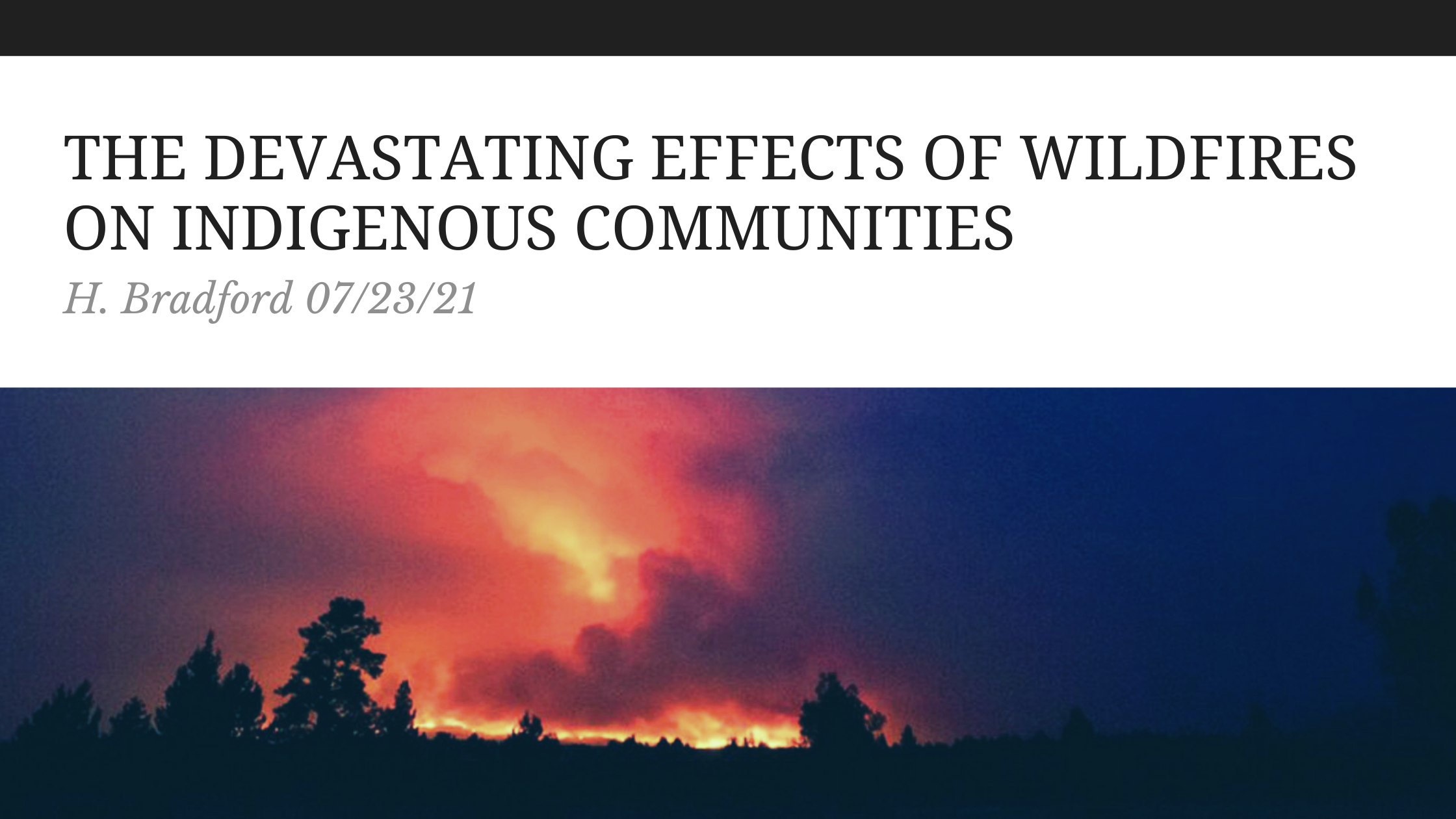
The summer of 2021 has been marked by catastrophic drought, heat, and fires across the United States and Canada. The Bootleg Fire, one of the largest fires in Oregon history, has incinerated an area larger than the city of Los Angeles and forced the evacuation of over 2,000 people. It is one of nearly eighty major fires in thirteen U.S. states. The Bootleg Fire is so large that it generates its own weather and has impacted air quality on the east coast of the United States, 2,500 miles away. The Bootleg fire is the third largest in Oregon history and just one of several large fires in Washington, California and Oregon. The largest Oregon fires were the 2002 Biscuit Fire and the Long Draw Fire in 2012. However, by the time the fire is extinguished, it will likely exceed them in size. These fires are an obvious and apocalyptic result of climate change, as the Western United States has grown hotter and drier over recent decades. As unfettered fossil fuel driven capitalism continues to warm the planet, massive fires are becoming an unsettling norm. These fires impact broad swaths of society, but indigenous people are often on the front line of their most devastating effects.

Although the Bootleg Fire has mostly destroyed rural, forested areas and has spared cities, the blaze is decimating tribal lands. Don Gentry, chairman of the Klamath Tribal Council reported that the fire threatens the tribal lands of the Klamath Tribes. The Klamath Tribes consist of three Native American tribes, including the Klamath, Modoc, and Yahoosin and the fire is just 25 miles from their tribal headquarters. Oregon Public Broadcasting reported that last September, wildfires destroyed at least one home, a cemetery, and land used by the Klamath Tribe for hunting, gathering, and fishing. These fires are the latest in their struggle for survival, as in the face of drought conditions, they have fought to preserve minimum water levels in Upper Klamath Lake. The Guardian reported that farmers also draw water from the lake, which threatens two species of endangered sucker fish that are central to Klamath culture and history. The Klamath Tribes have also sought to demolish dams that imperil salmon runs on the Klamath River.  The fires are burning their ancestral homeland. Gentry said that the area has been their home for 14,000 years and is also home to 500 year old growth Ponderosa Pine. The Klamath Tribes historically used controlled fire to periodically destroy the fuel for larger fires. James Johnston, a researcher with Oregon State University’s College of Forestry, reported to NPR that along with climate change fueled heat and drought, poor forest management has contributed to the fires. Fires have not been allowed to burn for 125 years, resulting in a buildup of excess fuel.  

In Washington, residents of Nespelem, part of the Colville Reservation, were evacuated due to fires.  Residents were able to evacuate before the fire burned seven homes. In response to the Chuweah Creek Fire, The Confederated Tribes of the Colville Reservation, a community of 9000 descendants of a dozen tribes, declared a state of emergency and closed the reservation to the public and to industrial activity. The Spokesman-Review reported that it was the third major wildfire on the Colville Reservation in six years. In 2015, 20% of the reservation was destroyed by fire. These fires have destroyed elk, deer, traditional plants, and timber that the tribe relies on for sustenance. The tribe derives 20% of their income from timber, which goes toward per capita payments. Elsewhere, last year’s Slater Fire in California destroyed over 200 homes belonging to the Karuk tribe and disrupted ceremonies and hunting. Many of those who lost their homes did not have insurance, owing to the rising cost of insuring homes in fire prone areas. Aside from houses, the Karuk people also lost important cultural artifacts such as animal hides and century old baskets. The tribe has advocated for more prescribed fires to control future wildfires. 

The destruction of forests, bear, elk, deer, cemeteries, homes, and cultural artifacts are just a few of the ways that the wildfires have inflicted loss upon Native Americans of the Western United States. The losses of Native Americans are not prioritized. For instance, FEMA refused to call the wildfire that destroyed the Karuk community at Happy Camp a disaster. This denied the tribe access to additional resources that would have enabled residents to return to their homes. At the same time, when the historical artifacts of the dominant colonizer culture is imperiled, the government goes to great lengths to protect them. When The Mitchell Monument was recently endangered by fire, the monument was saved by the efforts of firefighters to use aerial dropped flame retardant, protective wrap, and fuel reduction. The Mitchell Monument commemorates the death of six Americans killed by a Japanese balloon bomb during WWII. Native American losses barely make the news. 

The Western United States is not the only area where fire, heat, and drought are destroying Native American communities. In Manitoba, smoke from wildfires has caused the evacuation of several First Nations communities. According to the CBC, as of July 20th, over 1,600 people were being evacuated, including the entire populations of Little Grand Rapids and Pauingassi First Nations communities. Bloodvein and Berens River First Nations near Lake Winnipeg are also being evacuated to Winnipeg. There were 130 fires burning in Manitoba, of which, over two dozen were considered out of control by officials. Ellen Young, a Bloodvein First Nations Band Counselor, reported to the CBC that the fires were only six kilometers from the community. In a CBC radio interview, Blair Owens, a member of the Little Grand Rapids First Nations argued that not enough resources are being mobilized to fight the fires. In part, this is due to the fact that Manitoba’s forest fire fighting service, including its water bomber fleet, was privatized in 2018.  

CBC also reported on July, 21st that there were 167 active wildfires in northwestern Ontario. Of these, 57 were located in the Red Lake District. The Poplar Hill First Nation community, located four miles from the fires, was evacuated. Deer Lake First Nation, located 15 miles from the fire, was also evacuated. On Tuesday July, 20th the provincial government announced the partial evacuation of Cat Lake and North Spirit Lake First Nation communities. 500 people from Deer Lake were flown to Cornwall Ontario. Residents could only bring a single suitcase weighing under 28 lbs and some remained behind to care for pets. The Red Cross has housed evacuees in hotels in Winnipeg, Selkirk, and Thunder Bay, but families must sometimes share rooms with others. Evacuations are a grim reality of wildfires, but impose trauma upon indigenous people who already bear generational trauma from being forcibly removed from their lands and later torn from their families and put into deadly boarding schools.  

As Canada burns, construction continues on Line 3. Enbridge, a Canadian company, is racing to complete the 330 mile long Line 3 “replacement” pipeline. Despite fierce opposition from water protectors in Minnesota, the pipeline is nearly 70% completed. On Tuesday, July 20th, activists from a variety of indigenous and environmental organizations gathered at the headwaters of the Mississippi River to speak out against the project, for treaty rights, and to draw attention to water issues. The Minnesota Department of Natural Resources had designated 72% of the state in extreme or severe drought.  The Mississippi River was low and serves as a source of drinking water to many communities. The driest parts of the state are where the Enbridge Pipeline is currently being constructed, drawing from scarce water resources in the process. Wild rice, a culturally and economically important food to the Anishinaabe people, has been threatened by both the drought and potential leaks from the Line 3 project. On June 4th, the Minnesota DNR issued a permit to Embridge allowing the company to pump up 5 million gallons of water for the remaining 145 miles of pipeline construction. This was nearly 10 times the amount of water that they originally requested. Activists oppose this out of concern that during the drought, dewatering construction sites can put stress on wetlands, lakes, and streams. The DNR considers the state prime for wildfires on account of the drought. There have already been 250 wildfires in the state this summer, when 50 is more typical for June or July.

The recent and increasingly frequent wildfires indicate that even a shred of self-determination of indigenous people is impossible within capitalism. Treaty rights mean nothing if the land that sustains indigenous communities is charred by climate change driven fires. Indigenous struggles against corporate interests for fishing rights, clean water, wild rice beds, land access amount to little of the land itself is too parched by drought. Fire does what capitalism has always done, separate people from land and the means of sustenance outside of wage labor. The fact that Line 3 continues to be built through Native American lands in the face of drought, fire, and pandemic illustrates the cruelty of the profit motive. Climate change threatens the entire planet, but those who are the poorest, most marginalized, and most dependent upon hunting, gathering, and farming will feel its impacts the hardest. This environmental racism is genocide. The lands that are burning are not empty forests, but indigenous lands with the remnants of indigenous communities that have survived 500 years of genocide. More resources must be mobilized to fight these fires and manage forests in ways that are informed by indigenous knowledge and under their control. The privatization of land, fire fighting resources, and water resources and rights must be stopped. For the survival of the planet, fossil fuels and capitalism must be abolished.   

Monson Lake: The Worst State Park in Minnesota

H. Bradford

I am on a slow quest to see every state park in Minnesota. To this end, I visited Sibley State Park with my brother this past weekend. While in the area, we decided to stop by Monson Lake since it was only 17 miles away. There are 75 state parks and recreation areas in the state, so of course, one of them is going to be the worst. Thus far, Monson Lake State Park is the worst on account of its history and size.

The history of why it was established is the worst aspect of the park. Monson Lake State Park was established in the 1920s as a private memorial park to remember the deaths of 13 Swedish settlers who were killed in the Dakota War of 1862. Since the park is small, this history of the park isn’t masked by size, a large network of trails, or other facilities. There is only one trail, a camp site, the lake, and some signs about the white casualties in the Dakota War. The few signs remain stilted towards colonial history. Although there is brief mention that the conflict arose out of the starvation conditions imposed upon the Dakota people on account of late annuity payments, the signs were more sympathetic to the history of settlers. For instance, the informational sign mentioned that the Dakota people were resisting white civilization, which is loaded language which attributes “civilization” to white people, but not to Native Americans. A more accurate word for what they were resisting was genocide. The sign denotes the names and ages of the colonists who were killed, whereas the impact of the conflict on Dakota people is unspoken and far more horrific. If the park remains, it should expand its signs to include more information about Native American history of the region, more information about the conflict, and also facts about what happened after the Dakota War of 1862. The outcome of the Dakota uprising was the largest mass hanging in U.S. history (when 38 Dakota prisoners were hanged in a single day in Mankato) and mass internment. 1,600 Dakota prisoners of all ages were held near Fort Snelling, of which 300 died that winter. Previous treaties were nullified and the Dakota were forcibly expelled from Minnesota, with a bounty on any found in the state and state sponsored scouting parties to scalp those who remained.   

There are several other state parks which have connections to the Dakota War of 1862.  Nearby Sibley State Park was named after Henry Hastings Sibley, the first governor of Minnesota and a commander in the Dakota War. The park itself was established by a survivor of the Dakota war who wanted to see a local park established in the area. Fort Ridgely State Park was also established as a memorial to its role in the conflict. This park features a fort defenders monument and the site served as a fort in the war. As mentioned, Fort Snelling State Park was the site of an internment camp after the war.  Lake Shetek State Park was established from a site where settlers were buried after the war. Flandrau State Park was named after Charles Flandrau, a settler who defended New Ulm. Since many of these parks are in Southern and Western Minnesota, I have not yet visited them and it may happen that they are worse than Monson Lake. It remains to be seen how and if these parks approach this history. However, the sheer number of state parks with connections to the war should demonstrate that the state park system arose out of a movement to preserve and commemorate a certain version of history. It is easy to treat state parks as benign public spaces to preserve nature, but they are largely white spaces.     

Aside from this history, Monson Lake is rather small. It doesn’t seem like a destination in its own right. At 343 acres, it is not the smallest Minnesota State park. However, it featured only one trail, which took less than an hour to explore. The campground and lake seem like they could be locally attractive, but might have been better as a municipal park. The office is not staffed, so visitors must go to nearby Sibley State Park for passes or to speak to a ranger. Again, because of its small size and lack of points of interest, the history seemed like the main attraction.

The park may have some good qualities. For instance, the lake might offer opportunities for birding. My brother and I saw three snakes within the first few minutes of the hike, so the park seems to punch above its weight in reptiles. We also saw chipmunks, toads, a dead turtle, egret, and several other birds. The park is a small area but seemed to have a large number of animals for its size. Again, it probably is a nice local place for a picnic, camping, or fishing, but hardly worth the drive for visitors outside the area. The fact that it is a state park means that it is a protected area, which preserves it from private development. This should be viewed as a plus. But, the history is uncomfortably colonial and this is something which needs to change. Thus, that is why it is the worst state park I have been to.   


A Day in Hot Springs

A Day In Hotsprings

A Day in Hot Springs

H.Bradford
11/10/20

One of my bucket list goals for the year was to visit another state.  Another one of my goals was to visit a National Park. Of course, Covid-19 has upended many of my goals this year.  My mother and I managed to go on a road trip to Branson in October.  Branson is pretty close to the border of Arkansas, which was a new state for me. We decided to venture into Arkansas for a quick trip to Hot Springs, a National Park.  So, two bucket list goals in a day. It is about a four hour drive to Hotspring, Arkansas and we really only had the afternoon and evening to explore. Although we were pressed for time, we made the most of our short visit.  This is how we spent our time:


Ozark National Forest: 


We started out early in the morning from Branson and took Scenic Highway 7 to experience the Ozark National Forest. This route takes four hours from Branson and is about thirty miles less than the quicker route along 65, which passes through Little Rock.  The road was very curved and winding at first, which gave me a sense of motion sickness even though I was the driver! Eventually, the curves became less sharp and frequent, and it was easier to enjoy the drive.  This first section was dominated by various oaks, which were not yet in full fall color.  The views were spectacular, with several waysides to stop for photos and restrooms. As the route nears Hot Springs, the highway gives way to the Ouachita National Forest. The road was flanked by beautiful towering pines.  There are many attractions along the way, such as the Mystic Caverns near Harrison, AK and natural sights like Buffalo National River, Nimrod Lake, hiking trails, and several state parks (Mt. Nebo, Mt. Magazine, and Petit Jean). Because we were focused on making the most of our time at Hot Springs, we only stopped to enjoy the scenery.


Mueller’s Bakery and Bistro:


When we arrived in Hot Springs, it was time for lunch.  We stopped at Mueller’s Bakery and Bistro, a quaint little cafe off of Highway 7 on Crawford Street. My mother and I ordered pimento and cheese sandwiches on rye. I hadn’t tried this before, but it seems like the “Avocado Toast” of another place and time. The sandwich featured a heavy serving of pimento cheese; a cheddar, mayo, and pimento mix eaten in the southern U.S.  It was filling, fatty, and rich. I ordered mine with an iced tea and a strawberry salad. I was happy to have a vegetarian option. We both enjoyed homemade pie for desert, sharing strawberry rhubarb and coconut cream. The place was not very busy, but seemed frequented by locals at the time of our visit. It definitely had the aura of a small town cafe.

Bathhouse Row:


After stuffing ourselves with pie and pimento cheese, we set out to do some walking. We took advantage of the free parking and explored Bathhouse Row. The eight historical bathhouses are, of course, the main attraction of Hot Springs. The Fordyce Bathhouse, built in 1915, serves as the National Park office. However, due to Covid-19 the building and museum is closed. There was a staffed information table. Because of Covid-19, we could only enjoy the historical buildings from the outside. For instance, the Quapaw Bathhouse, which is still in use, had closed its steam cave and had very limited access to its thermal pools. We had tried to book spa services in advance, but they were sold out. We still had a fun time admiring the architecture of the bathhouses, which were built in the late 1800s and early 1900s using a variety of architectural styles. There are a few thermal water fountains in the area, which is a way to experience the springs for free.


Grand Promenade:   


Located just behind Bathhouse Row is a tranquil, half mile long brick trail.  Construction of the trail began in 1934 and in 1982 it became a National Recreational Trail. The trail begins near the Arlington Lawn, where the Hot Water Cascade can be found. Behind the Maurice Bathhouse, towards the middle of the trail’s length, one can find the Display Springs, where the spring flows from a fissure in the hill and forms a small, algae green, pool. There are a few interpretive signs along the tree lined path.  


Peak Trail:


The Grand Promenade offers access to several trails, including the .6 mile Peak Trail, which leads to the Hot Springs Mountain Tower.  My mother and I ambled up the hill for a pleasant, uphill hike to the tower. There were many pines along the way as well as late blooming wildflowers. The terrain is gravel and paved, with an elevation gain is 357 feet.   


Hot Springs Mountain Tower:


The Hotsprings Mountain Tower is definitely worth a visit, or in our case, the hike up hill to see it. There wasn’t much time to spare when we arrived, as the tower closes at 6:30 pm (and 5pm during the winter). The last visitors are allowed up the 216 foot tower a half hour before closing time and we arrived just in time. At the top, there is an open viewing platform, which offers a spectacular 360 degree view of Hot Springs and the Ouachita Mountains.  Entry to the tower costs $8 per adult and tickets can be purchased in the gift shop at the bottom of the tower. We also enjoyed posing in the bathtub outside of the shop, where I tried to reenact the Death of Murat.


Shopping:


There are many shops located along Central Avenue, across the street from the Bathhouses. We meandered around the shops for a while, looking for souvenirs and passing time. The Bathhouse Soapery was the best shop that we stopped at, since a person can purchase bath and beauty supplies. My mother bought a collection of pear scented bath supplies. I purchased a strange assortment including a chocolate mask, loblolly pine soap, and a pumpkin scented bath bomb. The loblolly pine is the state tree of Arkansas, so each time I use the soap I can think of our adventures. I purchased a pair of cactus earrings from Stella Mae’s, which had fun clothes and accessories.       


Fat Bottom Girl’s Cupcake Shoppe:


My mother wanted to visit this shop, since it had been featured on the Food Network’s Cupcake Wars. There was a cornucopia of cupcake flavors such as pumpkin cheese cake, key lime pie, creme brule, and salted caramel. My mother ordered a classic wedding cake cupcake along with a lemon lavender cupcake.  I had a bite of the lemon lavender cupcake, which was very floral, but definitely an interesting flavor. She loved the wedding cake flavor.  


Superior Bathhouse Brewery:  


Our adventure ended with dinner at the Superior Bathhouse Brewery. I don’t drink alcohol, but the beers and root beer are made from thermal water. My mother had a root beer. It is the only brewery in a National Park and operates out of the Superior Bathhouse, a small brick bath house built in 1916. I ate a delicious sweet potato and beet sandwich and my mother had a burger. It was a vegetarian friendly, sort of hipster place, with great service. There was a little wait for a table, due to limited seating. Overall, I loved it! The sandwich was my favorite meal on the road trip. 


Conclusion: 

Although our time in Hot Springs was limited, we did what we could to make the most of it.  I think we had a pretty good sample of some of the top attractions. Cupcakes, hiking, stunning views, a scenic drive, historic bath houses, pimento cheese sandwiches, hot spring root beer, who could ask for more?! It was a great time and a nice introduction to the state of Arkansas. 


The Hunt for the Brittle Prickly Pear

The Hunt for the Brittle Prickly Pear

The Hunt for the Brittle Prickly Pear

H. Bradford

8/26/20


Although it may not seem like the ideal habitat for cacti, Minnesota is actually home to three native species of cactus: the Plains Prickly Pear, the Brittle Prickly Pear, and the Purple Ball Cactus.  The Brittle Prickly Pear or Opuntia fragilis, which ranges into northern Alberta, just four degrees from the Arctic circle, is the northernmost cactus in the world. These northerly cacti have several adaptations which allow them to survive extreme conditions.  Although they flower and produce fruit, they can also reproduce from pads that have detached from the plant.  In the winter, they shrivel up to avoid freeze damage. They can tolerate a variety of soils and are fire tolerant, as long as their roots survive.  Prickly pears in general photosynthesize at night to avoid loss of water. These tough cacti can withstand a temperate range between -58 F and 131 F. Since I knew that this cactus could be found at Quarry Park in St. Cloud, which isn’t too far from where my brother lives, I was determined that this summer I would find this cacti.


The first attempt to find the Brittle Prickly Pear was this past June.  My brother and I spent over three hours at Quarry Park in St. Cloud searching the rocky outcrops for the cactus. Perhaps part of the problem was that I expected it to be larger. I have seen prickly pears before, and they are usually somewhat large plants with pads the size of my hands. When blooming, they have large yellow flowers. The Brittle Prickly Pear is remarkably small. The pads are about two inches tall and a half of an inch to an inch wide. They grow in small clusters on bare, southern facing rocks. While they tolerate many conditions, they do not tolerate shade, so they will not survive where they are crowded or shaded by other plants.  The area which we focused on the most was the State Scientific and Natural Area. This seemed like the most obvious place, since it featured a sign with information on the Brittle Prickly Pear. We scoured the rocks, but found nothing.  This isn’t to say that there are no Brittle Prickly Pear in the SNA, but we were not successful in this area.  Even though we didn’t find any cacti, we had a nice hike and even got yelled at by a man who looked like Santa Claus for talking too loudly out on the far end of the SNA (where we hadn’t seen any hikers for at least an hour).


SCUBA dive in St Cloud MN at Stearns County Quarry Park and Nature Preserve


My brother and I visited Quarry Park again in mid-August.  This second visit was cut short when I suddenly got a fever and had to turn around on the hike.  The cactus hunt turned into a Covid-19 scare that sent me back home.  I was quite disappointed that I had to abandon the quest, but my brother cheered me up by painting me a prickly pear portrait.


A week later, after my Covid-19 test came back negative, I visited my brother again.  For this third attempt to find the cactus, I prepared myself for the hunt by wearing a cactus shirt, mask, and earrings.  Clearly this outfit helped, as this time we were successful early in our hike.  We once again headed towards the SNA, but along the way my brother saw a trail which said, “Do Not Enter” or “Wrong Way.”  I believe that this was near number 11 on the map.  He thought we should enter anyway, which we did.  We came upon some rocks and I found a tiny cactus the size of my pinky lying on its side on a bed of moss. I found a cactus!  A tiny, uprooted cactus. A few feet away at the south end of these rocks were several other patches of small cacti.  We took many photos of our discovery, feeling very satisfied that we finally found the cacti. They were much smaller than I had imagined them.  In a way, it is easy to understand how such tiny cacti survive against the harsh winters. The are small, keeping close to the warmth of the rocks and insulating moss. These ones don’t appear to fruit or flower, struggling at the very edge of cacti survival.  And, while this guide is not precise because I don’t have a good memory of the layout of the park, hopefully this helps others find them as well.  As another clue, the spot where the cacti were located was near a quarry pond with trout on a trail which lead onward to the SNA.  I hope, of course, that no one digs up or destroys these cactuses.  They are not protected in Minnesota, but they are in other states and it would be nice to keep a healthy population of these unique plants.


Quarry Park is just one area where these cacti can be found. Some of the places where Brittle Prickly Pear are known to grow include Jeffer’s Petroglyphs, Pipestone National Monument, Blue Mounds State Park, Sherburne National Wildlife Refuge, granite outcrops around St. Cloud, rock outcrops of Big Stone County, and southern sloping rocky outcrops at Rainy Lake near Canada.  Having found one species of cactus in Minnesota, I hope to one day find the others as well. The Purple Ball Cactus is considered endangered in Minnesota, but can be found in Big Stone Wildlife Refuge and its populations outside of the refuge has been threatened by granite quarrying.  The Plains Prickly Pear is more common, but still rare in that it is confined to the south western parts of the state. Blue Mounds State Park seems like a great destination to see both the Plains Prickly Pear and Brittle Prickly Pear.  In any event, my brother and I were elated to find the prickly pear on our third attempt and I look forward to future cacti adventures.


A few sources:

https://www.minnesotawildflowers.info/flower/brittle-prickly-pear

Click to access 2012%20CSSJ%20Minnesota.pdf

https://www.catherineruddell.com/blog/2016/7/4/cactus-hunting-at-56-degrees-north#:~:text=Little%20Prickly%20Pear%2C%20or%20Opuntia,cactus%20species%20in%20THE%20WORLD.

https://www.fs.fed.us/database/feis/plants/cactus/opufra/all.html


Two Days at Pictured Rocks National Lakeshore

Two Days at (1)

Two Days at Pictured Rocks National Lakeshore


H. Bradford

08/09/20

One of my 2020 bucket list items was to visit a national park and a new state. I certainly won’t accomplish most of my 2020 bucket list due to Covid-19. Although there are many things I can’t do this year, I thought that one small thing I could do is visited Pictured Rock National Lakeshore in Michigan.  Michigan is not a “new” state on my list of states, but it is “new” for 2020.  Pictured Rocks National Lakeshore is operated by the National Park Service, so, it is a part of the national park system even if it is not one of the 62 designed national parks.   Pictured Rocks is one of only three National Lakeshores, which makes it special, even if it isn’t a national park.  The rocks get their name from the minerals such as iron, copper, and manganese in the groundwater that have dripped down the rock face.  Located only five and a half hours from Duluth, it made for the perfect quick getaway.  The following are some highlights of my two day visit.


Chapel Loop:


This was my favorite part of the trip.  It was a ten mile loop of trail which followed the cliffs of the Pictured Rocks National Lakeshore, while weaving through the forests as well. The trails were very muddy in many areas, which made the hiking slow and added more distance as muddy areas often had to be circumvented.  The trail brings hikers past Chapel Falls to Chapel Rock. Chapel Rock is an interesting looking sandstone formation. The outcropping is straddled by the roots of a large white pine.  Near Chapel Rock is Chapel Beach. This is the part of the trail which marks the beginning of following the Pictured Rocks cliffs. The trail offers stunning views of Lake Superior and the cliffs.  By the end of the hike, I felt worn out, but accomplished!

Image may contain: tree, sky, plant, outdoor and nature

Image may contain: ocean, plant, tree, sky, outdoor, nature and water


Image may contain: tree, plant, outdoor, nature and water


Pictured Rocks Boat Tour:


A less arduous way to see the Pictured Rocks is with a boat tour. Boat tours are very popular and were booked until the late afternoon on the second day of the trip.  I had also tried to book a shipwreck themed glass bottom boat tour, but these were booked for both days. I managed to snag a 3pm boat tour for the Pictured Rock boat.  The boat tour costs $38 and lasted about two and a half hours. Due to Covid-19, the occupancy of the boat is half of what is typical and everyone was required to wear a mask. There are two seating levels, so for the most part, people could space out.  There was some crowding in the line and when it started to rain, which sent upstairs passengers to the bottom of the boat.  The great thing about doing the boat tour after the hike was that it is an opportunity to see the places you’ve been!  It also is was an opportunity to see some of the landmarks that I did not have time to visit, such as Miner’s Castle and Miner’s Beach.  The boat tour also offers views of Grand Island, including the Grand Island East Channel Light.  The gray wooden lighthouse began operations in 1868.  The boat tour is a leisurely way to soak in the astonishing cliffs and learn more about their history.  The boat was very stable, so there seemed to be little risk of seasickness.

Image may contain: sky, tree, outdoor and nature

Image may contain: tree, outdoor, water and nature

Image may contain: sky, mountain, outdoor, nature and water


Grand Sable Dunes:


Grand Sable Dunes are located about an hour away from Munising, Michigan. The dunes are located on the far east end of the Pictured Rocks National Lake Shore.  Whereas Pictured Rocks is most famous for its fifteen miles of colorful cliffs, it also has a five stretch of impressive dunes called Grand Sable Dunes. The tallest of the dunes is 275 feet above the lake. A short, quarter mile long trail takes visitors to the dunes. I expected a sprawling, Sahara like landscape.  Instead, the trail ended with a few dunes which could be climbed and a view of other dunes which was partially obscured by jack pines. It was hard to appreciate the size and expanse of dunes from that vantage point.  The Log Slide offers a better overview of the dune landscape. Although the view does not offer a full account of the landscape, it is a first hand experience to hike up some smaller dunes.  I think my visit to Grand Sable Dunes was another example of my imagination imposing unrealistic expectations upon reality.  To be fair, my imagination has been informed by dunes in Namibia, including a hike up Dune 45 and an attempt to hike up Big Daddy (ran out of time…and it was hot).  The Grand Sable Dunes are an example of perched dunes, or dunes which occur on cliffs.  They were formed when sand was blown up and deposited upon a glacial moraine. According to the National Park Service, Ojibwe called the dunes Gitchi Nagow or Great Sands, and used them for religious fasting.  I know next to nothing about dune ecosystems, but the Grand Sable Dunes is orchid rich and home to some unique plant species.  I didn’t know that the dunes were home to rare orchids!  The only noteworthy plant that I saw during my hike was a gauntlet of poison ivy.  Grand Sable Dunes is definitely worth a visit!

Image may contain: sky, cloud, outdoor and nature

Image may contain: people standing, plant, sky, tree, mountain, outdoor and nature


   Grand Sable Waterfall:


There are dozens of waterfalls to visit in Pictured Rocks National Lakeshore and the surrounding area.  But with only two days to take in the sights of the Pictured Rocks National Lakeshore, there wasn’t time to visit many. One very easy to visit waterfall is Grand Sable Waterfall.  It is located right by the Grand Sable Dunes, making it easy to visit both at the same time. There are several viewing platforms from which visitors can view the 75 foot falls. There are 168 steps on the stairs that lead to the lowest viewing platform.

Image may contain: tree, plant, outdoor, nature and water


Log Slide Overlook:


The Log Slide Overlook is located about five miles west of Grand Sable Dunes. The overlook was used to roll logs down the dune into Lake Superior, hence the name.  A short trail (.25 miles round trip) leads visitors to the overlook.  The overlook is 175 feet above Lake Superior and offers views of the perched dune landscape as well as Au Sable Lighthouse in the distance.  Visitors can hike down the side of the dune, but this is a steep five minute journey down and a long, grueling, sandy hike back up.  There have been emergencies wherein tourists who could not make it back up the steep dune and had to be rescued. I was not inclined to tackle the sandy incline and enjoyed the views from above.


Image may contain: ocean, sky, plant, outdoor, nature and water

Image may contain: sky, plant, outdoor and nature


Sable Lake: 

This is close to Grand Sable Dunes on the other side of the highway.  There isn’t much to say about this stop, but that it only takes a minute or two to pull off and visit the lake.  There was a small bear near the lake when I stopped there.

Image may contain: grass, tree, outdoor and nature


Grand Marais:

Since Grand Sable Dunes are only a mile away from Grand Marais, there is no reason not to stop by this small town at the far east end of the Pictured Rocks National Lakeshore.  There are a few attractions in the town, such as the Pickle Barrel House, which is a barrel shaped house on the National Register of Historic Places.  There is a museum inside of the house, but it was closed due to Covid-19.  Another attraction is the Gitchi Gummee Agate Museum. This had limited due to Covid-19, with evening hours on the day that I visited.  There is also a memorial monument to commercial fishers, Lighthouse Keeper’s House Museum, and Old Post Office Museum.  I did not visit any of these museums. However, I made a brief visit to the public beach near the Lighthouse Keeper’s Museum, where visitors can view again the dune landscape. The area is also a breeding ground for rare Piping Plovers.

Image may contain: people standing and outdoor

Image may contain: sky, house, tree, plant and outdoor, text that says 'GITCHE GUMEE MUSEUM'


Christmas, MI:

Although this is not part of the Pictured Rocks, Christmas is an unusual stop right outside of Munising, Michigan.  The tiny town is definitely past its heyday, but tourists can still stop to take a photo of a giant Santa sign or the giant Santa outside of a casino. There is also a motel called the Christmas Motel and several streets with Christmas themed names.

Image may contain: outdoor

Image may contain: tree, sky, house, plant, outdoor and nature


Overall, I had a good but brief visit to Pictured Rocks National Lakeshore.  If I visited again, I would like to do more hiking and see a few more waterfalls.  I also wouldn’t mind going on the shipwreck tour and perhaps trying kayaking (I am not sure if I am confident enough to kayak on Lake Superior.) Otherwise, I felt that I made pretty good use of my time.  It is a popular tourist destination, so there were many people around.  The trails allowed enough area for social distancing and the tourist were less plentiful closer to Grand Marais. That seemed to be a quieter end of the Pictured Rocks National Lakeshore.  With plenty of things to do and see, it was definitely worth the visit!

Big Bog with My Brother

Big BoG

Big Bog with My Brother

H. Bradford

8/1/20


I promised my brother “it would be the Disneyland of bogs.” In my mind, the Big Bog State Recreation Area was a big deal. It had been on my bucket list for a few years and a July visit with my father in Bemidji provided the perfect opportunity to make the journey. So, I coaxed my brother into abandoning his family and coming along. As a spoiler, it was not “the Disneyland of bogs,” that I had promised. This has happened before. As a teen, I visited the amethyst mines by Thunder Bay, ON.  I imagined fantastic caverns of sparkling lavender hued crystals. Instead, it was a giant open pit mine of dusty brown rocks. Last summer, I visited the Forestville Mystery Cave, which was epic in my imagination with twisting caverns of fossil embossed walls. It was a large cave, but the standard tour visited only a small portion, and it was much more mundane than the cave I had imagined. Big Bog State Recreation Area was indeed a very large bog. It had all of the impressive qualities of a very large bog, but it was not the orchid bejeweled paradise with towering mounds of moss and giant, carnivorous plants. Big Bog was big in my imagination and big in real life, but it is best appreciated for exactly what it is…a large bog with an impressive, mile long bog walk.

Image may contain: Heather Bradford, standing, tree, plant, bridge, shoes, sky, outdoor and nature


To begin, bogs are a type of wetland or water saturated environment. They are furthermore a type of peatland, which is an environment wherein organic material has built up over time because cool (usually) low oxygen conditions have inhibited the decay of these materials. Among peatlands, bogs are characterized by peat or partially decayed vegetation that has built up over time. According to basic definitions of bogs, this built up peat landscape is not nourished by groundwater, and instead derives its nutrients from precipitation. This results in water with low nutrient content and high acidity. This means that bogs host uniquely adapted plants such as carnivorous plants, orchids, and stunted, slow growing trees.

Image may contain: plant, flower, tree, outdoor and nature


Minnesota has 6 million acres of peatlands, which make up 10% of the state. It is second only to Alaska in peatlands. According to the Department of Natural Resources, Minnesota’s peatlands began forming 5,000-6,000 years ago during a climate cooling period that saw increased precipitation. Big Bog State Recreational Area, which is also known as The Red Lake Peatland, was formed in the part of the basin of Glacial Lake Agassiz.  Nearby Upper Red Lake and Lower Red Lake are remnants of the lake.  Richard Ojakanga’s Roadside Geology of Minnesota states that Big Bog itself formed about 3,000 years ago as vegetation began to overtake low lying areas of Glacial Lake Agassiz. The average thickness of peat is ten feet. Big Bog is 50 miles long east to west and 12 miles wide. It is the largest bog in the lower 48 states. The Red Lake Peatland is also unique in that it is located only 50 miles from prairie.  

Image may contain: text that says 'E landforms. flowing water, and vegetation. The world' patterned oon mostly in the northern bo arctic regions of the north hemisphere. Smaller peatl elsewhere, too, at high alti tropical regions, and along deltas and ocean shoreline Minnesota Peatlands'


Big Bog State Recreation Area was added to the Minnesota State Park system in 2000. It was established through a local effort to boost the economy after the collapse of walleye fishing on Red Lake.  Fishing was the main tourist attraction for the nearby town of Waskish, which saw resorts close in the late 1990s. When I told my brother this, he was skeptical that a large bog would attract tourists.  After all, there is a difference between the type of tourist who wants to stroll through a bog and those who want to go walleye fishing.  In other words, people who like bogs might be a bit more on the nerdy side. I had read that several years after opening, there were 75,000 visitors to Big Bog, a number that was expected to grow (but cannot find the source). Since walleye fishing resumed in 2006 after efforts to restock the fish and a moratorium on fishing them, the two types of tourism actually coexist at the moment. 

Image may contain: plant, tree, outdoor and nature


Big Bog State Recreational Area attracted me for a number of reasons. One, I want to visit all of Minnesota’s State Parks (and Big Bog is part of the state park system). Two, I like big bogs and I can not lie. Really, I like bogs of all sizes. Bogs are interesting. They are full of interesting berries, carnivorous plants, orchids, and unique trees. In Europe, they have preserved corpses.  There are also opportunities to see unique birds. Three, it is the biggest bog in the lower 48 states! Four, it has a great board walk. Speaking of which, the boardwalk really is amazing. The mile-long boardwalk was completed in 2005. The DNR states that it is the longest boardwalk  in the U.S.  The Bemidji Pioneer reported that the boardwalk was constructed in a way which allowed for 60% of sunlight to reach the plants under the walkway (Wikipedia reports 38%). Sixteen foot sections of boardwalk were installed without machinery, as to avoid damage to the fragile ecosystem. Work was done in the winter to minimize damage and the boardwalk itself stands 18 inches above the bog on anchors drilled fifteen feet into the peat. The boardwalk itself is worth the visit.

Image may contain: tree, sky, plant, grass, outdoor, nature and water


As I mentioned in my introduction, the Big Bog Recreation Area didn’t quite live up to the hype in my head. One reason for this is that we wanted to see orchids. My brother and I had visited Lake Bemidji State Park the previous day and saw two species of orchids. The Showy Lady’s Slipper was past its prime and wilted. I was hoping that by going an hour north to Big Bog, we might catch some fresher specimens. We didn’t see any. Also, we were attacked by deer flies. This made it difficult to stop and enjoy the nature around us. We saw many different species of butterflies, but I was unable to stop and identify them because I would be immediately assaulted by flies once I stopped moving. The most comical example was when a Mourning Cloak butterfly landed on my butt, but I couldn’t stop to photograph it because of the flies. I also didn’t see many birds that morning. The boardwalk was impressive and certainly a feat to build.  It was also pretty astonishing to see what seemed like endless bog in all directions. But, my brother pointed out that we grew up in a boggy area and it really didn’t look that different. Perhaps it is hard to take in all of the small details of such a large area, especially while attacked by flies. 

Image may contain: plant, flower, nature and outdoor


The interpretive signs were full of useful facts. For instance, I learned about efforts in the early 1900s to drain the bog for farmland. Millions of dollars were spent to dig 1,500 miles of ditches in the Red Lake Peatlands. This project failed as farms were abandoned during the Great Depression, but the bog is still scarred in some areas due to the drainage ditches that were constructed earlier in the last century. I also learned that Big Bog was home to remnant woodland caribou into the 1930s. The population was cut off from its Canadian calving grounds and ultimately failed to thrive. The boardwalk might be better appreciated in the spring and fall when the bugs are less bad. It might also be better enjoyed on a guided hike, where a naturalist can point out the plants, butterflies, and birds. Due to Covid-19, Minnesota State Parks have not been offering naturalist programs. I think this would be a great way to get to know the bog.

DSCF3253


Another interesting fact about the Big Bog State Recreational Area was that it was used during the Cold War as a bombing/ammunition test site. Between 1947 and 1951, the U.S. army used Big Bog as Upper Red Lake Firing Range for gunnery and bombing training. Later, the Naval Reserve dropped over 50 bombs to create wallowing holes for moose. From 1948-1953, the National Guard set up targets in the bog for aerial bombing based on the Cold War fear that Duluth was a strategic target for the Soviet Union. Some of the bombs that were dropped in the bog were inert bombs or non-nuclear parts of bombs otherwise developed as nuclear weapons.  One of these non-nuclear bombs weighed 11,000 pounds, was detonated 3000 feet above the bog, and seen 60 miles away in Bemidji. This history was uncovered when researchers in the 1970s began to suspect that a meteor may have created Hillman Lake and a bomb casing was later found in the bog by a naturalist. Despite the fact that the bog was abused for military and agricultural purposes for most of the century, in 1975 it was designated a National Natural Landmark. Of course, the bog was a source of food, tools and housing supplies, and medicine to prehistoric Native Americans to Ojibwe. For instance, many Native American tribes have made medicinal beverages from Bog Labrador Tea. Yellow eyed grass is also one of the 150 medicinal bog plants utilized by the Ojibwe.

Image may contain: plant, flower, nature and outdoor


While the bog is not a magical wonderland, it is scientifically, ecologically, and culturally important. Had we visited a few weeks earlier, we may have seen orchids. Even without orchids, the simple vastness of the bog and engineering feat of the bog walk are worth the visit. The bog walk begins at Ludlow Pond and a wet mixed forest. This slowly transforms into the open expanse of tamaracks, spruce, and mounds of sphagnum moss. We were the only visitors on the bog walk during our short hike. The walkway is a unique opportunity to delve deeper into a bog than what is typical. The morning was noticeably quiet of people, cars, and the sounds of society. As a whole, it was a good experience. At the same time, there are many short bog walkways where it is easier to get a more condensed, but detailed experience. Because of the length of the bog walk and size of the bog, it was hard to focus on the tiny details around us. After a while, everything becomes moss. Perhaps that is the shortfall of “big things” as they are harder to comprehend and take in. A highlight of the experience was catching a glimpse of a bog lemming and stalking a park ranger for my collectable state park patch.  Maybe I will revisit the bog one day when programs resume.  Really, not matter how great the bog was, I was just happy to have a fun morning outdoors with my brother.   


No photo description available.

Image may contain: sky, tree, plant, outdoor and nature


Fighting the Plagues of Locusts and COVID-19

locusts

a version of this article can be found at: https://socialistresurgence.org/2020/04/17/fighting-the-plagues-of-locusts-and-covid-19/

Fighting the Plagues of Locusts and COVID-19

H. Bradford

Written 4/17/20

Posted 4/20/20


In the midst of the COVID-19 pandemic, parts of Africa, South East Asia, and the Middle East are facing another plague. A dangerous outbreak of locusts has ravaged multiple countries since last year, laying waste to crops and threatening millions of people with food insecurity. The current wave of locusts is the second this year and scientists predict it will not be the last. Currently, the hardest hit area is East Africa, where in February eight countries faced an initial swarm and now are hit by a second wave of the voracious insects. It is the largest locust infestation in the region in seventy years. This pestilence arose from the perfect storm of climate change, war, austerity, and imperialism.


The insect behind this scourge is Schistocerca gregaria or the desert locust. Desert locusts are a species of grasshopper found in North Africa, the Middle East, and Indian subcontinent. Owing to accounts in the Bible, Koran, and Ancient Egyptian hieroglyphs, they are the most famous species of locust, though various species are distributed around the world, such as the Australian plague locust, Migratory locust, South American locust, and High plains locust. Like other grasshoppers, locusts are often solitary, but under the right conditions they become gregarious. In their gregarious phase, they band together in large, devastating swarms which have plagued humanity for thousands of years.


Typically, swarming occurs when food becomes abundant due to wet conditions, resulting in a population boom. The perfect conditions for an outbreak of locusts began in 2018 when Cyclone Mekunu struck an area of the Arabian peninsula called the Empty Quarter or Rub’ al Khali, a sand desert which includes portions of Oman, Yemen, United Arab Emirates, and Saudi Arabia. Normally, this area of desert would dry out, controlling locust populations. However, according to a February article in National Public Radio the Empty Quarter was struck by a second cyclone in late 2018 and another in December 2019. “PBS NewsHour” noted that there were a total eight cyclones in 2019, an enormous deviation from the annual occurrence of one or zero. Prior to a year of flooding and heavy rains, there was three years of drought. Beyond the unusually wet conditions of the Empty Quarter, Space.com reported that the Horn of Africa received four times more rain than usual between October and December, in the wettest short wet season in 40 years. These conditions also fostered locust breeding once the insects moved into the region.


The rare and climate crisis driven bombardment of cyclones to an otherwise arid area increased vegetation and resulted in an explosion of the locust population. The Guardian reported that the second cyclone alone resulted in an 8000 fold increase in the locust population. Locusts reproduce with unstoppable speed as a single female can lay 300 eggs, which hatch in as little as two weeks and take only two additional weeks for larvae to mature and begin reproducing. Once mature, locusts can travel up to 90 miles a day. Their population grows exponentially, increasing 400 times every six months.


The locusts spread from Yemen, hitting Kenya, Somalia, and Ethiopia the hardest. National Public Radio reported that the locusts crossed the Gulf of Aden last year, arriving first in Somalia and Ethiopia.They were later spotted in Kenya in December 2019, some forming a swarm of over 192 billion insects in a mass three times the size of New York City. The United Nations has cautioned that a swarm the size of ⅓ of a square mile can eat as much food as 35,000 people in one day. The Guardian warned that East Africa is currently being hit the hardest, though owing to climate change and war, Yemen has also been hit hard. According to “PBS NewsHour” the latest wave of insects is 20 times larger than the February swarm, owing to heavy rains in March. It is currently planting season in East Africa and another wave of locusts is expected to hit during June, which is harvest time. Already, 33 million people in the region endure food insecurity.


The impacts of the infestation are already catastrophic. Al Jazeera reported that a half million acres of farm land in Ethiopia has been ravaged and 8.5 million Ethiopians experience acute food insecurity. As of early April, over 74,000 acres of crops were destroyed, including coffee and tea which make up 30% of Ethiopia’s exports.  In a Los Angeles Times report, Somalia had already lost 100% of  staple crops such as corn and sorghum loss by January. In Kenya, 30% of pastureland has been lost and as of mid-March, the pests had destroyed 2000 tons of food in the country. Over 173,000 acres of cropland in Kenya has been decimated, including corn, bean,and cow pea crops. Agriculture accounts for 25% of Kenya’s economy. Ethiopia, Somalia, Kenya, Djibouti, Eritrea, Tanzania, Sudan, South Sudan and Uganda are among the African countries currently under attack by locust swarms. As of late March, swarms were forming elsewhere in Pakistan, India, Saudi Arabia, and Iran.140,000 acres of crops have been destroyed in Pakistan. The swarms are expected to hit Pakistan’s cotton industry hard, as the textile industry is the country’s largest employer and accounts for 60% of exports. In Pakistan, it is the worst locust outbreak since 1993.


Efforts to stop the spread of locusts have been hampered by COVID-19 and the social problems already facing these countries. Locusts are usually controlled with pesticides, which are either applied by aircraft that target adult locusts through aerial spraying or by ground crews which target eggs and young locusts that can not yet fly. Closed borders and a global slowdown of shipping has slowed the transportation of pesticides. Reuters reported that in Somalia, an order of pesticides expected in late March was delayed. Surveillance of locust swarms is conducted by helicopters, but lock downs have made helicopters harder to secure. In Kenya, helicopter pilots from South Africa have had to quarantine for fourteen days before they could begin work. On the economic side, 60% of Kenya’s GDP went to servicing debt before COVID-19 and locusts hit.The economic impact of both plagues makes this debt even more punishing than it was before. As of 2017, nineteen African countries were spending more than 60% of their GDP on debt.


Somaliland, a self declared republic in Somalia, has no resources to fight locusts. Keith Cressman of the Food and Agriculture Organization (FAO) of the UN said that South Sudan and Uganda also lack programs for outbreaks. In South Sudan, 200,000 people live in UN camps, already in close conditions and at risk of food insecurity and COVID-19. Cressman noted that social distancing makes it hard to train new people to tackle the problem as this involves gathering people together in classrooms. Despite lockdowns and curfews, workers tackling the locust outbreak have been given exemptions for travel. Thus far, nearly 600,000 acres of land have been treated with pesticides and 740 people have been trained to do ground locust control. The FAO has obtained $111.1 million of $153.2 million it requested to fight the swarms. Because most of the world is focused on fighting COVID-19, additional aid to combat the locusts has been hard to come by.


Pesticides are an imperfect solution to the problem. When the pesticides are applied, villages must be warned to move livestock. According to a Kenyan news source, Daily Nation, one of the pesticides that the FAO recommends is Diazinon, which the U.S. banned from residential use in 2004. The pesticide works by affecting the nervous system of insects. However, human exposure can result in symptoms such as watery eyes, stomach pain, vomiting, coughing, and runny nose. Longer exposure can cause seizures, rapid heart rate, and coma. The Pesticide Action Network (Panna) warned that it can be harmful to children and can cause birth defects. A Pakistani news source named lambda cyhalothrin, chlorpyrifos, and bifenthrin as pesticides against locusts and cited worries that the chemicals could impact drinking water, cause respiratory problems, and irritate skin. Ground crews responsible for spraying the pesticides may be at risk. In the face of the COVID-19 outbreak and strained supplies of PPE, workers may not have necessary protections.


According to Science, the FAO has also used biopesticides in the form of fungus in Somalia. An article in the Zimbabwe news source, The Herald expressed concern over both pesticides and biopesticides, which mainly rely on spores from Metarhizium sp. The spores may not be as effective because they work best in moderate temperatures and high humidity, conditions that are not common in the areas most impacted by the locusts. The spores take fourteen days to take effect and are mainly used against young locusts. While it is unknown if this is the current practice, the French research program LUBILOSA, which developed the fungus, suggested that the spores should be dissolved in paraffin or diesel, both of which are carcinogens. Pesticides and biopesticides also risk harming other insects. Linseed oil and neem may have some potential as safer, natural insecticides. Likewise, The Locust Lab of Arizona State University has found that locusts prefer carbohydrate rich foods and lower carb crops may deter locusts. For instance, locusts do not care for millet. In the face of such the immediate, cataclysmic attack of locusts and the risk of famine, research into less harmful alternatives is something for future exploration.


A socialist solution to tackle locust outbreaks should begin with prevention. Unusually wet conditions and the bizarre frequency of cyclones last year was a catalyst for the current crisis. To stop the climate crisis, capitalism must end. Anything short of this will only result in more frequent and severe natural disasters and less predictable weather patterns. The Intergovernmental Panel on Climate Change predicts that Africa will experience a 20% increase in cyclones, coupled with 20% decrease in precipitation. These conditions will make future locust swarms more likely. Droughts, mudslides, floods, and infectious diseases are all predicted to increase with climate change. Agriculture that relies on water could drop 50% in some countries and wheat production could disappear by 2080. Climate change will only make the continent more food insecure at the cost of countless lives.


Another immediate concern to socialists should be organizing against imperialist wars. The locusts spread from Yemen, which could have played a crucial role in halting their migration towards Africa. Yemen was in no position to tackle this problem because it has been beleaguered by a brutal war lasting over five years between the U.S. supported Saudi-led coalition and Houthi fighters. The country has suffered through outbreaks of cholera, diphtheria, measles, dengue fever and now COVID-19. According to Human Rights Watch, there have been two million cases of cholera since 2016. Last fall, when the locust population exploded, ten million people in Yemen needed food aid and were already at risk of starvation. When the swarms appeared, people in Yemen actually began to collect them in bags, sell them, and eat them. Locusts are eaten by people outside of starvation conditions, but after experiencing the worst famine in the world in 100 years, they were a welcome bounty to some.


The war has cost at least 90,000 fatalities and the U.S. is complicit in the destruction. The U.S. has provided weapons and logistical support to Saudi Arabia and its allies which have conducted over 20,000 airstrikes, of which ⅓ were against military targets. Hospitals, ports, mosques, and schools are among the civilian targets. Prior to the war, the Ministry of Agriculture was usually able to control outbreaks of locusts. Presently, control of locusts is divided by government and Houthi forces. Both lack the resources to adequately address the problem. Locust infestations must be caught early and perhaps with better infrastructure or the plethora of other social problems faced in Yemen, it might have been addressed more effectively. Several of the countries now facing the desolation of locusts have similarly been destabilized by wars. This hampers their ability to organize a response.


All of the countries impacted have been saddled with debt and stunted by their economic dependency to wealthier nations. The plague hits the economies of these nations particularly hard because of their high debt and dependence on agricultural exports such as coffee, tea, and cotton. The reason these countries lack the medical infrastructure to combat COVID-19 and means to fight locust swarms is a direct result of colonization and the subsequent export economies, austerity, and debt that maintain dependency. Africa will always be a continent of crisis as long as hefty profits can be extracted from it. In this moment, all international debt should be forgiven and aid given unconditionally to prevent the threat of starvation. But, development of impoverished countries cannot happen within the framework of capitalism. The wealth that has been taken from Africa should be reinvested with a commitment to build infrastructure and capital based upon relationships of solidarity over dependency.


Locusts are often imagined as an act of God, but they exist in a material reality like everything else. The reality is that the climate conditions of the planet are increasingly unstable. One hundred year floods, one hundred year storms, and even, one hundred year locust hatchings are becoming frighteningly normal. The ability to mobilize resources to alleviate hunger and fight these pests is obstructed by war, economic dependency, and a global pandemic which already demands what few resources might be marshaled. In a brighter, socialist future, this insect that has tormented humans for thousands of years might again be minimized to a solitary grasshopper, controlled by sustainable and diverse agricultural practices, early detection, and stable climate conditions. In the case of a swarm, food would be abundant enough to be shared, rather than left to rot in the anarchistic, false abundance of capitalism.

Chernobyl Fires Threaten to Unleash Radiation

a version of this article can be found at: https://socialistresurgence.org/2020/04/13/chernobyl-fires-threaten-to-unleash-radiation/

(It should be noted that yesterday the fires drew dangerously close to Pripyat and that conditions can change rapidly. )

Chernobyl Fires Threaten to Unleash Radiation


Chernobyl Fires Threaten to Unleash Radiation

Written 4/12/20

Posted 4/14/20

H. Bradford


April 26 marks the 34th anniversary of Chernobyl, the worst nuclear disaster in history. By some estimates, the ruins of the Chernobyl reactor will remain highly radioactive for 20,000 years. Decades after the catastrophe, the dangers of radiation persist as forest fires rampage across the exclusion zone. The recent forest fires are only the latest in recent years to threaten the region with radioactive ash and smoke. This problem is compounded by the dual impacts of climate change and capitalist profit motives.


The Chernobyl Nuclear Disaster occurred in the early morning of April 26th, 1986 when a safety check to test if the Uranium 235 fueled reactors could remain cool during a power outage went catastrophically wrong. At the time, there were four graphite-moderated nuclear reactors at Chernobyl Nuclear Power Plant, with two more under construction. The reactors were situated two miles from Pripyat, a Soviet city of 50,000 people. Pripyat was constructed in 1970 with amenities such as quality schools, a supermarket, and sports stadium. The reactors were nine miles away from Chernobyl, a city of 12,000. In all, there were over 115,000 people living within an 18.6 mile radius of the power plant and five million people living in contaminated areas of Russia, Belarus, and Ukraine. During the fateful test, Reactor Four experienced a meltdown resulting in two explosions that unleashed 400 times the radiation of the U.S. atomic bombing of Hiroshima. The accident shrouded 77,000 square miles of Europe and Eurasia in radiation.


It took ten days for emergency workers to extinguish the graphite fueled fire, resulting in the deaths of 28 workers from acute radiation syndrome in the months immediately after the accident. Over 200,000 people were mobilized to clean up the disaster, exposing these liquidation workers to high levels of radiation. In all, 600,000 people in Soviet Union were subsequently exposed to high levels of radiation, including radioactive isotopes such as Iodine-131, Plutonium-239, Strontium-90, Cesium-134, and Cesium-137, which were unleashed during the explosion. As a result, there have been 20,000 thyroid cancer cases between 1991 and 2015 in people who were under the age of 18 at the time of the accident. 115,000 people were evacuated in 1986 and another 220,000 people were later evacuated and resettled. A 30 kilometer (approximately 18.6 miles) exclusion zone was established around the reactor. In the immediate aftermath of the disaster, trees near the reactor died off, becoming what was called a “Red Forest” to denote the russet tone of dead pine. In the decades since, the exclusion zone has become a refuge for returned wildlife and a collection of desolate ghost towns slowly vanishing into the overgrown forest.


The cautionary tale of Chernobyl does not end with the return of nature or the story of countless generations tasked with stewardship over the sarcophagus encased Reactor Four. Recent wildfires threaten to release Chernobyl’s radiation. According to NASA Earth Observatory, wildfires in the exclusion zone began in early April and firefighters have been working to put out the blaze since April 4th. The impacted areas include Denysovets, Kotovsky, and Korogodsky forests. On April 8th, the fires blew towards Kiev, which is located about sixty miles to the south. On April 9th, people were evacuated from the village of Poliske. Poliske is a sparsely inhabited village located within the exclusion zone. A few hundred people, mostly elderly women in their 70s or 80s, reside illegally within the exclusion zone. According to BBC News, conflict in the Donbass region has sent some families to seek safety in the area just outside of the exclusion zone, where the housing is the cheapest in Ukraine. The New York Times stated that as of Saturday April 11th, 400 firefighters had been deployed to the area and 8,600 acres had burned the previous week. The article further mentioned that the blaze has increased radiation levels in Russia and Belarus. Live Science reported that the fire is near the abandoned village of Vladimirovka. According to Ukraine’s Ecological Inspection Service, radiation readings near the blaze are 2.3 microsievert per hour. Typically, the exclusion zone’s ambient radiation is .14 microsievert per hour and .5 microsievert per hour is the threshold considered safe for humans. This calls into question the safety of firefighters working to extinguish the blaze as well as the people living in the region.


At the moment, fires are not located near the entombed reactor. However, Uranium-238, Cesium-137 and other radionuclides jettisoned from Reactor Four and have since been absorbed by vegetation and dirt. Fires can unleash these from the environment and ash condenses the radionuclides sequestered within vegetation. NASA Earth Observatory stated that smoke plumes can carry radiation long distances and that the severity of wildfires has only increased over the years. According to a study published in Ecological Monographs by Timothy Mousseau of University of South Carolina, wildfires that broke out in 2002, 2008, 2010 redistributed 8% of Cesium-137 released by the original Chernobyl disaster. Wildfires in 2015 came a mere 12 to 15 miles from Chernobyl’s reactors.


The most recent wildfire has been attributed to local farming practices, wherein fields are burned in spring and fall. While this may contribute to fires, climate change is certainly the main culprit. A report released by the Atlantic Council in January 2020 noted that the 2019-2020 winter in Ukraine was mild with little snowfall. According to the report, 2019 was the warmest year on record for Kiev and the yearly average temperature in Ukraine was 2.9 degrees celsius higher than average. In 2019, 36 temperature records were broken. Last year, there was 25% less precipitation than average. Droughts have nearly doubled over the last 20 years in Ukraine. In 2015, an article in the New York Times anticipated increased wildfires in the exclusion zone due to drier conditions. Likewise, in 2015 New Scientist reported that the Intergovernmental Panel on Climate Change (IPCC) predicted more fires near Chernobyl in the future.


Climate change driven droughts are one of the catalysts for the fires, but radiation itself contributes to the problem. Radiation slows the decay of leaf litter and inhibits growth of microorganisms, which creates more fuel for fires. In the absence of people, forests have expanded, which also generates more combustible material. The danger is amplified by the fact that local firefighters have seven times fewer crews and equipment than elsewhere in Ukraine. The IPCC predicted a similar outcome for Fukushima, which also has significant forests. They also posited that there is no threshold of radiation with zero effect. Climate change driven droughts, expanded forests, slow decay, few local resources, and strained water resources to fight fires create a recipe for disaster.


Behind the climate crisis is capitalism itself. All manner of environmental problems can be traced back to the profit motive in capitalism. The drive for lower wages, unsafe working conditions, fewer environmental regulations, the endless creation of waste, the lack of storage for the waste created, the generation of pollution itself, the shuttling of hazardous production and wastes to the third world and oppressed communities, the anarchy of too much production, and the insatiable need for growth are all connected to endless drive for profits. Therefore, sustainability and safety are anathema to capitalism. In the context of the Chernobyl exclusion zone, logging trees within the exclusion zone garners tens of millions of dollars in profits. Since 2004, limited amounts of timber can be cut from the exclusion zone as long as it is scanned for radiation. 90% of this timber is used for furniture. According to a January 2020 article in Al Jazeera, fires within the exclusion zone are started purposefully to justify the sale of timber. In a report released after the 2015 wildfires, Mykola Tomenko, head of parliamentary environmental commission stated that fires can conceal illegal logging. Two thirds of illegal profits derived from the exclusion zone are from timber. In 2007, state inspectors also found radiation contaminated charcoal sold in Ukrainian supermarkets. While the more recent fires have not been connected to the timber industry, the search for profits brings capitalists to the radioactive wilds of the exclusion zone to extract resources no matter the impact on consumers or the threat of unleashed radiation.


The Chernobyl Nuclear Accident is a horror story in the closing chapter of the Soviet Union. It is a tale that will last for thousands of years, written in elements with the potential to outlive humanity itself. If there is a moral of the story, it is that nuclear power is dangerous. Despite the threats, there is little motive within capitalism to mitigate the dangers. The only motive, as always, is the profit motive. Fires will certainly revisit Chernobyl and potentially visit Fukushima, once again spreading radiation. Beyond Chernobyl, wildfires have threatened the Hanford Site, a former nuclear production facility in Washington several times. In 2000, the Department of Energy declared an emergency when fires neared a building where nuclear waste was stored. In 2017, a wildfire burned part of the Hanford Site,though no buildings were threatened. Again, in 2019, wildfires burned more than 40,000 acres near the site. The Hanford Nuclear Waste Site is the largest nuclear waste dump in the U.S. and contains 56 million gallons of radioactive waste. The danger of aging nuclear reactors in the United States, the question of where nuclear waste is stored, the connection to terrifying weapons of war, and the catastrophic consequences when things go awry are just a few of the many reasons why nuclear energy must be nationalized and ultimately abolished.

Anxious Adventuring: Hiking Mount Scenery

Copy of Anxious Adventuring_Scenery

Anxious Adventuring: Hiking Mount Scenery

H. Bradford

02/03/2020


Another mountain.  I am not sure why I do this to myself, but I seem to have some sadistic urge to punish myself by forcing my out of shape self up hills, volcanoes, and mountains while on vacation.  Finally, the day of reckoning on my St. Maarten vacation had come. It was Sunday, the day I had purchased a ferry ticket to the island of Saba to hike up Mount Scenery. I woke up with a sense of dread.  In fact, I didn’t want to wake up at all. For the past several days, Saba loomed large in the near distance, its top shrouded in clouds. Every day brought me another day closer to visiting that cloud covered summit, the highest point in the Netherlands and the mythical Skull Island from King Kong. Aside from the hike, the day would involve transportation logistics that I worried wouldn’t work out.  What if I couldn’t find a taxi to the trail head? What if I couldn’t find a taxi back after the hike? What if the hike took too long? What if I missed my ferry back and was stuck on the island until Tuesday?  


Despite my trepidation, I got on the taxi that my hotel had arranged for me and headed to Simpson Bay, where the ferry was set to leave at 9 am.  I booked the ferry ticket through Aqua Mania Adventures, which seems to be the main distributor of tickets. It costs about $100 for the round trip ticket on a ferry that would take about an hour and a half each way.  My hope was to arrive at about 10:30 am and start hiking at 11 am, which would give me about three hours or so to hike up and down the popular Mt. Scenery trail and return to the ferry by 3:30pm. Thus, my day began with the taxi ride from Philipsburg to Simpson Bay, which took about a half an hour and cost me about $18.  


The taxi dropped me off at a parking lot in front of a police station, which suspiciously did not look like the sort of place a ferry would leave.  I doubled checked my paperwork. The instructions stated the Simpson Bay Police Dock, but there was nothing in the area which remotely resembled a ticketing desk. The ferry check in at Simpson Bay is actually located IN the police station near the immigration area.  This was very confusing, especially for the first few travelers to arrive as there was no office or sign indicating that it was the right place. I asked someone inside the building at the immigration desk, who informed me that someone from Aqua Mania Adventures would be arriving soon.  Soon, some equally confused tourists arrived and began milling about the area, waiting for the ticketing agents. A little after 8 am, two individuals from Edge Ferries and Aqua Mania Adventures arrived and set themselves up at an empty table in the immigration office area. They began checking in tourists, scanning passports, and issuing the plastic card that would serve as the ferry ticket.  This process lasted until about 9am, when the ferry arrived and picked up near the police station.


The trip to Saba takes about an hour and a half and most of the travelers on the ferry were there for day trips.  In fact, over half were there to hike Mount Scenery. The ferry offered a complimentary soft drink and was otherwise a calm, uneventful journey. Upon arrival at the very small port, all passengers went through customs and passport control.  All of the other hikers had booked a package which included transportation and lunch. Thus, I was a little concerned about the transportation issue. There were enough taxis for all of the travelers, but I had to wait for my taxi to fill up with other people.  It was the last taxi to leave among the few parked at the ferry terminal. Since other passengers in the taxi van had other plans, the other hikers were able to get a half an hour head start on the trail before I was dropped off.


Due to the time constraints, the taxi driver decided to drop me off at a different trail head than the Mount Scenery Trail head near the Windwardside town.  I was instead dropped up the hill a bit, which cut off about a half an hour of my hike (a one hour hike up rather than 90 minutes) and caught me up to the other hikers.  The taxi itself cost $12, but would have been less with more people in the taxi van, so this number is variable. The driver agreed to meet me at the actual Mt. Scenery trail head (near the trail shop) at 2:45 pm, which would offer enough time to return for the ferry check in at 3:15.  I arrived at the trail just after 11:30. The driver said it would be an hour hike up and an hour hike down (to the actual trailhead). He also told me to turn left at the fork (towards the town) so that I would head to the correct trailhead at the designated meeting time.

Image may contain: plant, tree, bridge, outdoor and nature

Image may contain: plant, tree, outdoor and nature


From the spot on the trail, I began the hour hike up to Mt. Scenery.  It was a humid, hot day, but the forest provided some shade and there was sometimes a breeze.  Because of recent rains, the trail was very slippery. The biggest offender was decaying vegetation and moss on the rocks.  I almost wiped out a few times from slipping, but was able to keep balanced. The steps were unevenly sized and also slippery.  However, the upper third of the trail often featured metal railings which aided with balance and also helped me pull my exhausted body up all those steps.  The trail is primarily made of stone steps, which can be tiring in the heat or simply due to the shear number of them (over 1000 from the trail head). There were enough flowers, foliage, and jumping lizards to occupy my mind as I ascended.  It took almost exactly an hour as the driver had predicted.  

Image may contain: plant, outdoor and nature

Image may contain: plant and outdoor

Image may contain: plant, nature and outdoor


The top of Mount Scenery featured a radio tower and a plaque with its elevation.  It was cloudy at the top, but I was able to take a few photos of the town at the bottom and of the sea before the cloud cover returned.  I didn’t linger long at the top since I wanted to make sure that I had enough time to return and visit the town below. So, after taking some photos, watching the moving clouds, and some time spent drinking my water, I set off back towards the bottom.  As predicted, this also took about an hour. Other people are likely to take less time, but I found it particularly slippery on the way down. This was where I slipped the most, as gravity wanted me to go faster than my feet did. I also stopped to take more photos on the way down, as I knew I had more time to spare.  Once at the bottom, I visited the trail shop, where I made a donation and received a certificate that I had reached the top. I then walked around the town, but many things were closed due to it being a Sunday.  

Image may contain: cloud, sky, plant, tree, outdoor, nature and water

Image may contain: Heather Bradford, smiling, selfie, tree, outdoor, closeup and nature


I returned to the trailhead and was picked up by the taxi at 2:45 without incident.  Along the way, the driver pointed out some of the sights on the island, such as a university, some old churches, nearby islands such as Statia, and a hospital.  I arrived back with plenty of time to go through passport control and wait around in the scorching sun for the ferry to board. Some children were swimming in the small boat landing, as there are few beaches on the island.  I watched as some tropicbirds flew over the nearby cliffs until the ferry finally boarded and we set off back for Simpson Bay. The ferry ride back was equally calm and passengers were treated to pods of jumping dolphins, a swimming iguana, diving brown boobies, and flying fish. 

Image may contain: shoes, plant, outdoor and nature

Image may contain: sky, cloud, ocean, mountain, outdoor, nature and water


At Simpson Bay, I once again went through passport control, then realized that there were no taxis waiting for the ferry.  I had assumed that taxis would congregate around the ferry drop off point waiting for business. This was not the case and I was instead met with an empty parking lot.  I walked to the nearby McDonalds, as it seemed like a more likely place to find a taxi, and waited for a taxi to pass. While I didn’t see any pass, I did see an approaching van with “Phillipsburg” in red letters in the window.  I flagged down the van, which is one of the public transportation vans. Although I was not at an actual bus stop, it stopped and picked me up anyway. It was $2 to ride back to Phillipsburg. The vans serve as the public transportation for the island, but they don’t have fixed schedules or precise routes.  They can be picked up at actual bus stops which say “bushalte”, but I also saw other people just flag down the van as I had. Apparently the rate varies at different times of the day. In any event, I found it to be a convenient and cheap way to return to Phillipsburg.


In the end, I was happy that everything worked out!  I made all of my transportation connections, arrived at Saba, climbed Mount Scenery, and made it back to Phillipsburg to tell the tale.  To other travelers, I would suggest that the police station is indeed the correct location for the ferry and that it is probably much less worrisome to book transportation and lunch ahead of time on Saba.  I was the only hiker who had not pre-arranged these details. Nevertheless, I fared just fine as there were enough taxis waiting at the tiny port. As for the return trip, it was certainly a pretty good savings to take the public van on the way back.  I am sure I could have taken the public van on the way to the ferry terminal as well, but because I am not accustomed to their regularity and I wanted to arrive on time, I didn’t consider it. There are ferries which leave from Philipsburg as well. Because they leave earlier and return later, the Philipsburg ferry provides a longer window for hiking.  However, I had plans on the days that the Phillipsburg ferries were operating so I had to take the ferry from Simpson Bay. Finally, the hike itself is challenging, but not impossible. I huffed,puffed, and sweated up those stairs, but in the end, it is only an hour or an hour and a half of effort up to the top. This is very doable. The biggest challenge is simply knowing that there is a time constraint due to the ferry schedule and taxi logistics.  With more time, a person could really savor the scenery, bird life, and many lizards. The hardest part was how slippery it was. I would recommend hiking sticks, though with the railings, these could become a nuisance when they have to be stowed away. Otherwise, it was a great little hike!

Image may contain: sky, cloud, mountain, tree, outdoor and nature     
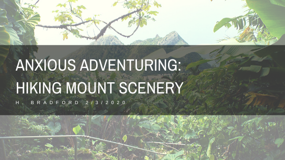
View of Mount Scenery from Windwardside


Inca Trail Packing Guide

Inca Trail Packing Guide


Inca Trail Packing Guide


H. Bradford


01/08/2020


Back in November, I hiked the Inca Trail.  If you read my previous blog post, https://brokenwallsandnarratives.wordpress.com/2020/01/03/hiking-the-inca-trail-while-out-of-shape/, then you learned that I wasn’t in the best shape.  While I struggled along, I took some mental notes of what I would pack and or not to pack if I ever did it again.  There isn’t a lot of room to pack many items. We were provided a small duffel bag which could be packed with about 5 KG of items, which included a sleeping bag, sleeping bag liner, toiletries, and clothes. It is up to each hiker to carry whatever else they need beyond the 5 KG (this weight may vary by company) in a day pack.  Hopefully, most hikers will not need too much more.  Medications, rain gear, layers, snacks, and water are among the things carried in a day pack. I probably packed a bit too much, but at least this can provide an overview of what I found useful.

20191127_054822


Things I didn’t Pack, But Should Have:


Rehydration Salts/Electrolyte Powder:


Based on my experience, this was the number one item I should have packed.  There are a number of reasons why this would have been handy. One, I was not feeling well the third day and didn’t drink enough water.  When a fellow hiker, Elise, put some berry flavored electrolyte powder in my water bottle, I almost immediately felt better and more interested in drinking water.  This helped me to stay hydrated and feeling better for the rest of the day, as it was like drinking a refreshing, yet watery Gatorade. Dehydration can exacerbate the symptoms of altitude, so I suspect this is why I felt so terrible. Secondly, the water provided by porters is filtered and boiled, but doesn’t taste great.  I saw porters washing dishes in a stream, which I have to assume is also one of the sources of water for the trek. There is some running water early in the trek, but I would be surprised if large amounts of water was slugged up on the mountain with everything else. Whatever the source, I found that it sometimes tasted a little rusty (perhaps from rusty pipes) or just a little off.  The water is lukewarm while hiking, which may also be a deterrent to drinking enough of it. Adding flavored electrolyte powder masks the flavor of the water, making drinking water more likely. Thirdly, some people become sick to their stomach on the trail. This thankfully didn’t happen to me until after the trek, but having electrolyte powder can help keep hikers hydrated if they have diarrhea.  Anyway, I can’t stress enough how much having a rehydration pack helped me!


salt

Water Bladder:


Water is an important theme here.  Water was the heaviest item that I carried.  Hikers usually start the day carrying one or two liters of water, which can be 4.4 lbs (if two liters).  It can be many hours before this water is restocked (until at least the lunch stop). I carried two water bottles (one disposable plastic one I carried the entire trip and one that was metal).  Since I carried them on my backpack, to take a drink of water I had to stop and remove the bottles. This deterred me from drinking, since I didn’t want to bother stopping. A water bladder with a hose would have been far easier, as I could have had water on the go.  The worst thing is that I actually brought a water bladder along on the trip, but felt it took up too much space in my small backpack so I opted for the other water bottles! I could have avoided dehydration had I ensured easier access for my water.


Cold Medicine:


In the interest of saving space and weight, I did not bring any cold medicine.  This was foolish, considering that I had only recently recovered from a six week chest cold.  When symptoms of the cold returned, I didn’t have any medicine with me! Thankfully, Elise gave me a cold tablet, which really opened my airways and stopped my coughing.


Vicks Vaporub:


Speaking of cold medicine, my unhappy lungs would have loved some Vicks vaporub.  Vicks is my go to cold relief medicine, since it opens my airways. It can also be used to provide mild relief to sore muscles.  Another way that I would have used Vicks was to block out the terrible toilet smells. Seriously. I gagged several times while trying to use some of the squalid toilets towards the end of the trek.  Vicks is strong smelling, so I could have applied it to the bandana over my nose to mask the ungodly odor. I have heard that police use Vicks to help them block the smell of dead bodies, so it should also provide some relief against squatty potties. vicks

Better Sunscreen:


I didn’t want to pack two different kinds sunscreens (one for my face and one for my body), so I went with the facial sunscreen.  It was SPF 110, which was higher than the body one, and less greasy. My intent when was to save space in my bag while packing one that I didn’t mind putting on my face.  I probably should have packed both. My face did not get burned, but my forearms got roasted with severe sunburn. A waterproof, sweat proof formula might have saved my skin!


More Toilet Paper:


I went through a roll before the trek was over.  Granted, the locally available toilet paper is a little thin, flimsy, and economical on the roll.  I also used the toilet paper to blow my nose. Once the toilet paper was gone, I had to use wet wipes I had packed and napkins I stole from lunch.  This wasn’t an emergency, but would have been without the backup paper.


Sanitary Pads:


Altitude and physical exertion was unkind to my uterus.  It causes spotting to the degree that it seemed like a full blown period at times.  I happened to have a couple pads with me, but I was concerned that if things got heavier, it would not be adequate.  There are many things that can cause a period to come early, late, or spotting to occur. With that said, it is wise to pack a few pads, tampons, a diva cup, etc.  I use Nuvaring, which SHOULD prevent a period from happening until it is removed and has always reliably worked in this manner for me. The hormones were no match for the hike.


“She-Wee”/Travel Urinal:


There are long stretches of the hike without toilets.  Hikers should expect to see toilets at camp (so in the morning and at night) and usually at lunch.  It really isn’t advised to poop on the trail, as a person is expected to carry their used toilet paper with them.  On the other hand, if a person drinks enough water, having to urinate is a likely outcome. There are areas of the trail that really don’t have anywhere private to pee (as there is a ledge on one side and mountain/rock on the other).  For those who lack penises, having a she-wee might be a useful way to quickly and privately urinate. I have one, but didn’t pack it. I didn’t want to waste the space and didn’t know how I felt carrying around a urine soaked rubber funnel if I indeed had to use it.  A person can wash it with water from their water bottle if they do use it. I don’t think it is essential, but it could be useful. Also, I think “She-Wee” is a fun name, since it rhymes. But, I want to point out that it is not inclusive of trans/non-binary travelers who may not identify as “she.”  Go Girl, Lady J, and other similar products are also pretty gendered. I didn’t previously know what to call this product, but travel urinal is probably the most trans friendly.

shopping


Things I Packed, But Didn’t Need:


Many Snacks:


I worried that I would get hungry during the long hikes or that the meals would not be enough.  I packed more snacks than I needed, which took up unnecessary space and weight. The meals were always TOO big.  I was constantly over stuffed by the three course lunches and dinners. I slogged along with a belly full of soup each day, as each lunch and dinner included soup.  There was so much food that it felt oppressive. I ate a few of my snacks, including my mini PayDay bars and a protein bar.


Birding Book/Nature Guide:


I had high hopes for seeing birds along the trail.  Alas, I was too busy hiking to stop and identify the birds that I saw.  I really had to focus on keeping moving. While I did stop for some photos, I was too exhausted by the end of the day to identify the birds I had seen.  I had a bird guide in my day pack, but I didn’t use it at all. I also made my own guide to orchids, flowers, and cacti along the way, which I printed on a few sheets of paper.  Again, I didn’t have time to stop and identify orchids or cacti. I passed them by, aware of their variety and splendor, but unable to take the time to know them. shopping2


Extra Rain Gear:


Since I hiked at the end of November, which was the rainy season, I fully expected rain the entire hike.  I checked the weather forecast before the trek and of course it called for rain each day. Thankfully, I only rained one afternoon and the rest was mostly clear.  However, because I expected the worst, I over packed rain gear. I had both a rain jacket, disposable rain poncho, and heavier rain poncho, when the rain jacket alone would have sufficed.


Extra Leggings:


I wore two outfits during the four day trek.  However, I packed too many leggings. I could have survived with just two pairs or two pairs and one fleece legging.  Instead, I packed four pairs of leggings, two of them fleece. I only used one pair of the fleece leggings and that was during the cold nights.


Sunhat:


Although it was sunny, I felt like the hat only got in the way.  It would blow off my head or dangle sideways from its strap. In the end, I used a bandana to protect my head from the sun. 20191126_094648

You can see the sunhat is already in the way….


Things I was Glad I Packed:


Altitude Medication (Acetazolamide):


I can’t imagine hiking the trail without altitude medication.  I was only prescribed three days worth, so I had to purchase more.  It was about $20 in Cusco and did not require a prescription. I am not sure how much the $20 bought me, but I needed it for about ten days and had some leftover tablets when I returned.

shopping3


Wet Wipes:


An all around good idea for the day pack!  And a great way to clean up after a long day!


Hand Sanitizer:


Again, another good idea for the day pack!


Pepto Bismol:


Altitude, hygiene conditions, less familiar foods, etc. put a person’s digestive system to the test.  I didn’t became ill on the hike, but I did experience some heartburn and mild upset stomach.

PayDay Bars:


Although I didn’t eat many snacks, my mini PayDay Bars were a treat at the end of the day.  Because they weren’t chocolate, they didn’t melt on the hotter days.


Make-up:


This may seem frivolous, but it helped me feel less dirty and unkempt after four days without a shower.  I wear makeup each day, so I felt more like myself. 20191129_075133

Day Four


Dry Shampoo:


Again, this helped me feel less dirty.


Bandana:


Bandanas are useful in many ways.  I used mine to protect my scalp from the sun, around my neck, and to wrap up a severe sunburn. 20191129_082117

The bandana is covering a terrible burn.


Travel Blanket:


This took up a lot of extra space, but it doubled as a pillow and provided extra warmth during the colder nights.


Everything I Packed:


2 fleece leggings (only needed 1)

2 leggings

4 pairs of socks

4 pairs of underwear

2 t-shirts (may have benefited by another)

2 Shorts

1 sweatshirt

1 fleece top

Rain jacket

Hoodie

Bandana

Sunhat (not needed, as bandana was used for this purpose)

(Note: many people packed a winter jacket, but I felt fine without one and just layered my clothes)

Sunglasses

Wash rag

Hiking Boots

Moleskin for Blisters


Hiking poles

Sleeping Bag

Sleeping bag liner

Travel Blanket

Power Bank

Alarm Clock

Camera

Batteries

Chargers

Headlamp

Bird Guide (not needed)

Small notebook (I did take some notes along the way)

Pen

Altitude medication

Ibuprofen

Antibiotics (never used)

Pepto Bismol

Band-aids

Sunscreen 

Deodorant

Make up

Dry Shampoo

Soap

Hairbrush (a comb would have taken less space)

Toothbrush

Toothpaste

Snacks

Water Bottle

Hand Sanitizer

Wet Wipes

Toilet Paper

Sanitary Pads (not enough)

20191129_082205


Post Navigation