broken walls and narratives

A not so revolutionary blog about feminism, socialism, activism, travel, nature, life, etc.

Archive for the category “hiking”

Monson Lake: The Worst State Park in Minnesota

H. Bradford

I am on a slow quest to see every state park in Minnesota. To this end, I visited Sibley State Park with my brother this past weekend. While in the area, we decided to stop by Monson Lake since it was only 17 miles away. There are 75 state parks and recreation areas in the state, so of course, one of them is going to be the worst. Thus far, Monson Lake State Park is the worst on account of its history and size.

The history of why it was established is the worst aspect of the park. Monson Lake State Park was established in the 1920s as a private memorial park to remember the deaths of 13 Swedish settlers who were killed in the Dakota War of 1862. Since the park is small, this history of the park isn’t masked by size, a large network of trails, or other facilities. There is only one trail, a camp site, the lake, and some signs about the white casualties in the Dakota War. The few signs remain stilted towards colonial history. Although there is brief mention that the conflict arose out of the starvation conditions imposed upon the Dakota people on account of late annuity payments, the signs were more sympathetic to the history of settlers. For instance, the informational sign mentioned that the Dakota people were resisting white civilization, which is loaded language which attributes “civilization” to white people, but not to Native Americans. A more accurate word for what they were resisting was genocide. The sign denotes the names and ages of the colonists who were killed, whereas the impact of the conflict on Dakota people is unspoken and far more horrific. If the park remains, it should expand its signs to include more information about Native American history of the region, more information about the conflict, and also facts about what happened after the Dakota War of 1862. The outcome of the Dakota uprising was the largest mass hanging in U.S. history (when 38 Dakota prisoners were hanged in a single day in Mankato) and mass internment. 1,600 Dakota prisoners of all ages were held near Fort Snelling, of which 300 died that winter. Previous treaties were nullified and the Dakota were forcibly expelled from Minnesota, with a bounty on any found in the state and state sponsored scouting parties to scalp those who remained.   

There are several other state parks which have connections to the Dakota War of 1862.  Nearby Sibley State Park was named after Henry Hastings Sibley, the first governor of Minnesota and a commander in the Dakota War. The park itself was established by a survivor of the Dakota war who wanted to see a local park established in the area. Fort Ridgely State Park was also established as a memorial to its role in the conflict. This park features a fort defenders monument and the site served as a fort in the war. As mentioned, Fort Snelling State Park was the site of an internment camp after the war.  Lake Shetek State Park was established from a site where settlers were buried after the war. Flandrau State Park was named after Charles Flandrau, a settler who defended New Ulm. Since many of these parks are in Southern and Western Minnesota, I have not yet visited them and it may happen that they are worse than Monson Lake. It remains to be seen how and if these parks approach this history. However, the sheer number of state parks with connections to the war should demonstrate that the state park system arose out of a movement to preserve and commemorate a certain version of history. It is easy to treat state parks as benign public spaces to preserve nature, but they are largely white spaces.     

Aside from this history, Monson Lake is rather small. It doesn’t seem like a destination in its own right. At 343 acres, it is not the smallest Minnesota State park. However, it featured only one trail, which took less than an hour to explore. The campground and lake seem like they could be locally attractive, but might have been better as a municipal park. The office is not staffed, so visitors must go to nearby Sibley State Park for passes or to speak to a ranger. Again, because of its small size and lack of points of interest, the history seemed like the main attraction.

The park may have some good qualities. For instance, the lake might offer opportunities for birding. My brother and I saw three snakes within the first few minutes of the hike, so the park seems to punch above its weight in reptiles. We also saw chipmunks, toads, a dead turtle, egret, and several other birds. The park is a small area but seemed to have a large number of animals for its size. Again, it probably is a nice local place for a picnic, camping, or fishing, but hardly worth the drive for visitors outside the area. The fact that it is a state park means that it is a protected area, which preserves it from private development. This should be viewed as a plus. But, the history is uncomfortably colonial and this is something which needs to change. Thus, that is why it is the worst state park I have been to.   


Yurt Camping at Cuyuna State Recreation Area

Yurt Camping at Cuyuna State Recreation Area

Yurt Camping at Cuyuna State Recreation Area

H. Bradford

11/21/20

I learned this summer, while visiting Glendalough State Park, that some Minnesota State Parks have yurts for rent.  Only three state parks feature yurt rental including Glendalough State Park, Afton State Park, and Cuyuna State Recreation Area. I decided this would be a fun adventure, so I set out to rent one at Cuyuna State Recreation Area.  However, as it turns out, the yurts are pretty popular, so there were no reservations until late October. I nabbed the available reservation, which was for Monday, October 26th. At $70, the rental is not exactly cheap for one person, but would be a pretty good deal for a group. The yurt at Cuyuna State Recreation Area can sleep up to seven people!  In my case, I had the whole unit to myself. 

Winter came early to Minnesota, so there was snow on the ground and cold temperatures by mid-October. The night that I planned on camping was particularly cold, with a low of 16 degrees F.  I was a little worried about the wintery conditions.  But, I set out anyway, hoping for the best.  The park itself was a former mining area from the early 1900s to 1960s and is pocked with deep mining pits. It was also the site of the deadliest mining accident in Minnesota history, when a mine shaft of the Milford Mine suddenly filled with water and mud on Feb. 5th, 1924, killing forty one miners. There is still mining equipment, historical markers, old buildings, and of course, the landscape itself, which mark decades of mining history in the park. Some of these historical areas were closed for the season.


The Cuyuna State Recreation Area is located about 100 miles west of Duluth. Many of the trails at Cuyuna State Recreation Area were closed until the ground was frozen, as to avoid damage. In better weather conditions, the park is known for its mountain bike trails. I had thought of bringing my bicycle, as there are also flat trails, but, it worked out better that I didn’t. During my visit, I was the only person in the park. The yurts are located at Yawkey Lake, where there are three yurts and a few trails. My yurt was named Manganese. It was the furthest from the parking lot and the outhouse restroom. Campers can use a cart found at the yurt to haul in their items. Instructions of where to find the key are sent with the reservation, so there is no need to check in at an office. I carted in my items from my car, grabbing firewood along the way. There is a firewood station near the outhouses, where free firewood is available for the wood stove during the winter months. A hand pumped water spigot is also located in that area, but I packed my own water.  I was definitely glad that there was plenty of  free firewood to use in the stove!


My first order of business was setting up LED candles in the yurt. Actual candles are not allowed and I wanted some source of light during the dark evening ahead. I set up a dozen LED candles, unpacked some things, took a few photos, then set off to do some hiking before sunset. As I had mentioned, many trails were closed, but there were a few nearby trails which I explored before it got dark. Upon my return from hiking, I started up a fire in the wood stove. That was my first time using a wood stove, but it was pretty easy to figure out, with a single lever used to control the oxygen to the fire.  The stove was small and it took over six hours for the yurt to become semi-comfortably warm. I also started a fire outside in the fire pit, where I joined a weekly socialist meeting via zoom and ate s’mores. I was happy that my cell phone actually had reception and it is interesting how a person can be in the middle of the woods but also on a video conference.


After sunset, it definitely felt cold. The yurt has a pretty large area to heat, so I found myself huddled by the wood stove for hours in my winter jacket. I even pulled my mattress off one of the bunks so that I could sleep on the floor by the wood tove. It was also dark. The many LED candles, my camping lantern, and small flashlight didn’t provide nearly enough light. I managed to spend a few hours reading, but the room beyond my book was very dark and cold.  Outside the yurt, I could hear many nature noises, such as the yipping of dogs or coyotes from across the mining lake and the flutey call of a saw-whet owl.  I didn’t sleep well, as I woke up throughout the night to feed wood to the stove. A few times throughout the night, I stepped out into the cold and looked out at the stars. By morning, the yurt was toasty and comfortable. I went for another hike in the morning, then packed up my things. I made the mistake of trying to clean out the ashes from the stove, which only brought them back to life and filled the yurt with smoke. I had to fan out the smoke with the door. Outside the yurt, the sun shone brightly on the cool morning and there were many chickadees and juncos fluttering about the campsite, perhaps eating leftover crumbs from my s’mores.

Overall, I had a fun time. It was my first time “camping” in cold weather and my first time using a wood stove. Although many of the trails were closed, I enjoyed the time spent hiking alone. There wasn’t a single car in the whole park. The early cold weather really seemed to scare people away from nature. I was happy to hear a saw-whet owl and would try winter cabining again. My main advice would be to bring plenty of light. The night is long and dark. While the LED candles provided some ambiance, they did not shed a lot of light. I relied on my camp flashlight for my reading. Another thing I learned was not to clean out the ashes in the morning. I was trying to be thoughtful, but it ended up being a smoky mess. Also, I went through a lot of wood! I used almost all of the wood that I had carted in, which was more than I expected to use. So, I would definitely try to overshoot the amount of wood needed, as it wouldn’t have been fun to fetch more in the middle of the night. On the way home, I stopped in Aitkin, where I ate lunch at the Block North Brew Pub. I had a PLT sandwich (portabella, mushroom, and tomato) and it was great! They also have a wild rice black bean burger. I would definitely recommend Block North for a post-camping meal.


A Day in Hot Springs

A Day In Hotsprings

A Day in Hot Springs

H.Bradford
11/10/20

One of my bucket list goals for the year was to visit another state.  Another one of my goals was to visit a National Park. Of course, Covid-19 has upended many of my goals this year.  My mother and I managed to go on a road trip to Branson in October.  Branson is pretty close to the border of Arkansas, which was a new state for me. We decided to venture into Arkansas for a quick trip to Hot Springs, a National Park.  So, two bucket list goals in a day. It is about a four hour drive to Hotspring, Arkansas and we really only had the afternoon and evening to explore. Although we were pressed for time, we made the most of our short visit.  This is how we spent our time:


Ozark National Forest: 


We started out early in the morning from Branson and took Scenic Highway 7 to experience the Ozark National Forest. This route takes four hours from Branson and is about thirty miles less than the quicker route along 65, which passes through Little Rock.  The road was very curved and winding at first, which gave me a sense of motion sickness even though I was the driver! Eventually, the curves became less sharp and frequent, and it was easier to enjoy the drive.  This first section was dominated by various oaks, which were not yet in full fall color.  The views were spectacular, with several waysides to stop for photos and restrooms. As the route nears Hot Springs, the highway gives way to the Ouachita National Forest. The road was flanked by beautiful towering pines.  There are many attractions along the way, such as the Mystic Caverns near Harrison, AK and natural sights like Buffalo National River, Nimrod Lake, hiking trails, and several state parks (Mt. Nebo, Mt. Magazine, and Petit Jean). Because we were focused on making the most of our time at Hot Springs, we only stopped to enjoy the scenery.


Mueller’s Bakery and Bistro:


When we arrived in Hot Springs, it was time for lunch.  We stopped at Mueller’s Bakery and Bistro, a quaint little cafe off of Highway 7 on Crawford Street. My mother and I ordered pimento and cheese sandwiches on rye. I hadn’t tried this before, but it seems like the “Avocado Toast” of another place and time. The sandwich featured a heavy serving of pimento cheese; a cheddar, mayo, and pimento mix eaten in the southern U.S.  It was filling, fatty, and rich. I ordered mine with an iced tea and a strawberry salad. I was happy to have a vegetarian option. We both enjoyed homemade pie for desert, sharing strawberry rhubarb and coconut cream. The place was not very busy, but seemed frequented by locals at the time of our visit. It definitely had the aura of a small town cafe.

Bathhouse Row:


After stuffing ourselves with pie and pimento cheese, we set out to do some walking. We took advantage of the free parking and explored Bathhouse Row. The eight historical bathhouses are, of course, the main attraction of Hot Springs. The Fordyce Bathhouse, built in 1915, serves as the National Park office. However, due to Covid-19 the building and museum is closed. There was a staffed information table. Because of Covid-19, we could only enjoy the historical buildings from the outside. For instance, the Quapaw Bathhouse, which is still in use, had closed its steam cave and had very limited access to its thermal pools. We had tried to book spa services in advance, but they were sold out. We still had a fun time admiring the architecture of the bathhouses, which were built in the late 1800s and early 1900s using a variety of architectural styles. There are a few thermal water fountains in the area, which is a way to experience the springs for free.


Grand Promenade:   


Located just behind Bathhouse Row is a tranquil, half mile long brick trail.  Construction of the trail began in 1934 and in 1982 it became a National Recreational Trail. The trail begins near the Arlington Lawn, where the Hot Water Cascade can be found. Behind the Maurice Bathhouse, towards the middle of the trail’s length, one can find the Display Springs, where the spring flows from a fissure in the hill and forms a small, algae green, pool. There are a few interpretive signs along the tree lined path.  


Peak Trail:


The Grand Promenade offers access to several trails, including the .6 mile Peak Trail, which leads to the Hot Springs Mountain Tower.  My mother and I ambled up the hill for a pleasant, uphill hike to the tower. There were many pines along the way as well as late blooming wildflowers. The terrain is gravel and paved, with an elevation gain is 357 feet.   


Hot Springs Mountain Tower:


The Hotsprings Mountain Tower is definitely worth a visit, or in our case, the hike up hill to see it. There wasn’t much time to spare when we arrived, as the tower closes at 6:30 pm (and 5pm during the winter). The last visitors are allowed up the 216 foot tower a half hour before closing time and we arrived just in time. At the top, there is an open viewing platform, which offers a spectacular 360 degree view of Hot Springs and the Ouachita Mountains.  Entry to the tower costs $8 per adult and tickets can be purchased in the gift shop at the bottom of the tower. We also enjoyed posing in the bathtub outside of the shop, where I tried to reenact the Death of Murat.


Shopping:


There are many shops located along Central Avenue, across the street from the Bathhouses. We meandered around the shops for a while, looking for souvenirs and passing time. The Bathhouse Soapery was the best shop that we stopped at, since a person can purchase bath and beauty supplies. My mother bought a collection of pear scented bath supplies. I purchased a strange assortment including a chocolate mask, loblolly pine soap, and a pumpkin scented bath bomb. The loblolly pine is the state tree of Arkansas, so each time I use the soap I can think of our adventures. I purchased a pair of cactus earrings from Stella Mae’s, which had fun clothes and accessories.       


Fat Bottom Girl’s Cupcake Shoppe:


My mother wanted to visit this shop, since it had been featured on the Food Network’s Cupcake Wars. There was a cornucopia of cupcake flavors such as pumpkin cheese cake, key lime pie, creme brule, and salted caramel. My mother ordered a classic wedding cake cupcake along with a lemon lavender cupcake.  I had a bite of the lemon lavender cupcake, which was very floral, but definitely an interesting flavor. She loved the wedding cake flavor.  


Superior Bathhouse Brewery:  


Our adventure ended with dinner at the Superior Bathhouse Brewery. I don’t drink alcohol, but the beers and root beer are made from thermal water. My mother had a root beer. It is the only brewery in a National Park and operates out of the Superior Bathhouse, a small brick bath house built in 1916. I ate a delicious sweet potato and beet sandwich and my mother had a burger. It was a vegetarian friendly, sort of hipster place, with great service. There was a little wait for a table, due to limited seating. Overall, I loved it! The sandwich was my favorite meal on the road trip. 


Conclusion: 

Although our time in Hot Springs was limited, we did what we could to make the most of it.  I think we had a pretty good sample of some of the top attractions. Cupcakes, hiking, stunning views, a scenic drive, historic bath houses, pimento cheese sandwiches, hot spring root beer, who could ask for more?! It was a great time and a nice introduction to the state of Arkansas. 


Walking around Branson with my Mother

Walking around Branson with my Mother

H. Bradford

11/04/20

My mother and I recently went on a road trip to Branson. We had wanted to go to Niagara Falls this summer, but with Covid-19 it was impossible to visit the Canadian side. We had also considered a visit to South Dakota, but after Sturgis, it didn’t seem safe. Although travel anywhere poses risks, we had thought that Branson would be an option, since it is a place my mother enjoys visiting and Covid-19 had not yet spiked in the midwest when we were considering it.  This of course changed. To mitigate some of the risk, we spent a lot of time outdoors enjoying nature as it is easier to social distance.  Branson is better known for shows and family entertainment, but it also offers a lot of opportunities to explore nature. We spent about two full days in Branson, but managed to see quite a bit!


Waterfall Trail:


This plainly named trail is ⅔ of a mile long and as the name suggests, leads to a waterfall.  The trailhead can be found near the entrance of the Westgate Resort, where there is a free parking lot at the base of the hill. We hiked in mid-October, so the trail was mostly dry at the time.  The riverbed of the Roark River tributary also had a low water level.  The trail was rocky and had a steep hill towards the beginning, but was otherwise easy.  A highlight of the hike was a persimmon tree, which was the first that I have seen in the wild.  Friendly Carolina chickadees and American goldfinches were another highlight.  

Lakeside Forest Wilderness Area:


Lakeside Forest Wilderness Area is conveniently located off of 76 near many Branson attractions, such as Dolly Parton’s Stampede, the Auto and Farm Museum, and between many Branson hotels and Branson landing. For lack of time, my mother and I only explored the Bluff Trail, which is marked in blue and the Owen Drive Trail, which is yellow.  The Bluff Trail offers spectacular views of Lake Tanycomo and the Branson area. Lake Tanycomo looks like a river, and was actually a human made reservoir created by damming the White River.  The Owen Drive Trail leads to the Owen Homestead and because it was a driveway, it is flat and even. In all, the wilderness area has over five miles of trails. Since it closes at dark, and sunset is just after 6pm, there wasn’t nearly enough time to explore this park. However, both the blue and yellow trails were easy and interesting, flanked with late blooming autumn flowers. 

Branson Landing:


Branson Landing features a popular walkway along Lake Tanycomo, as well as many shops and restaurants. The central attraction is a Fountain Show; a color changing, musical fountain.  During some songs, the fountain also produces flames, as I learned when Bon Jovi’s Living on a Prayer came on. The grand finale of the day is the Star Spangled Banner at 10 pm. The promenade is less than a mile long and a great place to visit at night, when it is hard to walk elsewhere.  Water shows start at noon and go until ten most days, except sunday, which is nine pm. We strolled around during the late evening, enjoying the fresh air, well lit path, colorful fountain, and some shops.  There isn’t much nature here, but due to the cool weather, it wasn’t too busy with people while we were visiting. Coming from Minnesota, the weather felt fine.

Table Rock State Park:


With a packed schedule, we only managed to explore the Table Rock Lakeshore Trail, which follows Table Rock Lake for over two miles. Like the other parks and trails mentioned thus far, it is free to visit. We visited in the morning, when the area was active with many birds.  Some of the birds we saw included several species of woodpeckers, such as red headed and red bellied woodpeckers. Tufted titmice and Carolina chickadees were also prevalent along the trial. A highlight was a fish crow, which was a new species of bird for me. Visually, the fish crow looks like an American crow.  The main difference is their calls, which for the fish crow is more truncated and nasal. The paved trail was pleasant and lined with hardwood trees. There were also scenic views of Table Lake and Branson along the drive to the state park.

Top of the Rock at Cedar Lodge:


While the other hikes were free, Top of the Rock at Cedar Lodge isn’t cheap.  A guided hike costs $34.  For the price, I expected that the guides would interpret the nature of the area. Instead, the guides mostly made sure that walkers were safe from the golf carts which used the same path. Although the path was paved, there were some pleasant views of the area and a variety of things to see along the way. It also featured a visit to a cave, where visitors can drink lemonade or alcohol at the Bat Bar.  Bat Bar is featured in Atlas Obscura because it is an unusual spot for drinking and bat watching. We did not see any bats, perhaps because it was day time or too late in the season. Since it is more of a kiosk, Bat Bar looks a bit like a lemonade stand in a cave. Aside from the Bat Bar, there is also a covered bridge, waterfalls, and two hills at the end. The trail is suitable for most people of all ages and fitness levels.


Attending a walking tour offers a discount at the expansive Ancient Ozarks Natural History Museum of the Ozarks. The museum features some “natural” history, but really is more generally about the human history of the Ozarks, spare some information on the megafauna which roamed Missouri.  I was impressed with the many rooms focused on Native American history, which as far as I could tell seemed sympathetic to the genocide of Native Americans even though the methods of collection and those who created the collections likely have a dubious history. There is a shuttle which carts visitors between the museum and visitor center.  As a whole, the area is over developed and over priced, so there is not the sense of rugged nature. The lemonade at the Bat Bar tasted like it had gone bad. Overall, it seemed overpriced. But, the museum at the end was worth the visit on account of the large collection of Native American artifacts, historical information, art, and cultural items.

Ruth and Paul Henning Conservation Area:


This was my favorite area to explore.  I visited here on Sunday while my mother was at church.  During the few hours I hiked, I explored the Glade Trail, Riverside Trail, Dewey Bald Trail, and Shanee’s Shortcut.  Of the places explored during our visit, this was the most rugged. The area is dry, seeing as it is a glade, and I became quite warm during the hike.  I spotted many lizards along the way.  I also saw many birds, such as Carolina wrens, Carolina chickadees, crows, Blue jays, Black vultures, and a house wren. The paved Dewey Bald Trail leads to a tower, which can be climbed for a view of Branson. The boards of the tower are a little wobbly at the viewing platform. The structure seems a little old, but generally safe. The trails can be rocky and uneven, which some incline, which make them slightly more challenging, but only modestly saw.  Ruth and Paul Henning Conservation area is located on the west side of Branson, not far from Butterfly Palace. The land was donated by the Hennings, who produced popular television shows such as the Beverly Hillbillies, Green Acres, and Petticoat Junction. My mother is a fan of those old shows, but probably would have found the trails a little too challenging due to the uneven terrain. It is free to visit.      

Conclusion:


These are just a small sample of outdoor areas in and near Branson.  I had also wanted to go to Dogwood Canyon, which also charges a fee. Due to limited capacity, I did not end up there. It is advised to buy tickets in advance, as they were sold out the day of my intended visit. The Brusiek State Forest and Wilderness Area is located just north of Branson and almost made it onto the itinerary, but was cut due to the time crunch.  The Branson area offers a lot of natural beauty and I was glad that I was able to enjoy some of it with my mother.  We had a wonderful time and my mother did a great job keeping an active schedule!

The Hunt for the Brittle Prickly Pear

The Hunt for the Brittle Prickly Pear

The Hunt for the Brittle Prickly Pear

H. Bradford

8/26/20


Although it may not seem like the ideal habitat for cacti, Minnesota is actually home to three native species of cactus: the Plains Prickly Pear, the Brittle Prickly Pear, and the Purple Ball Cactus.  The Brittle Prickly Pear or Opuntia fragilis, which ranges into northern Alberta, just four degrees from the Arctic circle, is the northernmost cactus in the world. These northerly cacti have several adaptations which allow them to survive extreme conditions.  Although they flower and produce fruit, they can also reproduce from pads that have detached from the plant.  In the winter, they shrivel up to avoid freeze damage. They can tolerate a variety of soils and are fire tolerant, as long as their roots survive.  Prickly pears in general photosynthesize at night to avoid loss of water. These tough cacti can withstand a temperate range between -58 F and 131 F. Since I knew that this cactus could be found at Quarry Park in St. Cloud, which isn’t too far from where my brother lives, I was determined that this summer I would find this cacti.


The first attempt to find the Brittle Prickly Pear was this past June.  My brother and I spent over three hours at Quarry Park in St. Cloud searching the rocky outcrops for the cactus. Perhaps part of the problem was that I expected it to be larger. I have seen prickly pears before, and they are usually somewhat large plants with pads the size of my hands. When blooming, they have large yellow flowers. The Brittle Prickly Pear is remarkably small. The pads are about two inches tall and a half of an inch to an inch wide. They grow in small clusters on bare, southern facing rocks. While they tolerate many conditions, they do not tolerate shade, so they will not survive where they are crowded or shaded by other plants.  The area which we focused on the most was the State Scientific and Natural Area. This seemed like the most obvious place, since it featured a sign with information on the Brittle Prickly Pear. We scoured the rocks, but found nothing.  This isn’t to say that there are no Brittle Prickly Pear in the SNA, but we were not successful in this area.  Even though we didn’t find any cacti, we had a nice hike and even got yelled at by a man who looked like Santa Claus for talking too loudly out on the far end of the SNA (where we hadn’t seen any hikers for at least an hour).


SCUBA dive in St Cloud MN at Stearns County Quarry Park and Nature Preserve


My brother and I visited Quarry Park again in mid-August.  This second visit was cut short when I suddenly got a fever and had to turn around on the hike.  The cactus hunt turned into a Covid-19 scare that sent me back home.  I was quite disappointed that I had to abandon the quest, but my brother cheered me up by painting me a prickly pear portrait.


A week later, after my Covid-19 test came back negative, I visited my brother again.  For this third attempt to find the cactus, I prepared myself for the hunt by wearing a cactus shirt, mask, and earrings.  Clearly this outfit helped, as this time we were successful early in our hike.  We once again headed towards the SNA, but along the way my brother saw a trail which said, “Do Not Enter” or “Wrong Way.”  I believe that this was near number 11 on the map.  He thought we should enter anyway, which we did.  We came upon some rocks and I found a tiny cactus the size of my pinky lying on its side on a bed of moss. I found a cactus!  A tiny, uprooted cactus. A few feet away at the south end of these rocks were several other patches of small cacti.  We took many photos of our discovery, feeling very satisfied that we finally found the cacti. They were much smaller than I had imagined them.  In a way, it is easy to understand how such tiny cacti survive against the harsh winters. The are small, keeping close to the warmth of the rocks and insulating moss. These ones don’t appear to fruit or flower, struggling at the very edge of cacti survival.  And, while this guide is not precise because I don’t have a good memory of the layout of the park, hopefully this helps others find them as well.  As another clue, the spot where the cacti were located was near a quarry pond with trout on a trail which lead onward to the SNA.  I hope, of course, that no one digs up or destroys these cactuses.  They are not protected in Minnesota, but they are in other states and it would be nice to keep a healthy population of these unique plants.


Quarry Park is just one area where these cacti can be found. Some of the places where Brittle Prickly Pear are known to grow include Jeffer’s Petroglyphs, Pipestone National Monument, Blue Mounds State Park, Sherburne National Wildlife Refuge, granite outcrops around St. Cloud, rock outcrops of Big Stone County, and southern sloping rocky outcrops at Rainy Lake near Canada.  Having found one species of cactus in Minnesota, I hope to one day find the others as well. The Purple Ball Cactus is considered endangered in Minnesota, but can be found in Big Stone Wildlife Refuge and its populations outside of the refuge has been threatened by granite quarrying.  The Plains Prickly Pear is more common, but still rare in that it is confined to the south western parts of the state. Blue Mounds State Park seems like a great destination to see both the Plains Prickly Pear and Brittle Prickly Pear.  In any event, my brother and I were elated to find the prickly pear on our third attempt and I look forward to future cacti adventures.


A few sources:

https://www.minnesotawildflowers.info/flower/brittle-prickly-pear

Click to access 2012%20CSSJ%20Minnesota.pdf

https://www.catherineruddell.com/blog/2016/7/4/cactus-hunting-at-56-degrees-north#:~:text=Little%20Prickly%20Pear%2C%20or%20Opuntia,cactus%20species%20in%20THE%20WORLD.

https://www.fs.fed.us/database/feis/plants/cactus/opufra/all.html


Big Bog with My Brother

Big BoG

Big Bog with My Brother

H. Bradford

8/1/20


I promised my brother “it would be the Disneyland of bogs.” In my mind, the Big Bog State Recreation Area was a big deal. It had been on my bucket list for a few years and a July visit with my father in Bemidji provided the perfect opportunity to make the journey. So, I coaxed my brother into abandoning his family and coming along. As a spoiler, it was not “the Disneyland of bogs,” that I had promised. This has happened before. As a teen, I visited the amethyst mines by Thunder Bay, ON.  I imagined fantastic caverns of sparkling lavender hued crystals. Instead, it was a giant open pit mine of dusty brown rocks. Last summer, I visited the Forestville Mystery Cave, which was epic in my imagination with twisting caverns of fossil embossed walls. It was a large cave, but the standard tour visited only a small portion, and it was much more mundane than the cave I had imagined. Big Bog State Recreation Area was indeed a very large bog. It had all of the impressive qualities of a very large bog, but it was not the orchid bejeweled paradise with towering mounds of moss and giant, carnivorous plants. Big Bog was big in my imagination and big in real life, but it is best appreciated for exactly what it is…a large bog with an impressive, mile long bog walk.

Image may contain: Heather Bradford, standing, tree, plant, bridge, shoes, sky, outdoor and nature


To begin, bogs are a type of wetland or water saturated environment. They are furthermore a type of peatland, which is an environment wherein organic material has built up over time because cool (usually) low oxygen conditions have inhibited the decay of these materials. Among peatlands, bogs are characterized by peat or partially decayed vegetation that has built up over time. According to basic definitions of bogs, this built up peat landscape is not nourished by groundwater, and instead derives its nutrients from precipitation. This results in water with low nutrient content and high acidity. This means that bogs host uniquely adapted plants such as carnivorous plants, orchids, and stunted, slow growing trees.

Image may contain: plant, flower, tree, outdoor and nature


Minnesota has 6 million acres of peatlands, which make up 10% of the state. It is second only to Alaska in peatlands. According to the Department of Natural Resources, Minnesota’s peatlands began forming 5,000-6,000 years ago during a climate cooling period that saw increased precipitation. Big Bog State Recreational Area, which is also known as The Red Lake Peatland, was formed in the part of the basin of Glacial Lake Agassiz.  Nearby Upper Red Lake and Lower Red Lake are remnants of the lake.  Richard Ojakanga’s Roadside Geology of Minnesota states that Big Bog itself formed about 3,000 years ago as vegetation began to overtake low lying areas of Glacial Lake Agassiz. The average thickness of peat is ten feet. Big Bog is 50 miles long east to west and 12 miles wide. It is the largest bog in the lower 48 states. The Red Lake Peatland is also unique in that it is located only 50 miles from prairie.  

Image may contain: text that says 'E landforms. flowing water, and vegetation. The world' patterned oon mostly in the northern bo arctic regions of the north hemisphere. Smaller peatl elsewhere, too, at high alti tropical regions, and along deltas and ocean shoreline Minnesota Peatlands'


Big Bog State Recreation Area was added to the Minnesota State Park system in 2000. It was established through a local effort to boost the economy after the collapse of walleye fishing on Red Lake.  Fishing was the main tourist attraction for the nearby town of Waskish, which saw resorts close in the late 1990s. When I told my brother this, he was skeptical that a large bog would attract tourists.  After all, there is a difference between the type of tourist who wants to stroll through a bog and those who want to go walleye fishing.  In other words, people who like bogs might be a bit more on the nerdy side. I had read that several years after opening, there were 75,000 visitors to Big Bog, a number that was expected to grow (but cannot find the source). Since walleye fishing resumed in 2006 after efforts to restock the fish and a moratorium on fishing them, the two types of tourism actually coexist at the moment. 

Image may contain: plant, tree, outdoor and nature


Big Bog State Recreational Area attracted me for a number of reasons. One, I want to visit all of Minnesota’s State Parks (and Big Bog is part of the state park system). Two, I like big bogs and I can not lie. Really, I like bogs of all sizes. Bogs are interesting. They are full of interesting berries, carnivorous plants, orchids, and unique trees. In Europe, they have preserved corpses.  There are also opportunities to see unique birds. Three, it is the biggest bog in the lower 48 states! Four, it has a great board walk. Speaking of which, the boardwalk really is amazing. The mile-long boardwalk was completed in 2005. The DNR states that it is the longest boardwalk  in the U.S.  The Bemidji Pioneer reported that the boardwalk was constructed in a way which allowed for 60% of sunlight to reach the plants under the walkway (Wikipedia reports 38%). Sixteen foot sections of boardwalk were installed without machinery, as to avoid damage to the fragile ecosystem. Work was done in the winter to minimize damage and the boardwalk itself stands 18 inches above the bog on anchors drilled fifteen feet into the peat. The boardwalk itself is worth the visit.

Image may contain: tree, sky, plant, grass, outdoor, nature and water


As I mentioned in my introduction, the Big Bog Recreation Area didn’t quite live up to the hype in my head. One reason for this is that we wanted to see orchids. My brother and I had visited Lake Bemidji State Park the previous day and saw two species of orchids. The Showy Lady’s Slipper was past its prime and wilted. I was hoping that by going an hour north to Big Bog, we might catch some fresher specimens. We didn’t see any. Also, we were attacked by deer flies. This made it difficult to stop and enjoy the nature around us. We saw many different species of butterflies, but I was unable to stop and identify them because I would be immediately assaulted by flies once I stopped moving. The most comical example was when a Mourning Cloak butterfly landed on my butt, but I couldn’t stop to photograph it because of the flies. I also didn’t see many birds that morning. The boardwalk was impressive and certainly a feat to build.  It was also pretty astonishing to see what seemed like endless bog in all directions. But, my brother pointed out that we grew up in a boggy area and it really didn’t look that different. Perhaps it is hard to take in all of the small details of such a large area, especially while attacked by flies. 

Image may contain: plant, flower, nature and outdoor


The interpretive signs were full of useful facts. For instance, I learned about efforts in the early 1900s to drain the bog for farmland. Millions of dollars were spent to dig 1,500 miles of ditches in the Red Lake Peatlands. This project failed as farms were abandoned during the Great Depression, but the bog is still scarred in some areas due to the drainage ditches that were constructed earlier in the last century. I also learned that Big Bog was home to remnant woodland caribou into the 1930s. The population was cut off from its Canadian calving grounds and ultimately failed to thrive. The boardwalk might be better appreciated in the spring and fall when the bugs are less bad. It might also be better enjoyed on a guided hike, where a naturalist can point out the plants, butterflies, and birds. Due to Covid-19, Minnesota State Parks have not been offering naturalist programs. I think this would be a great way to get to know the bog.

DSCF3253


Another interesting fact about the Big Bog State Recreational Area was that it was used during the Cold War as a bombing/ammunition test site. Between 1947 and 1951, the U.S. army used Big Bog as Upper Red Lake Firing Range for gunnery and bombing training. Later, the Naval Reserve dropped over 50 bombs to create wallowing holes for moose. From 1948-1953, the National Guard set up targets in the bog for aerial bombing based on the Cold War fear that Duluth was a strategic target for the Soviet Union. Some of the bombs that were dropped in the bog were inert bombs or non-nuclear parts of bombs otherwise developed as nuclear weapons.  One of these non-nuclear bombs weighed 11,000 pounds, was detonated 3000 feet above the bog, and seen 60 miles away in Bemidji. This history was uncovered when researchers in the 1970s began to suspect that a meteor may have created Hillman Lake and a bomb casing was later found in the bog by a naturalist. Despite the fact that the bog was abused for military and agricultural purposes for most of the century, in 1975 it was designated a National Natural Landmark. Of course, the bog was a source of food, tools and housing supplies, and medicine to prehistoric Native Americans to Ojibwe. For instance, many Native American tribes have made medicinal beverages from Bog Labrador Tea. Yellow eyed grass is also one of the 150 medicinal bog plants utilized by the Ojibwe.

Image may contain: plant, flower, nature and outdoor


While the bog is not a magical wonderland, it is scientifically, ecologically, and culturally important. Had we visited a few weeks earlier, we may have seen orchids. Even without orchids, the simple vastness of the bog and engineering feat of the bog walk are worth the visit. The bog walk begins at Ludlow Pond and a wet mixed forest. This slowly transforms into the open expanse of tamaracks, spruce, and mounds of sphagnum moss. We were the only visitors on the bog walk during our short hike. The walkway is a unique opportunity to delve deeper into a bog than what is typical. The morning was noticeably quiet of people, cars, and the sounds of society. As a whole, it was a good experience. At the same time, there are many short bog walkways where it is easier to get a more condensed, but detailed experience. Because of the length of the bog walk and size of the bog, it was hard to focus on the tiny details around us. After a while, everything becomes moss. Perhaps that is the shortfall of “big things” as they are harder to comprehend and take in. A highlight of the experience was catching a glimpse of a bog lemming and stalking a park ranger for my collectable state park patch.  Maybe I will revisit the bog one day when programs resume.  Really, not matter how great the bog was, I was just happy to have a fun morning outdoors with my brother.   


No photo description available.

Image may contain: sky, tree, plant, outdoor and nature


Glacial Lakes State Park with My Brother

Glacial Lakes State Park with My brother

Glacial Lakes State Park with My Brother

H. Bradford

7.1.20


One of my goals is to visit every state park in Minnesota.  To this end, I try to visit a few new state parks each year.  The most recent park that I visited (this time with my brother) was Glacial Lakes State Park, which is located about an hour and a half west of St. Cloud, Minnesota, five miles south of the small town of Starbuck. The drive from St. Cloud is a pleasant journey across farmland, bypassing Sauk Center, and passing Glenwood and Lake Minnewaska.  Sauk Center is the birthplace of Sinclair Lewis, and features an interpretive center, plaque, campground, and park in his honor.  I recently read, “It Can’t Happen Here,” a fictional account of fascism arising in the United States under the leadership of a Trumpish president named Buzz Windrip. We didn’t stop in Sauk Center, but if I visited the state park again, it might be worth a brief visit. In fact, one of his books might be the perfect reading material for a camping trip to the park! Image may contain: tree, grass, outdoor and nature, text that says 'GLACIAL LAKES STATE PARK'


Image may contain: sky, cloud, outdoor and nature


Glacial Lakes State Park appears as a bit of an anomaly in the landscape. Until arriving at the park, the landscape was mostly flat farmland.  But, as we turned off HWY 29 to HWY 41, we were suddenly met with a landscape of rolling hills. These conical hills are called kames and were formed when sediments accumulated in depressions located within the ice of a retreating glacier. Other glacial features of the park include eskers and kettles, which can be read about on interpretative signs. According to “Roadside Geology of Minnesota,” the glacial features of the park were formed by the Des Moines Lobe. The Des Moines Lobe was the largest lobe (blobby, jutting feature) of the Laurentide Ice Sheet. The Laurentide Ice Sheet was a large sheet of ice which covered most of Canada and the Northern Midwest United States. This itself was a part of the Wisconsin Glaciation, the most recent glacial period which lasted until 11,000 years ago.  I have not studied geology or climate history, but suffice to say the park features interesting glacial formations and history. Because the park is a transition between hardwood forests and prairies, it is also a unique ecosystem which blends flora and fauna of both ecosystems. To a science novice like myself, it feels like a special place, with wooded and prairie hills, lakes, and diverse plants and birds. My immediate impression when I was greeted with a view of rolling hills from the visitor’s was that the park indeed deserved to be a landscape set aside as a nature reserve. My brother and I were both glad that someone had the foresight to create the state park.

Image may contain: cloud, sky, mountain, grass, nature and outdoor


Image may contain: plant, sky, mountain, grass, flower, tree, outdoor and nature


While visiting the park, my brother and I explored two trails. The first was an interpretive trail/boardwalk which hemmed the east side of Signalness Lake.  The boardwalk was partially submerged, so watch out for water! This shorter trail leads to the Oakridge Campground and then to the High Peak Trail. The High Peak Trail offers two loop options and we opted to take the slightly longer loop, which nears an unnamed lake on the map. The unnamed lake featured ducks, great egrets, and other birds. There were also many butterflies fluttering amongst the prairie grasses and flowers. A highlight of the hike was the discovery of a patch of Showy Lady’s Slippers near the lake.  According to the DNR, these orchids are uncommon in the state,but can be found in bogs, wet prairies, damp woods, and wet meadows. It was my first time discovering Minnesota’s state flower in the wild. They can live 100 years and takes 15-20 years from germination to flower. Because they need particular soil and fungus to grow, have lost habitat over time, and were once over harvested, the flower is uncommon, but not rare or endangered. It is illegal to uproot or pick them in Minnesota. Image may contain: flower, plant, nature and outdoor


The High Peak Trail continued along to an overlook at the top of a hill. At 1,352 feet, it is the highest point in the park. The overlook offers a bench for resting and a view of Kettle and Baby Lake, as well as the hilly landscape.  From this high point, we took a .5 mile loop back to the main High Peak Trail, this time taking the shorter route back to our parking spot. This brought us back through the campground and across the soggy boardwalk once more. Along the way back, my brother raised the question on why the last ice age happened in the first place. I didn’t know at the time. According to the Wisconsin Geological and Natural History Survey, over the past 2.5 million years, the Northern Hemisphere has fluctuated between warm and cool periods. Over the last 700,000 years there have been 100,000 year climate cycles of warming and cooling. This is related to shifts in the axial tilt of the earth and the shape of earth’s orbit around the sun. The most recent ice age began about 100,000 years ago and ice sheets didn’t retreat fully from Minnesota until about 11,000 years ago. So, there you go. The earth’s axial shift and orbit is believed to be the cause of these ice ages over the last few million years.    

Image may contain: sky, cloud, grass, mountain, tree, plant, outdoor and nature


After returning to the parking lot, we decided to explore Mardy’s Trail.  Mardy’s Trail flanks the west side of Signalness Lake.  This trail was less interesting, but brought us past a boat landing and by a number of thirteen lined ground squirrels. We did not do the complete loop, as this would have circled us back to the High Peak Trail. We hiked as far as a second overlook, which was less impressive than the first, but offered an overview of the other side of the park. The only downside of this was that my brother decided to trail blaze his own path down the hill, as a shortcut back to my car.  He boldly proclaimed that it wa “Lonnie’s Trail.” Unfortunately, “Lonnie’s Trail” was a guantlet overgrown poison ivy.  I was wearing long pants, but he was wearing shorts. Thankfully, he was able to avoid a rash by immediately applying rubbing alcohol to his legs. He dabbed his legs with hand sanitizer, which may have broken up the urushiol.  So, as a note to other hikers, pack rubbing alcohol or a preventative cream to avoid a rash. We weren’t really prepared, but both narrowly avoided a rash (I washed my clothes after).  From now on, we will take poison ivy more seriously! Image may contain: grass, outdoor and nature


Image may contain: 1 person, plant and outdoor


After a fun day of hiking at Glacial Lakes State Park, we headed off to Morris, Mn, where my brother went to college. I never visited him in Morris, so we took the opportunity to venture there as it was 30 minutes from the park. Although the campus was closed, we wandered the grounds and past the buildings where he embarked on his life journey. There is something melancholy about touring the places of long ago, where new, young, hopeful students will gather in the fall. It is sad to think of all that was or wasn’t and how time moves us forward, relentlessly towards death, change, and loss. But, on a happier note, we also enjoyed some delicious Mexican food at Mi Mexico. Mi Mexico was a Chinese buffet when my brother was in college. Although I never visited him while he was at Morris, at least we revisited it years later after a pleasant day of hiking. I was happy for the opportunity to visit a new state park and spend the day with my brother. I hope that we have many years of hikes together!   

Image may contain: sky, outdoor and nature, text that says 'GLACIAL LAKES STATE PARK A'


Anxious Adventuring: Hiking Mount Scenery

Copy of Anxious Adventuring_Scenery

Anxious Adventuring: Hiking Mount Scenery

H. Bradford

02/03/2020


Another mountain.  I am not sure why I do this to myself, but I seem to have some sadistic urge to punish myself by forcing my out of shape self up hills, volcanoes, and mountains while on vacation.  Finally, the day of reckoning on my St. Maarten vacation had come. It was Sunday, the day I had purchased a ferry ticket to the island of Saba to hike up Mount Scenery. I woke up with a sense of dread.  In fact, I didn’t want to wake up at all. For the past several days, Saba loomed large in the near distance, its top shrouded in clouds. Every day brought me another day closer to visiting that cloud covered summit, the highest point in the Netherlands and the mythical Skull Island from King Kong. Aside from the hike, the day would involve transportation logistics that I worried wouldn’t work out.  What if I couldn’t find a taxi to the trail head? What if I couldn’t find a taxi back after the hike? What if the hike took too long? What if I missed my ferry back and was stuck on the island until Tuesday?  


Despite my trepidation, I got on the taxi that my hotel had arranged for me and headed to Simpson Bay, where the ferry was set to leave at 9 am.  I booked the ferry ticket through Aqua Mania Adventures, which seems to be the main distributor of tickets. It costs about $100 for the round trip ticket on a ferry that would take about an hour and a half each way.  My hope was to arrive at about 10:30 am and start hiking at 11 am, which would give me about three hours or so to hike up and down the popular Mt. Scenery trail and return to the ferry by 3:30pm. Thus, my day began with the taxi ride from Philipsburg to Simpson Bay, which took about a half an hour and cost me about $18.  


The taxi dropped me off at a parking lot in front of a police station, which suspiciously did not look like the sort of place a ferry would leave.  I doubled checked my paperwork. The instructions stated the Simpson Bay Police Dock, but there was nothing in the area which remotely resembled a ticketing desk. The ferry check in at Simpson Bay is actually located IN the police station near the immigration area.  This was very confusing, especially for the first few travelers to arrive as there was no office or sign indicating that it was the right place. I asked someone inside the building at the immigration desk, who informed me that someone from Aqua Mania Adventures would be arriving soon.  Soon, some equally confused tourists arrived and began milling about the area, waiting for the ticketing agents. A little after 8 am, two individuals from Edge Ferries and Aqua Mania Adventures arrived and set themselves up at an empty table in the immigration office area. They began checking in tourists, scanning passports, and issuing the plastic card that would serve as the ferry ticket.  This process lasted until about 9am, when the ferry arrived and picked up near the police station.


The trip to Saba takes about an hour and a half and most of the travelers on the ferry were there for day trips.  In fact, over half were there to hike Mount Scenery. The ferry offered a complimentary soft drink and was otherwise a calm, uneventful journey. Upon arrival at the very small port, all passengers went through customs and passport control.  All of the other hikers had booked a package which included transportation and lunch. Thus, I was a little concerned about the transportation issue. There were enough taxis for all of the travelers, but I had to wait for my taxi to fill up with other people.  It was the last taxi to leave among the few parked at the ferry terminal. Since other passengers in the taxi van had other plans, the other hikers were able to get a half an hour head start on the trail before I was dropped off.


Due to the time constraints, the taxi driver decided to drop me off at a different trail head than the Mount Scenery Trail head near the Windwardside town.  I was instead dropped up the hill a bit, which cut off about a half an hour of my hike (a one hour hike up rather than 90 minutes) and caught me up to the other hikers.  The taxi itself cost $12, but would have been less with more people in the taxi van, so this number is variable. The driver agreed to meet me at the actual Mt. Scenery trail head (near the trail shop) at 2:45 pm, which would offer enough time to return for the ferry check in at 3:15.  I arrived at the trail just after 11:30. The driver said it would be an hour hike up and an hour hike down (to the actual trailhead). He also told me to turn left at the fork (towards the town) so that I would head to the correct trailhead at the designated meeting time.

Image may contain: plant, tree, bridge, outdoor and nature

Image may contain: plant, tree, outdoor and nature


From the spot on the trail, I began the hour hike up to Mt. Scenery.  It was a humid, hot day, but the forest provided some shade and there was sometimes a breeze.  Because of recent rains, the trail was very slippery. The biggest offender was decaying vegetation and moss on the rocks.  I almost wiped out a few times from slipping, but was able to keep balanced. The steps were unevenly sized and also slippery.  However, the upper third of the trail often featured metal railings which aided with balance and also helped me pull my exhausted body up all those steps.  The trail is primarily made of stone steps, which can be tiring in the heat or simply due to the shear number of them (over 1000 from the trail head). There were enough flowers, foliage, and jumping lizards to occupy my mind as I ascended.  It took almost exactly an hour as the driver had predicted.  

Image may contain: plant, outdoor and nature

Image may contain: plant and outdoor

Image may contain: plant, nature and outdoor


The top of Mount Scenery featured a radio tower and a plaque with its elevation.  It was cloudy at the top, but I was able to take a few photos of the town at the bottom and of the sea before the cloud cover returned.  I didn’t linger long at the top since I wanted to make sure that I had enough time to return and visit the town below. So, after taking some photos, watching the moving clouds, and some time spent drinking my water, I set off back towards the bottom.  As predicted, this also took about an hour. Other people are likely to take less time, but I found it particularly slippery on the way down. This was where I slipped the most, as gravity wanted me to go faster than my feet did. I also stopped to take more photos on the way down, as I knew I had more time to spare.  Once at the bottom, I visited the trail shop, where I made a donation and received a certificate that I had reached the top. I then walked around the town, but many things were closed due to it being a Sunday.  

Image may contain: cloud, sky, plant, tree, outdoor, nature and water

Image may contain: Heather Bradford, smiling, selfie, tree, outdoor, closeup and nature


I returned to the trailhead and was picked up by the taxi at 2:45 without incident.  Along the way, the driver pointed out some of the sights on the island, such as a university, some old churches, nearby islands such as Statia, and a hospital.  I arrived back with plenty of time to go through passport control and wait around in the scorching sun for the ferry to board. Some children were swimming in the small boat landing, as there are few beaches on the island.  I watched as some tropicbirds flew over the nearby cliffs until the ferry finally boarded and we set off back for Simpson Bay. The ferry ride back was equally calm and passengers were treated to pods of jumping dolphins, a swimming iguana, diving brown boobies, and flying fish. 

Image may contain: shoes, plant, outdoor and nature

Image may contain: sky, cloud, ocean, mountain, outdoor, nature and water


At Simpson Bay, I once again went through passport control, then realized that there were no taxis waiting for the ferry.  I had assumed that taxis would congregate around the ferry drop off point waiting for business. This was not the case and I was instead met with an empty parking lot.  I walked to the nearby McDonalds, as it seemed like a more likely place to find a taxi, and waited for a taxi to pass. While I didn’t see any pass, I did see an approaching van with “Phillipsburg” in red letters in the window.  I flagged down the van, which is one of the public transportation vans. Although I was not at an actual bus stop, it stopped and picked me up anyway. It was $2 to ride back to Phillipsburg. The vans serve as the public transportation for the island, but they don’t have fixed schedules or precise routes.  They can be picked up at actual bus stops which say “bushalte”, but I also saw other people just flag down the van as I had. Apparently the rate varies at different times of the day. In any event, I found it to be a convenient and cheap way to return to Phillipsburg.


In the end, I was happy that everything worked out!  I made all of my transportation connections, arrived at Saba, climbed Mount Scenery, and made it back to Phillipsburg to tell the tale.  To other travelers, I would suggest that the police station is indeed the correct location for the ferry and that it is probably much less worrisome to book transportation and lunch ahead of time on Saba.  I was the only hiker who had not pre-arranged these details. Nevertheless, I fared just fine as there were enough taxis waiting at the tiny port. As for the return trip, it was certainly a pretty good savings to take the public van on the way back.  I am sure I could have taken the public van on the way to the ferry terminal as well, but because I am not accustomed to their regularity and I wanted to arrive on time, I didn’t consider it. There are ferries which leave from Philipsburg as well. Because they leave earlier and return later, the Philipsburg ferry provides a longer window for hiking.  However, I had plans on the days that the Phillipsburg ferries were operating so I had to take the ferry from Simpson Bay. Finally, the hike itself is challenging, but not impossible. I huffed,puffed, and sweated up those stairs, but in the end, it is only an hour or an hour and a half of effort up to the top. This is very doable. The biggest challenge is simply knowing that there is a time constraint due to the ferry schedule and taxi logistics.  With more time, a person could really savor the scenery, bird life, and many lizards. The hardest part was how slippery it was. I would recommend hiking sticks, though with the railings, these could become a nuisance when they have to be stowed away. Otherwise, it was a great little hike!

Image may contain: sky, cloud, mountain, tree, outdoor and nature     
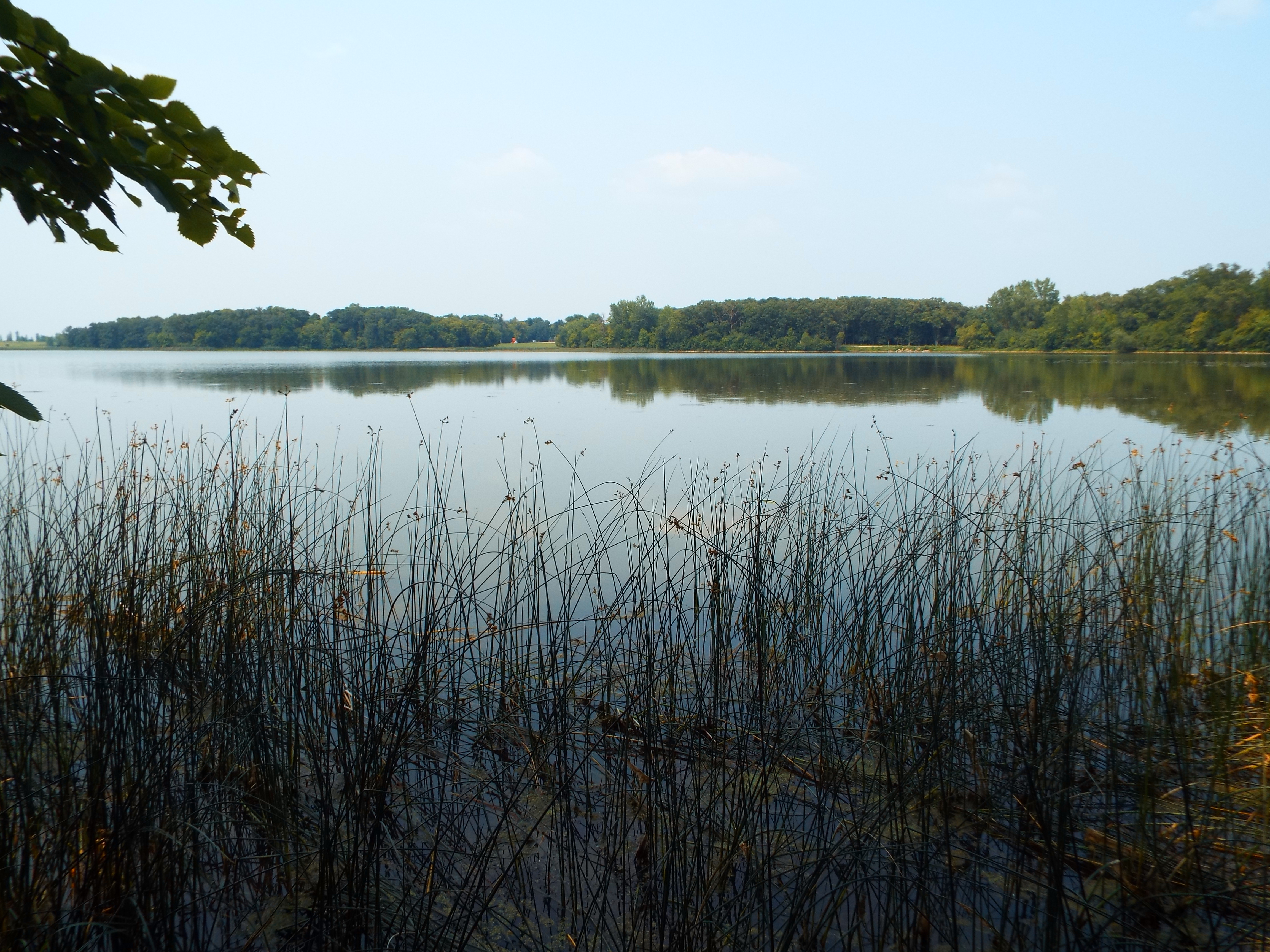
View of Mount Scenery from Windwardside


Post Navigation